In the early 1960's, the United States and the Soviet Union (along with the other nuclear-weapons powers at the time, England, Russia, and China) had come to an agreement to cease testing nuclear weapons in the atmosphere. While this was fine and dandy, the respective countries wanted to still test their weapons, both large and small. In the United States, tests were conducted primarily at the Nevada Test Site (near Las Vegas, Nevada), and the Pacific Testing Area (in the south Pacific Ocean). The atmospheric test ban accelerated existing underground nuclear weapons testing. In the United States, the Atomic Energy Commission began searching for a testing location further removed from a large population center such as Las Vegas, Nevada. After searching several desert valleys in central Nevada, the AEC settled on the Hot Creek Valley as the location of its new "Central Nevada Test Area." On January 19th of 1968 a one megaton nuclear weapon was exploded 3,000 feet below the surface of the valley floor. This was supposed to prove the effectiveness of the CNTA, but instead the Project Faultless test was much less than a success. There was over a dozen feet of ground movement above the detonation, and a huge surface rupture (a fault, some might say) was formed by the collapse of the underground cavity created by the explosion. This vented radioactive material into the atmosphere. It was judged by the AEC that the area was unsuitable for multimegaton blasts and the CNTA was essentially abandoned in favor of testing back at the NTS and remote islands in Alaska.
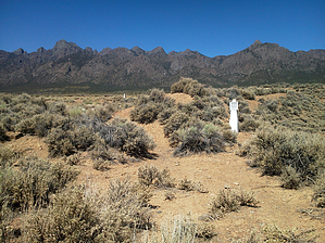
Now the Project Faultless site is one of the few places in the United States where you can visit ground zero of a nuclear explosion. Parking is easy at the drill location where the weapon was lowered into the drill hole, and you can wander at will across the site. Note the escarpment nearby - this is actually the "fault" formed by the ground collapse. Some areas of contaminated soil are being reclaimed - do not cross any fences or signed boundaries. It is also illegal to take rocks, plants, or any samples of anything from within 3,000 feet of the drill hole. You don't want to go home contaminated!
The area is beautiful in its own right, with plenty of classic Great Basin vistas. Take your time exploring the site, and then return to your car. While camping is theoretically allowed in the area, I would advise against camping in or near the test area.
 Route Editor