Overview
The hike enters the Goldfields thru a corridor known as the Golden Hillside. A few gold mines that produced gold are in this area, and with a little exploration, you can find evidence of activity. The hike eventually arrives at the Javelina mining claim and mine. It's unknown if the claim name is associated with the Javelina animal, but we can assume it is. The name Javelina comes from the Spanish, meaning javelin or spear, named for the animal's razor-sharp tusk. This brought to mind an album by the same name, (Tusk) performed by Fleetwood Mac and set the soundtrack in my mind for this day's adventure.
Hike
From the trailhead, walk north on the shoulder of Highway 88 about fifty feet towards the milepost marker 203. Short of the sign, cross to the west side of 88 and up the embankment. This is to avoid the fence erected to stop any motor vehicles from entering this area. Angle to the left once on the level ground and locate the jeep road. Take the jeep road in a northwest direction and continue straight at the first intersection by the power lines. It becomes evident that there was a lot of activity in this area with remnants of old settlements and mining claim markers peppered through the area. There are a couple of other dead-end spurs off this trail that you may wish to ignore. When the jeep trail comes to a Y, bear right. After passing by someone's unwanted household items, the trail climbs then comes to a variety of side trails as it curves more to the north. Do not make any turns. Stay on the main road until you see a rusted old hulk of a vehicle along the left side of the road. Go right at this point and pick up a faint trail. A single track from here, the trail dips down into a wash, climbs out the other side, then basically stays to the right of that wash as it climbs a ravine.
Near the top of the ravine, the trail crosses to the left side of the wash. Look left at the lower saddle marked by a huge Saguaro. The trail passes to the right of this Saguaro and into the valley ahead. You are now entering the Javelina Mining Claim. Perhaps you will spot a marker. The trail makes a swing to the northeast with a mountain that resembles a battleship in front of you and Little Four Peaks to the right. A new wash develops in the valley, and the trail stays on the left side for quite a while. The trail eventually crosses the wash to the right. Look high on the left at this point to see Checkmate Arch. The trail leaves the wash here and starts climbing towards the saddle ahead. Once at the saddle, you can see great distances to the west far beyond the Goldfields thru the valley. The trail starts down towards the next valley with colorful lichen filled rock structures on your left. Watch along the right side of the trail for claim markers and the Javelina mine, which is easy to miss. The backdrop is a cholla covered hillside to your right. The trail ends at the bottom of the hill just past the wash, at an unmarked Y intersection. To the right is the Golden Eagles Nugget Trail. To the left is the Golden Eye Mine Trail. Either continue on one of these trails or return the way you came.
When hiking several trails on a single "hike", log it with a generic name that describes the hike. Then link the trails traveled, check out the example.
WARNING! Hiking and outdoor related sports can be dangerous. Be responsible and prepare for the trip. Study the area you are entering and plan accordingly. Dress for the current and unexpected weather changes. Take plenty of water. Never go alone. Make an itinerary with your plan(s), route(s), destination(s) and expected return time. Give your itinerary to trusted family and/or friends.
Permit $$
None
Directions
Road
FR / Dirt Road / Gravel - Car Okay
To Javelina Mine (arbitrary/unofficial) Trailhead About 2 miles past the Lost Dutchman Park entrance.
NW on the Apache Trail from AZ-88 & Idaho Road in Apache Junction. 6.8 miles to just short of highway marker 203. Just before the marker turn right into parking area. The trailhead is not marked but is a clear pull off area just before the 203 sign and has parking for several many cars or horse trailers.
From PHX (I-10 & AZ-51) 42 min (41.5 miles) From TUC (Jct 1-10 & Grant) 1 h 53 min (112 miles) From FLG (Jct I-17 & I-40) 2 h 50 min (183 miles) (Trailhead is generic)
 Route Editor

 Overview
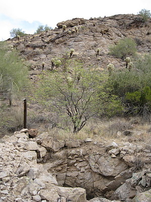


