 Route Editor

| Guide | ♦ | 12 Triplogs | 2 Topics |
details | drive | no permit | forecast | 🔥 route |
stats |
photos | triplogs | topics | location |
| 79 | 12 | 2 |
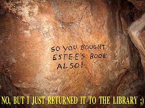
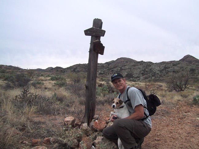
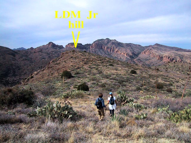
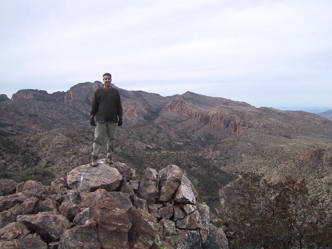
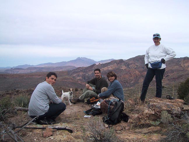
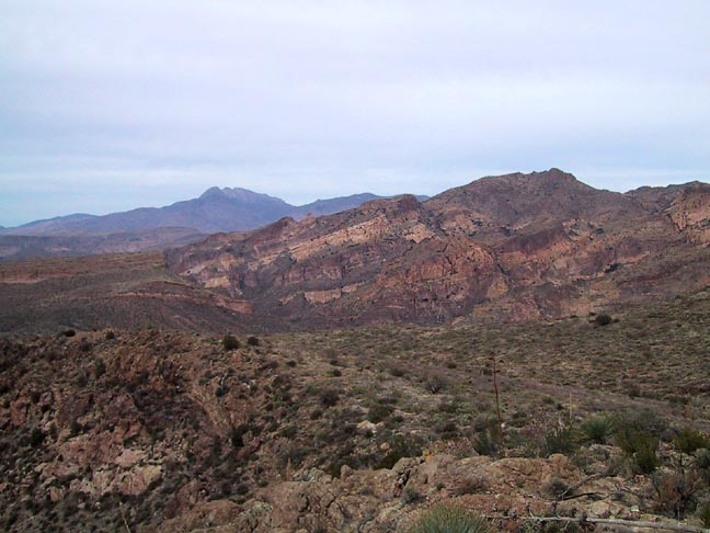
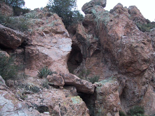
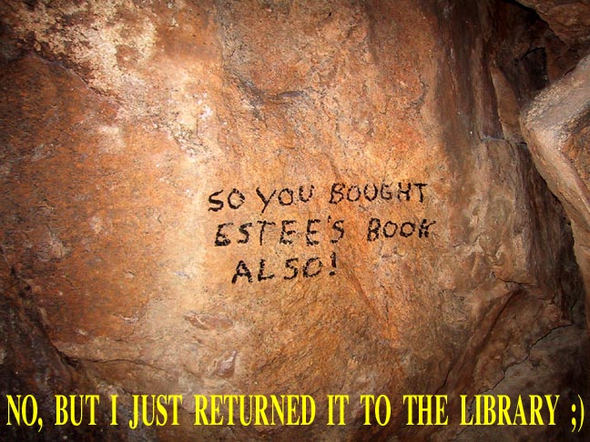
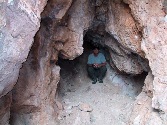
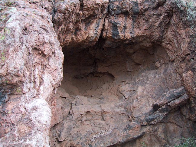
Reliving a little Superstition History by Fritzski   This hike takes you to a little-known site in the Superstition Mountains where dreams of finding the elusive Lost Dutchman Mine once flourished, if just for a fleeting moment. This hike takes you to a little-known site in the Superstition Mountains where dreams of finding the elusive Lost Dutchman Mine once flourished, if just for a fleeting moment.History In the early 1960s, a gal named Estee Conatser and her small "crew" spent several seasons combing the mountains for lost gold. On their last day before departing for the season, they noticed a curious cave on the eastern face of the cliff above from their camp in Tortilla Canyon. With time to burn and nothing to lose, they decided to check it out and eventually found that the only way to the cave was to climb to the top of the mountain and then back down to the cave. Our hike will take full advantage of this good tidbit of information.
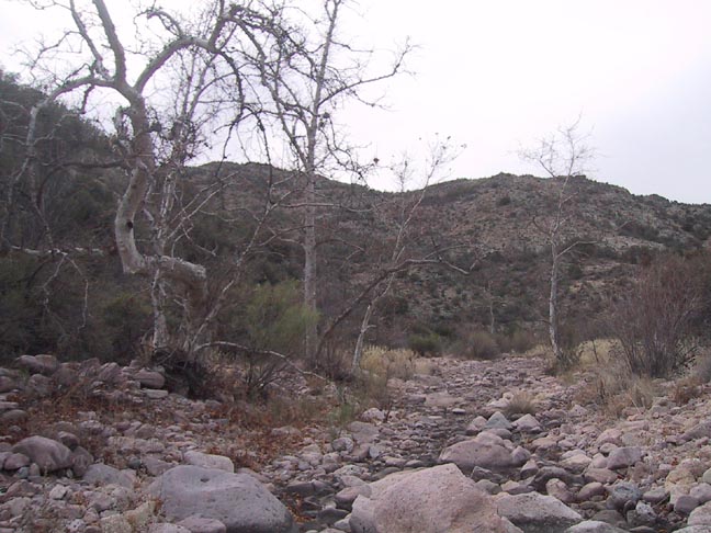
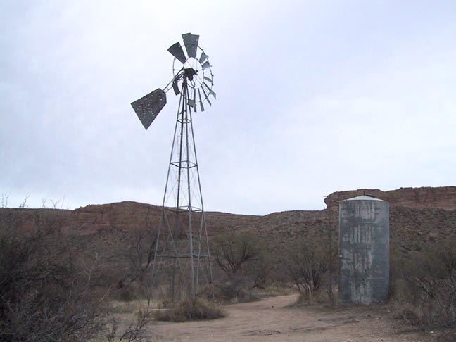
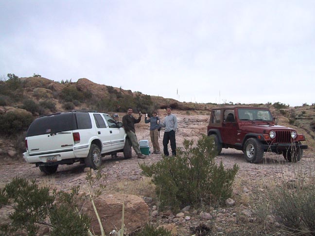
Many of the classic Lost Dutchman clues just seemed to be falling into place. It was "high on a hillside and carefully hidden", and "it could not seen from the canyon below, but from it, you could see the canyon". While it wasn't the "Old Military Trail below", it was the Old Spanish Trail (now Hoolie Bacon). The "Needle could be seen from a distance" and there was no "cave across the valley", but one below. "The top of the mountain was flat and covered with grass" as Jacob Waltz described the area where he grazed his horse. And finally, the existence of a ceiling shaft - could that once have been a "cone shaped pit"? As with every other "discovery of the Lost Dutch Mine", there was only one problem: NO GOLD! After going so far as scouring the area with metal detectors and coming up with not a flake of color, they finally concluded that despite the tantalizing evidence, that this was sadly not the LDM and very possibly not even a mine at all. Although Estee never did find her treasure, she did, however, go on to write a most excellent book, "The Sterling Legend", which, among other things, describes her search for the legendary mine and the one she found, which she would then affectionately nickname the "LDM Junior". Hike I apologize for the lengthy history above. I feel without it; the hike would be somewhat meaningless. So let's get started then. The first and maybe most challenging part of the hike is the Forest Road leading from Hwy88 to the Tortilla trailhead. There are two rather onerous ledges in the road early on, the second being the worst. AzScrapper accompanied us that day, and her stock GMC Jimmy 4X4 with street tires conquered the first obstacle quite impressively but was unable to tackle the second. So the five of us then crammed into my Jeep, and off we went. The moral of the story is "don't expect to get through without a fairly robust 4X4". Tortilla Trailhead is located amongst relics of the old Tortilla Wells Ranch, and there are no trail signs, so head out on the only trail going south through the fence. You will soon come to a dilapidated trail sign showing the JF / Hoolie intersection at about 0.75mi. Stay left on the JF trail for the next 1.75 miles, which will consist of a gradual climb through the dry, low scrub country to the point where we eventually depart the trail and head for the mine. At the 2mi point, just after a couple of slight switchbacks, you will be approaching the top of a small saddle to your upper left. This is the point where you want to depart the trail and make your way cross country to the easily visible lone peak on your right about a quarter-mile away. You should be roughly at the same elevation as the top of the peak, so the trick is to skirt along the contours of the terrain to conserve altitude. The vegetation is relatively sparse, and the terrain is smooth so picking a path is not too difficult. The top of the peak is a great place to take a break and leave your gear before making the short scramble down to the caves. The views are great, and one can easily pick out the rugged Fish Creek Canyon and Four Peaks to the NE. My wife Karen also found some very nice quartz crystal specimens exposed in the weathered terrain. Although getting down to the mine is not all that difficult, it is rather tricky and may require some substantial scrambling around the general area before you finally figure it out. From the top, proceed down the crevice on the NW edge about 50', then begin to work left around the western edge. You should have to drop down about 5' to the base of a large boulder, and the entrance to the mine is just on the other side. It is very easy to go down too far where you will encounter various other small caves, but not the LDM Jr. You'll know when you've found the right place courtesy of someone leaving behind an appropriate bit of graffiti. Although I don't generally condone such things, it was obscure, of little or no harm, and given the situation, really quite humorous. Should the author happen to read this, I would appreciate a personal email for a good laugh. I guess the real humor lies in the fact that the "mine" doesn't quite live up to all the anticipated hype, and you are left wondering what sort of wild imaginations led to all the fuss. Way too much time spent in the desert would be my guess. In the book she describes the mine as 40-50' deep with the top hole 8-10' in. Splitting those numbers in half would likely be more accurate in my estimation. J.Carlson and E.Stewart, authors of "Hiker's Guide to the Superstition Wilderness", express doubts about this being a mine rather than just a natural opening, and I would have to agree. Their originally spotted cave is a short scramble below and was nothing more than a typical shallow alcove with no "signs of fires" as mentioned in the book. Finally, to make the hike just a little more substantial, we threw in a short loop at the end through a nice section of Tortilla Creek. After retracing your route back as far as the JF/ Hoolie intersection, take the Hoolie Bacon trail to the left and follow it about 0.3mi down to the bed of Tortilla Creek. At this point depart the trail and follow the open creek bed to the right. There are some nice rock features along the way, and the going is easy all the way to the Peters trail. Just remember to keep an eye out for the trail as it crosses the wash, although if you continue to bear right following the main wash, you can't miss it. Once on the Peters Trail, it is a smooth, quick cruise back to the trailhead going through some more abandoned ranch property. I guess the bottom line is this, like most features of historical significance in the Superstitions, one must never forget "it is the beauty of the search, and not the objective itself, that is the true reward!" "FRITZSKI'S BONUS TRIVIA FOR THOSE THAT GIVE A @#?!" Today's subject: "MINING" Just as a "prospector" and a "miner" are not necessarily one and the same, neither is a "prospect" or a "mine". One is an exploratory digging, while the other is an ore bearing works. A "tunnel" is horizontal, while a "shaft" is vertical. Both are "adits", meaning they are used merely as a means of entrance or access. A "drift" is the actual working tunnel that follows the "lode" as nature dictates. A "stope" is an expanded pocket dug out where the lode was enlarged. "Waste" is the course rock removed while opening the mine (this is the stuff that interests most rock hounds). "Tailings", on the other hand, consist of finely ground particles from which the ore has been extracted (may be easily recognized by staining due to chemical action and metal residues). Check out the Official Route and Triplogs. Leave No Trace and +Add a Triplog after your hike to support this local community. | ||||||||||||||||||||||||||||||||||||||||||||||||||||||||||||||||||||||||||||||||||||||||||||||||||||||


