 Route Editor

| Guide | ♦ | 12 Triplogs | 0 Topics |
details | drive | permit | forecast | 🔥 route |
stats |
photos | triplogs | topics | location |
| 113 | 12 | 0 |
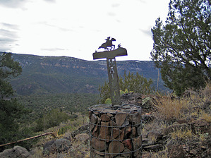
Hike-able history by toddak   History: From about 1884 to 1914, a horse and rider carried the mail from Camp Verde to Payson across what is now the rugged Fossil Springs Wilderness, a 50-mile trip that could take up to 18 hours to complete. This remote section of the route from General Crook Trail (now Highway 260) to Fossil Springs was painstakingly researched and reconstructed, with dedication ceremonies for the aptly-named Mail Trail #84 held in September 2006. History: From about 1884 to 1914, a horse and rider carried the mail from Camp Verde to Payson across what is now the rugged Fossil Springs Wilderness, a 50-mile trip that could take up to 18 hours to complete. This remote section of the route from General Crook Trail (now Highway 260) to Fossil Springs was painstakingly researched and reconstructed, with dedication ceremonies for the aptly-named Mail Trail #84 held in September 2006.Hike: The trail begins across FR 9247B from the parking lot, and here's where you begin cairn-spotting. There are 156 of these well-constructed, nicely-spaced cylindrical rock baskets that will guide your steps across the mesa and down into the canyon. For the first 0.75 miles or so, you head west, paralleling the highway, before turning to the south somewhere around the tenth cairn. At times you will be on faint trails or old roads; at other times, you're essentially cross country, cairn-to-cairn.
NOTE: It is possible to drive a series of dirt roads from the trailhead to Mail Trail Tank #2, but they are very rough in places and would require a high clearance vehicle. Of course, driving there would also mean missing out on the historic trek across the mesa. Just before you reach Mail Trail Tank #2, be looking for a signpost on the left that is somewhat hidden by a tree. The sign indicates four miles to Fossil Springs. Follow the trail and cairns up a short ridge and then drop down to the Wilderness boundary marker, with extensive views into Fossil Creek canyon below. The trail down is relatively well defined and marked with cairns and signs as you descend to a plateau above the creek. At some point, you will be directly north of Fossil Springs, but there are cliff bands below you, and the trail continues traversing well to the east. As you approach Mud Tanks Draw, the trail gets fainter, and the brush and trees become thicker so that the big rock basket cairns are no longer effective, and they quit building them. However, there are occasional ribbons in the trees, blue-painted rocks on the ground, small ducks, and enough scattered signposts to keep you more or less on track, and you're close enough now to Fossil Creek that you can't get completely lost. If you get tired of wandering through the scrub, one option would be to just drop into the open, boulder-filled creek bed of Mud Tanks Draw and rock-hop the rest of the way down to Fossil Creek. But if you manage to stay on the official trail, you will also come to Fossil Creek at an unmarked junction. It won't be visible, but directly across Fossil Creek from the junction is a Wilderness sign-in box and the well-established trail that will take you to the springs, located about one mile downstream, as well as the junction with the trail up to the well-used trailhead near Strawberry.
Check out the Official Route and Triplogs. Note This is a moderately difficult hike. Leave No Trace and +Add a Triplog after your hike to support this local community. One-Way Notice This hike is listed as One-Way. When hiking several trails on a single "hike", log it with a generic name that describes the hike. Then link the trails traveled, check out the example. | |||||||||||||||||||||||||||||||||||||||||||||||||||||||||||||||||||||||||||||||||||||||||||||||||||||||||||||||||||||||||||||||||||||||||||||||||||||||||||||||||||||||||||||||||||||||||||||||||||||


