 Route Editor

| Guide | ♦ | 49 Triplogs | 1 Topic |
details | drive | permit | forecast | route |
stats |
photos | triplogs | topic | location |
| 730 | 49 | 1 |
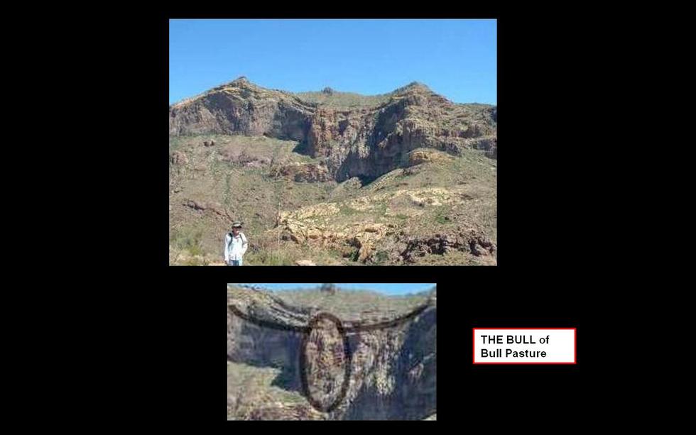
No Bull by Randal_Schulhauser  History HistoryCattle Ranching at Organ Pipe from the National Monument archives; "The history of the earliest cattle ranching here in Organ Pipe's territory started when the Spanish introduced cattle, perhaps Coronado or Padre Kino at his mission near Sonoyta. Cattle prospered on the mission farms, and their ancestors provided stock for Indian herds in the area. The introduction of cattle, horses, and burros changed the face of this area forever. After the US/Mexico international boundary fence was established between Arizona and Mexico, cattle could no longer roam freely back and forth, and the range became more restrictive. American ranching in the Monument region goes back to the early decades of the 1900s when southern Arizona was the new (and last) frontier. Desert ranching is unique. The carrying capacity for the 500 square mile Monument is only one head of cattle per square mile. These cattle fed on various desert food sources, from annual grasses to mesquite beans and even cholla joints. An old-time rancher once said that here in the desert, his cattle did not graze; they browsed.
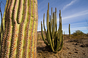
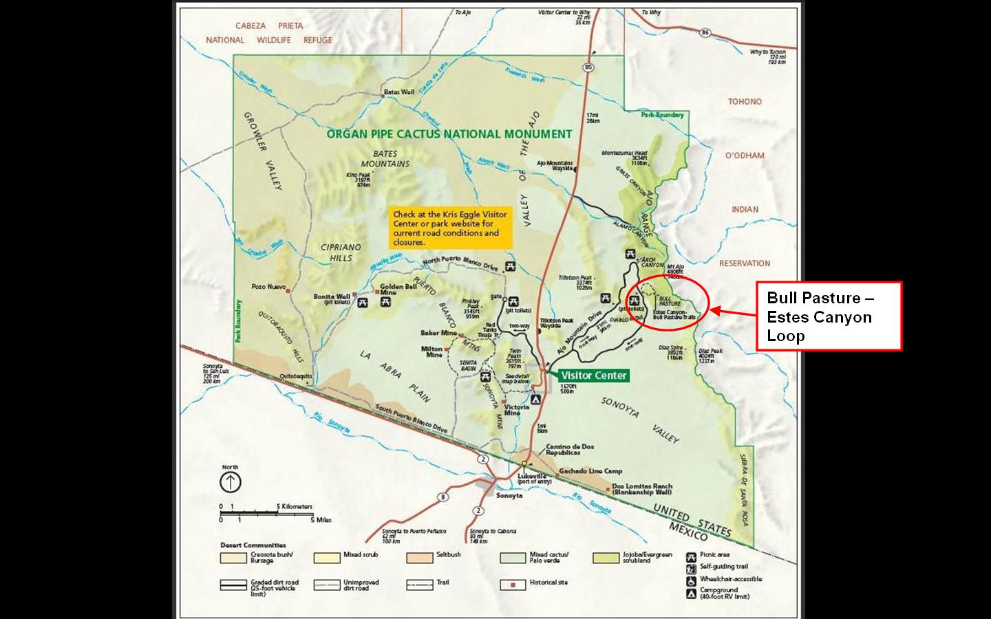
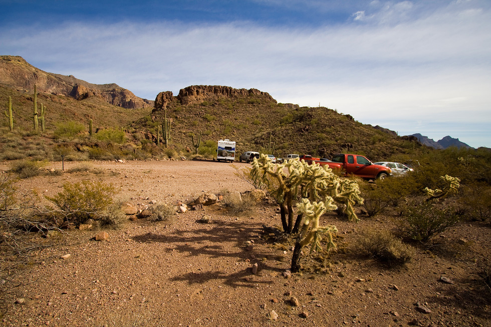
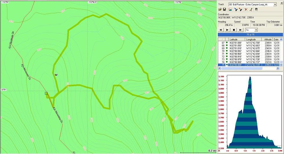
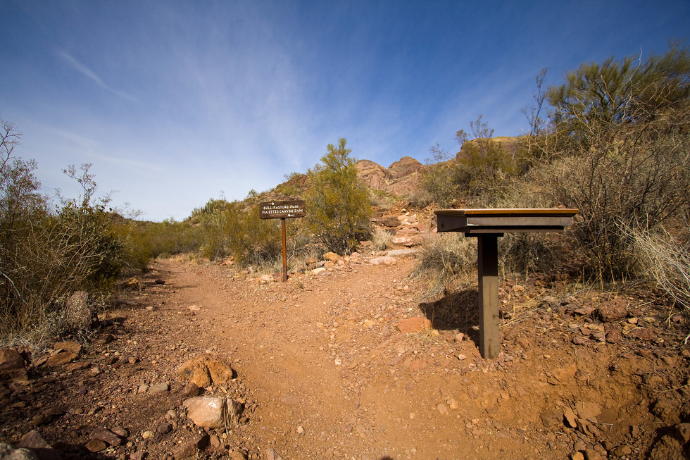
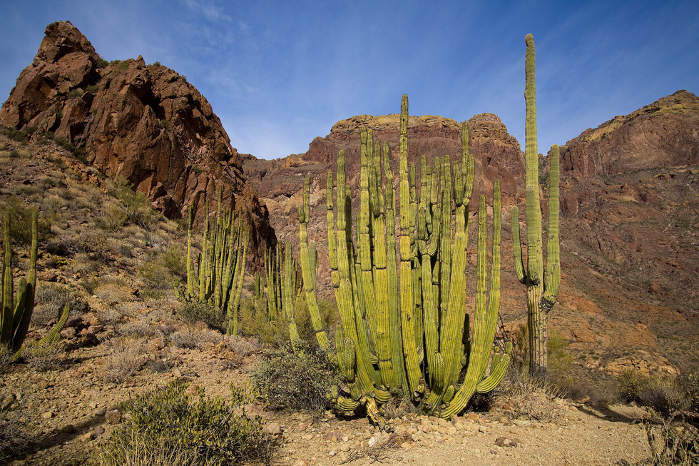
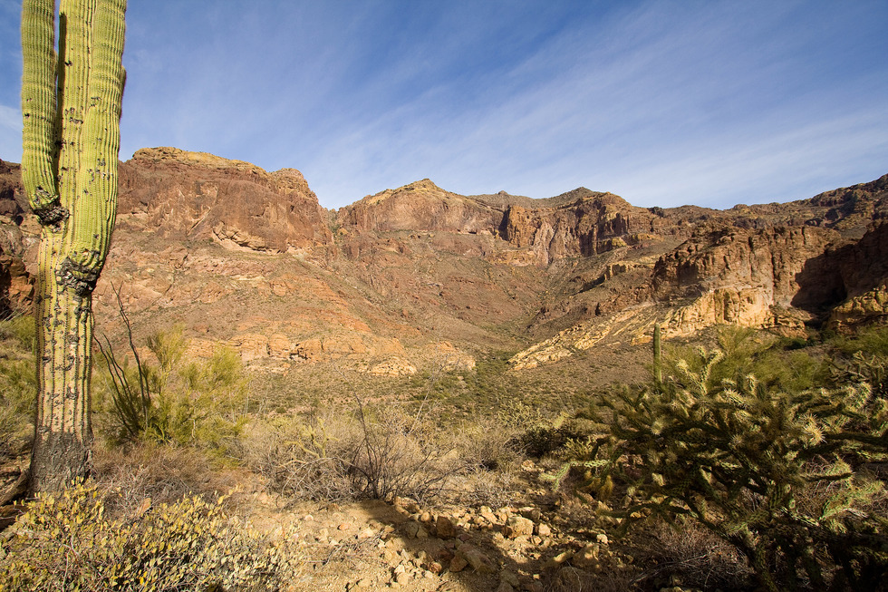
When the Monument was established in 1937, great controversy surrounded whether to continue to allow grazing permits and what the carrying capacity was for the range. The Gray family originally received annual permits to graze 550, and a few years later, a 1,050 head of cattle. These grazing permits were canceled in the 1960s, and in the last roundup, over 1,700 cattle were counted. The final cattle were removed from Organ Pipe Cactus in 1972, effectively ending the Monument's cowboy era. The prolonged ranching period had a great effect on the desert ecosystem. Wild grasses were nearly eaten towards extinction. Small cacti were trampled out of the ground. These effects can still be witnessed today, almost 40 years since the last roundup. Bull Pasture was one of the choice summer ranges for these cattle. Don't forget to look for THE BULL when you visit Bull Pasture." Hike Obtain your day pass from the Visitor Center located on the west side of Hwy 85 about 5 miles from the Mexican Border. Once again, my NPS Annual Pass comes in handy. Proceed to the east side of Hwy 85, taking the maintained gravel road. This is Ajo Mountain Scenic Drive. Travel along the Ajo Mountain Scenic Drive 11.4 miles until you reach the Estes Canyon Picnic Area. The Bull Pasture and Estes Canyon trails, as well as the trail ascending Mount Ajo Peak all share this common trailhead. There's TH parking on both sides of the road for at least a dozen vehicles. There are a few options for this hike, but I'll describe the gentler ascent to Bull Pasture Overlook via Bull Pasture Trail and return via the steeper Estes Canyon Trail. NOTE: there is some minor exposure on the final ascent up to the overlook that may intimidate novice hikers. From the TH parking, you will descend into a wash on the east side of Ajo Mountain Scenic Drive. As you exit Estes Canyon Wash, you will see a trail register and a fork in the trail. To the left is Estes Canyon Trail (our return route) and to the right is Bull Pasture Trail. Take the right fork and begin climbing a series of switchbacks to the top of the ridge. You will notice some stands of Organ Pipe Cacti on the south-facing slopes. Near the crest of the ridge, the trail will swing around a large rock outcrop and head north and east towards another rock outcrop and saddle. A bench strategically located by the saddle allows you to take a break and enjoy the view. Notice how Mount Ajo forms the eastern wall of the expansive Estes Canyon. Having caught your breath, continue your hike as the trail descends slightly as you head southeast towards the junction with Estes Canyon Trail. Past the junction, Bull Pasture Trail will climb another series of switchbacks until you reach another saddle named Bull Pasture Overlook. There is some minor exposure in this section as you approach the overlook. At Bull Pasture Overlook, you can look down on the elevated grasslands that comprise Bull Pasture - an important summer pasture from the areas' ranching past. From this vantage, you can see Sonoyta Valley directly to the south, and beyond that is Mexico. The overlook is an excellent spot to turnaround, having hiked 1.8 miles per the Park Service map or 1.3 miles per my GPS. Return to the junction of Bull Pasture Trail and Estes Canyon Trail, continuing the steeper descent into Estes Canyon. You will quickly reach Estes Canyon floor and will traverse the wash several times as you make your way back to the parking area trailhead. The flat basin of Estes Canyon is described as a "natural amphitheater" surrounded by "towering cliff walls" that make up the Ajo Range. Summary Organ Pipe Cactus National Monument is one of my "special" places. Everything about it is unique and quite unlike anywhere else in the world. Unique flora. Unique fauna. Unique geology. Unique history. Unique political/policy "situation." Experience it for yourself! Enjoy!
Check out the Official Route and Triplogs. Leave No Trace and +Add a Triplog after your hike to support this local community. | ||||||||||||||||||||||||||||||||||||||||||||||||||||||||||||||||||||||||||||||||||||||||||||||||||||||||||||||||||||||||||||||||||||||||||||||||||||||||||||||||||||||||||||||||||||||||


