|
tap row or icons for details
|
| Difficulty |
|
4.5 of 5 |
| Distance One Way |
|
16.6 miles |
| Trailhead Elevation |
|
3,439 feet |
| Elevation Gain |
|
2,330 feet |
| Accumulated Gain |
|
4,400 feet |
| Kokopelli Seeds |
|
31.26 |
| Backpack Yes & Connecting | | unreported if dogs are allowed
editedit > ops > dogs to adjust |
| | |
|
|
5 |
2026-02-24 |
Cross F - Potato Patch |
DixieFlyer |
|
|
|
56 |
2026-01-04 |
Sunflower Trail #344 |
DesertNymph |
|
|
|
2 |
2025-05-14 | mazatzal |
|
|
16 |
2025-05-07 | CannondaleKid |
|
|
6 |
2025-04-06 |
Little Saddle Mountain Trail #244 |
CannondaleKid |
|
|
|
17 |
2025-03-22 |
Saddle Thicket Loop |
BiFrost |
|
|
|
35 |
2025-02-02 |
Black Ridge Loop - Mazatzal |
CannondaleKid |
|
|
|
2 |
2025-01-09 | mazatzal |
| | Page 1, 2, 3, 4, 5 ... 18 |
| |
|
|
|
list |
map |
done |
Phoenix Region |
| | |
|
| |
|
|
Historical Weather |
| Trailhead Forecast | | |
|
 |
|
|
| Preferred Nov, Mar, - -, - - → 7 AM |
|
|
| | |
| |
Named Locations Coordinate Links
| |
|
| Saddle Mountain - AZT #22
|
13.86 mi
3,218 ft |
|
|
|
Saddle Mountain - AZT #22
|
12.39 mi
2,329 ft |
 |
| Saddle Mountain - AZT #22
|
12.09 mi
1,048 ft |
|
|
| Saddle Mountain - AZT #22
|
5.96 mi
922 ft |
|
|
| Saddle Mountain - AZT #22
|
8.21 mi
794 ft |
|
|
| Saddle Mountain - AZT #22
|
9.86 mi
1,095 ft |
|
|
| Saddle Mountain - AZT #22
|
17.8 mi
2,136 ft |
|
|
| Saddle Mountain - AZT #22
|
18.18 mi
4,182 ft |
|
|
| Saddle Mountain - AZT #22
|
17.26 mi
4,252 ft |
|
|
| Saddle Mountain - AZT #22
| 2010-11-21 |
azdesertfather |
|
16.31 mi
4,176 ft |
|
|
|
Cross F - Potato Patch
|
10.88 mi
2,122 ft |
|
| Sunflower Trail #344
|
11.87 mi
1,439 ft |
|
|
| Saddle Thicket Loop
|
11.97 mi
2,410 ft |
|
|
|
Saddle Mountain Mine Tour
|
12.9 mi
2,448 ft |
|
|
Little Saddle Mountain Trail #244
|
6.83 mi
1,433 ft |
|
|
Cross F - Potato Patch - Cross F
|
10.91 mi
2,156 ft |
|
| Saddle Thicket Loop
|
14.53 mi
2,948 ft |
|
|
| Sheep Creek Trail #88
|
17.4 mi
4,507 ft |
|
|
|
Black Ridge Lasso-Loop Mazatzals
|
16.41 mi
2,482 ft |
|
|
Little saddle / saddle mountain t...
|
14.14 mi
2,442 ft |
|
| AZ Trail Passage 22B
|
9.24 mi
1,530 ft |
|
|
| AZ Trail-22A1-Saddle Mountain
|
10.59 mi
1,005 ft |
|
|
| Black Ridge Loop - Mazatzal
|
8.94 mi
2,212 ft |
|
|
| AZT #22 south from Peeley Trailhead
|
9.87 mi
1,753 ft |
|
|
| S Mazatzal Roundup
|
35.42 mi
6,039 ft |
|
|
| Cornucopia - Thicket Spring Loop
|
10.3 mi
2,531 ft |
|
|
| AZT #22 Little saddle to Cornucop...
|
15.39 mi
3,159 ft |
|
|
| Little Saddle Mountain Loop
|
7.4 mi
798 ft |
|
|
| AZT Supes-Mazatzal
|
107.09 mi
21,457 ft |
|
|
| AZT Trail: Picketpost to Pine
|
161.36 mi
32,598 ft |
|
|
| AZT #22 Beeline Hwy to Little Saddle
|
15.72 mi
2,204 ft |
|
|
| AZT #22 south from Mormon Grove
|
10.38 mi
721 ft |
|
|
| Saddle Mtn / Peeley Loop
|
16.49 mi
3,721 ft |
|
|
| Copper Camp Loop
|
22.02 mi
6,378 ft |
|
|
| Black Ridge Loop - Mazatzal
|
7.67 mi
1,969 ft |
|
|
| Upper Sheep Creek Loop
|
17.38 mi
4,687 ft |
|
|
| Drive to Peeley TH
|
10.7 mi
2,145 ft |
|
|
| | |
| |
|
|
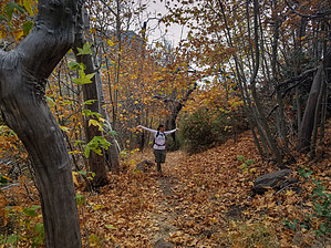
Passage 22 begins a long stretch through the Mazatzal Wilderness, which will continue through Passage 25. The Mazatzal Mountains are a diverse range defined by craggy peaks, serpentine canyons, and solitude. The trail follows singletrack through thick manzanita and mountain shrubs. It features verdant hillsides, winding canyons, and craggy peaks. It passes by seeps and springs, and briefly follows Sycamore Creek. The trail continues north through scrub oak and crosses a streambed in a charming valley under idyllic white cliffs. It skirts the side of Saddle Mountain, traversing through hillsides and rolling grasslands. It climbs up to Thicket Spring and continues along a rocky ascent to the junction with the Mazatzal Divide Trail #23 and the end of the passage. Check out the Triplogs. NoteThis is a more difficult hike. It would be unwise to attempt this without prior experience hiking. One-Way NoticeThis hike is listed as One-Way. When hiking several trails on a single "hike", log it with a generic name that describes the hike. Then link the trails traveled, check out the example. |
 Route Editor


