 Route Editor

| Guide | ♦ | 83 Triplogs | 3 Topics |
details | drive | no permit | forecast | 🔥 route |
stats |
photos | triplogs | topics | location |
| 733 | 83 | 3 |
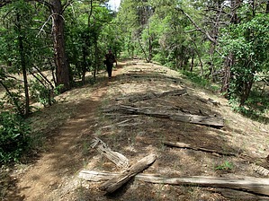
whip up classic English pudding along the hike by HAZ_Hikebot  Overview OverviewFrom Gooseberry Springs Trailhead on FR 92, the trail crosses a meadow and a wooded area and then reaches Highway 3. After crossing the highway and passing through a gate in the fence that parallels the highway, the trail follows an old railroad bed. It leaves the railroad and crosses FR 91, and then heads north-northeast until it reaches Railroad Spring. At this point, the route follows a road for about a mile and then becomes a trail again. It crosses FR 219 and then FR 219A and then passes near Navajo Spring. From here, the trail heads north and west, passes Wallace Spring, crosses FR 90H, and then contours over to Double Springs Campground. The trail climbs up to FR 240 and then turns east. It circles back around to the west and passes above Dairy Springs Campground, crosses several forest roads, and then comes to the end of the passage at Mayflower Spring. Southern Trailhead Gooseberry Springs Trailhead From the turnoff leading from Forest Highway 3 to Mormon Lake Village, continue south on Forest Highway 3 for approximately 5 miles and then turn left onto a prominent road (FR 92) on the south side of an open meadow, and drive 0.25 miles to a sharp left turn in the road; the trailhead and a steel AZT sign are on your right. You can also reach this point from AZ 87 by driving north on Forest Highway 3.
Mayflower Spring From Flagstaff, take the Lake Mary Road exit (339) off I-17 for ~20 miles, then turn right (west) on Mormon Lake Road (Highway 90). Follow this about 3 miles to an unmarked turnoff on the right. This two-track dirt road leads to Mayflower Spring (~0.4 miles). Updated 2017-07-24 Gate Policy: If a gate is closed upon arrival, leave it closed after you go through. If it is open, leave it open. Leaving a closed gate open may put cattle in danger. Closing an open gate may cut them off from water. Please be respectful, leave gates as found. The exception is signage on the gate directing you otherwise. Check out the Official Route and Triplogs. Leave No Trace and +Add a Triplog after your hike to support this local community. One-Way Notice This hike is listed as One-Way. When hiking several trails on a single "hike", log it with a generic name that describes the hike. Then link the trails traveled, check out the example. | |||||||||||||||||||||||||||||||||||||||||||||||||||||||||||||||||||||||||||||||||||||||||||||||||||||||||||||||||||||||||||||||||||||||||||||||||||||||||||||||||||||||||||||||||||||||||||||||


