Overview
From the Schultz Tank parking lot, the route proceeds north on the Weatherford/Kachina trail for a short distance and then turns left (west) on a new single-track trail.
It works its way west-northwest across the Fort Valley Experimental Forest for about 7.4 miles to the Snowbowl Road. After crossing Snowbowl Road it climbs steeply for the next 4 miles, gaining about 1,400 ft to the bottom end of the Aspen Loop connector trail. From here the trail passes Lew Tank, and the junction with the Bismarck Lake TH access trail, and Bismarck Lake. The trail then trends northward down the slope, across several two-track roads, and through an aspen grove to FR-418.
It heads north-northwest around the base of the White Horse Hills, joins a two-track for a short distance, and then leaves the road and works its way northeast up to FR 514 and Kelly Tank. The trail parallels FR 514 and then continues to the north when FR 514 turns to the east. The route crosses FR 523 and begins following FR 416. It passes Badger Tank and Bonita Tank, and then the route turns to the northwest and travels to Missouri Bill Hill. It skirts around the west side of this hill, heads northwest to FR 417, and then west over to Cedar Ranch.
When hiking several trails on a single "hike", log it with a generic name that describes the hike. Then link the trails traveled, check out the example.
WARNING! Hiking and outdoor related sports can be dangerous. Be responsible and prepare for the trip. Study the area you are entering and plan accordingly. Dress for the current and unexpected weather changes. Take plenty of water. Never go alone. Make an itinerary with your plan(s), route(s), destination(s) and expected return time. Give your itinerary to trusted family and/or friends.
Permit $$
no fees or permits reported
if incorrect tell us about it
Directions
Road
To hike
page created by joebartels on Jan 09 2010 12:41 am
 Route Editor

 Overview
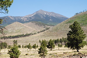


