 Route Editor

| Guide | ♦ | 44 Triplogs | 1 Topic |
details | drive | permit | forecast | 🔥 route |
stats |
photos | triplogs | topic | location |
| 476 | 44 | 1 |
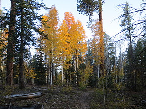
 Overview OverviewThis passage begins at the North Kaibab Trailhead on the North Rim of the Grand Canyon. The trail crosses Highway 67 and heads northwest, passing through Harvey Meadow and then the Widforss Trail junction. It joins a road and then leaves it to the right. The trail climbs steeply, crosses a road and then levels out and heads northwest. It turns to the north and runs through forests and meadows, and then reaches Highway 67. After crossing the highway the trail soon turns to the left and parallels the highway. The trail reaches a high point and then drops down near the highway again and follows it to the Grand Canyon National Park entrance station. From here the route is to the right along a service road for just over a mile. The trail then leaves the road to the left and runs down to the park boundary. Southern Trailhead: North Kaibab TH - Hwy 67
Note This page is open to authors. Hike must be listed South to North as one-way. Do not include an overview as the above is permanent. Check out the Official Route and Triplogs. Leave No Trace and +Add a Triplog after your hike to support this local community. One-Way Notice This hike is listed as One-Way. When hiking several trails on a single "hike", log it with a generic name that describes the hike. Then link the trails traveled, check out the example. | |||||||||||||||||||||||||||||||||||||||||||||||||||||||||||||||||||||||||||||||||||||||||||||||||||||||||||||||||||||||||||||||||||||||||||||||||||||||||||||||||||||||||||||||||||||||||||||||||||||||||||


