 Route Editor

| Guide | ♦ | 145 Triplogs | 2 Topics |
details | drive | no permit | forecast | 🔥 route |
stats |
photos | triplogs | topics | location |
| 872 | 145 | 2 |
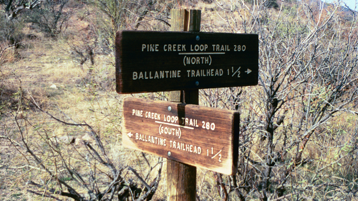
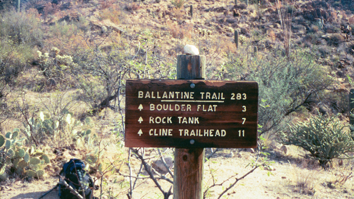
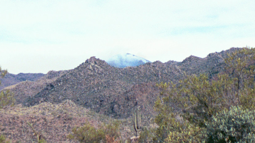
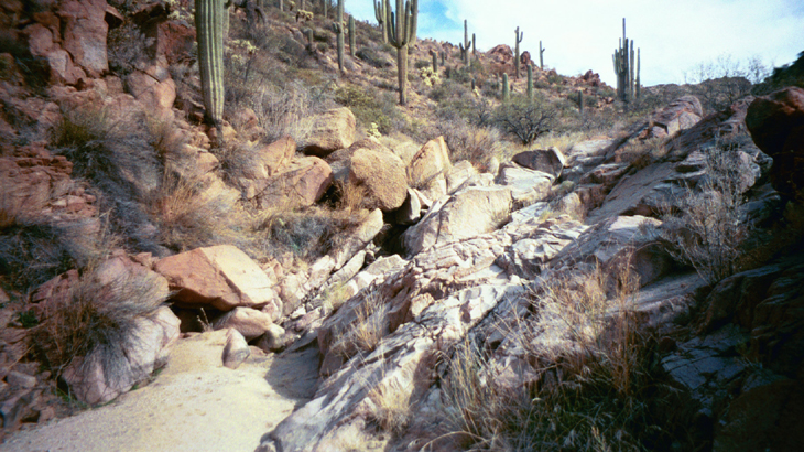
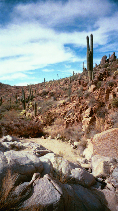
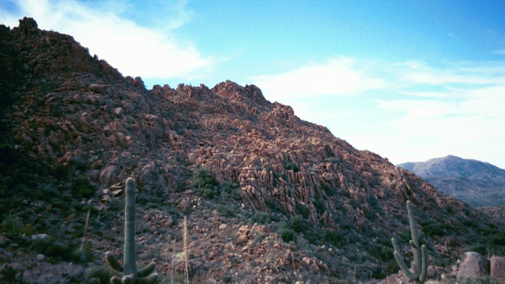
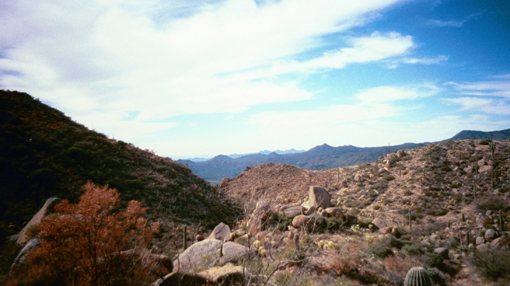
Oh Rocky!! by Mike   This trail gets pretty light traffic considering its proximity to the Valley and the fact that the trailhead is right next to the Beeline Highway. It's a great trail with a little bit for everybody. A seasonal creek, plenty of rocks for the kids to explore, great views, some good climbing sections for a workout. Even the occasional wildlife (moo...). It has become one of my favorite, close-to-town hikes. This trail gets pretty light traffic considering its proximity to the Valley and the fact that the trailhead is right next to the Beeline Highway. It's a great trail with a little bit for everybody. A seasonal creek, plenty of rocks for the kids to explore, great views, some good climbing sections for a workout. Even the occasional wildlife (moo...). It has become one of my favorite, close-to-town hikes.The Ballantine Trail officially begins on a small saddle at the eastern junction of the two halves of the Pine Creek Loop Trail. (For directions to the trailhead and a description of the first part of this hike, see the Pine Creek Loop description.) On this trip, we took the north half of the loop. I have taken both halves into the Ballantine trail, and either is fine. If you want a more gentle approach, take the north, and if you want a thigh-burning workout, take the south. This trip's destination is Boulder Flat, which the sign at the beginning of the Ballantine Trail indicates is 3 miles. I think this is overestimated, and it's more like 1.5 miles from the beginning of the Ballantine and 3 miles from the trailhead.
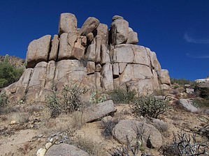
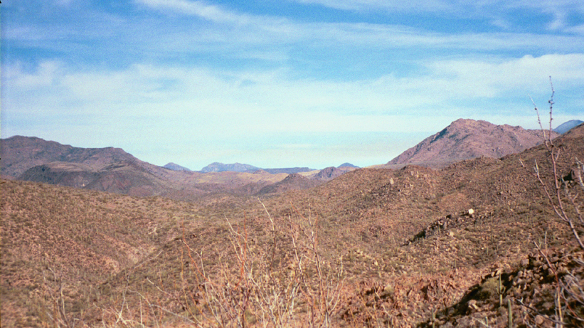
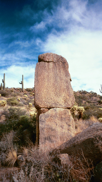
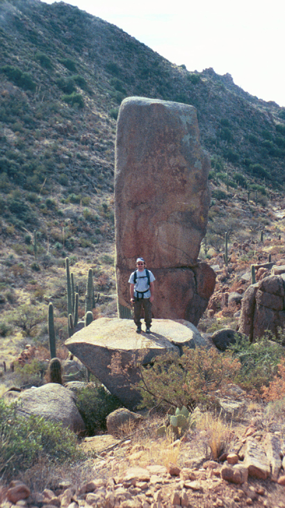
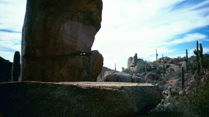
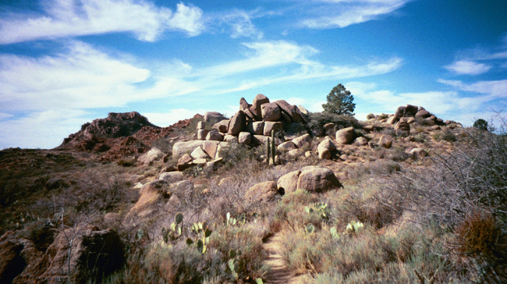
Along the way, you'll come to a spot with two huge, upright boulders, one to the left of the trail, and a larger one below the trail to the right, just beyond the first. The rock at the base of this one looks like a perfect spot for lunch, or a nap. We bushwhacked down to the creek from here, for a short exploration. I was here a couple of years ago when there was snow on the higher mountains in the area, and this creek was running quite well then. On this trip, however, it was bone-dry. Eventually, the trail will drop into a more open area at the east end of "The Boulders". Watch for a side trail heading off to the right toward a large pile of boulders. This is a great spot to rest, and the boulders are great to climb among. The view here isn't too shabby, either. To the south, you can see the Beeline Highway far off in the distance. You can continue on a short way to Boulder Flat and beyond if you wish. I've gone a bit beyond Boulder Flat. Return the way you came in. Someday I plan to do this trail from Cline Cabin TH on Four Peaks Road to the Ballantine TH on the Beeline, a total of about 12 miles, if the sign is right! Check out the Official Route and Triplogs. Leave No Trace and +Add a Triplog after your hike to support this local community. | ||||||||||||||||||||||||||||||||||||||||||||||||||||||||||||||||||||||||||||||||||||||||||||||||||||||||||||||||||||||||||||||||||||||||||||||||||||||||||||||||||||||||||||||||||||||||||||||||||||||||||||


