 Route Editor

| Guide | ♦ | 31 Triplogs | 0 Topics |
details | drive | no permit | forecast | 🔥 route |
stats |
photos | triplogs | topics | location |
| 379 | 31 | 0 |
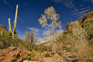
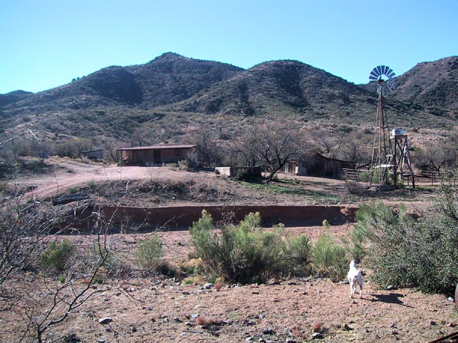
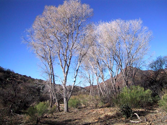
Peaceful and Secluded by Fritzski   This nice loop hike is originally described in J.Carlson and E.Stewart's book "Hiker's Guide to the Superstition Mountains" as Trip #50 "Randolph Canyon". It starts at the Woodbury trailhead and proceeds west on the Coffee Flat trail through Fraser Canyon to Dripping Spring. From there, it heads north on the Red tanks trail for a short distance, where it soon departs the trail and turns east through the bed of Randolph Canyon. Finally, intersecting the JF trail, you take it south back to the trailhead. This nice loop hike is originally described in J.Carlson and E.Stewart's book "Hiker's Guide to the Superstition Mountains" as Trip #50 "Randolph Canyon". It starts at the Woodbury trailhead and proceeds west on the Coffee Flat trail through Fraser Canyon to Dripping Spring. From there, it heads north on the Red tanks trail for a short distance, where it soon departs the trail and turns east through the bed of Randolph Canyon. Finally, intersecting the JF trail, you take it south back to the trailhead.History The JF Ranch and the JF Trail are named after rancher Jack Fraser who established a cattle ranch in this area in the 1890s, and it is still in operation today. Carlson surmises there may be a connection between Whetrock Canyon and a certain James Whetlach who also mined and ranched in the same area. Although I can't ascertain the origin of the Randolph Canyon name at this time, there was also a Randolph Mining District in the area. The Woodburys, after which the trailhead and the nearby windmill are named, evidently filed mining claims in that immediate area, and some evidence of their old workings are discussed below.
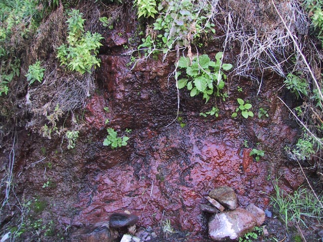
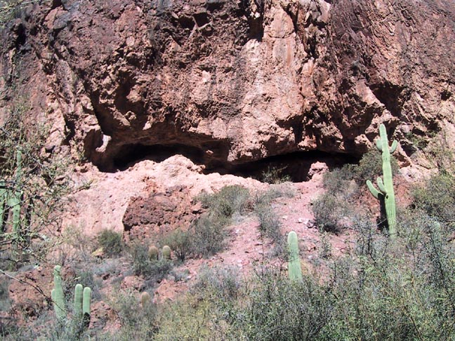
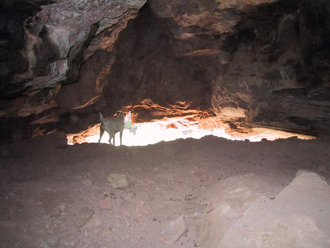
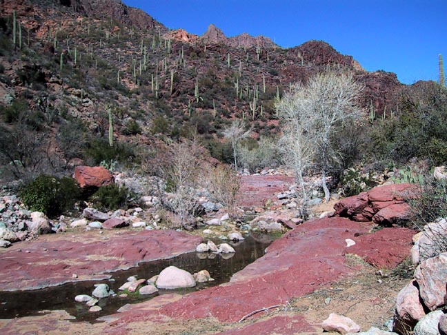
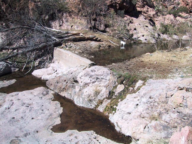
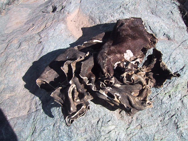
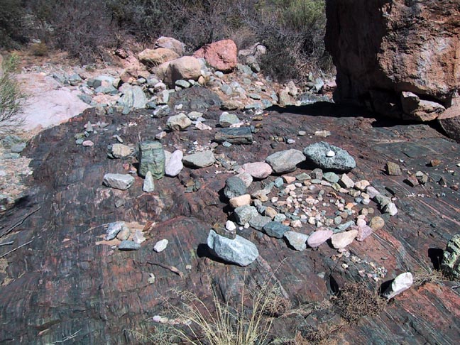
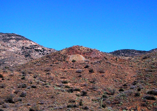
This is an enjoyable hike through what I would call the middle Superstition area. Elevations are generally about a thousand feet higher than the western Superstitions, making it a little more attractive as the temperatures begin to climb. The entire hike is on the still active JF Ranch grazing allotment, so cattle are very abundant throughout. For a more detailed description of the first segment from the trailhead to Dripping Spring, I suggest cross-referencing the Dripping Spring from Woodbury hike. Briefly, from the parking area, you start by backtracking on the dirt road to the locked gate at the top of the hill. Climb over the convenient built-in ladder and continue down the road to the JF Ranch. From there, you can pick up the westbound Coffee Flat trail by skirting around the north side of the corrals. The ranch is situated in a very scenic riparian area. Crisscrossing the canyon floor, there are numerous well-defined use trails to choose from, but for the most part, they are rendered useless because from about chest height and above, they are completely overgrown. After all, is said and done, it will behoove you to remain in the relatively clear wash as much as possible. As you proceed downstream through the canyon, you will pass the mouths of two intersecting canyons - the Whetrock and Musk Hog Canyons. Both are easy to miss from the canyon's bottom due to the thick vegetation on the banks. The creek bed itself varies mostly between smooth rock and sandy gravel. At about the 4-mile point, you will come to a beautiful small basin formed by the confluence of the Fraser and Randolph Canyons. This is the home of Dripping Spring and is characterized by numerous smooth rock pools and sheer walls. The spring itself is located at the west end of the basin at the cliffs base on the south bank. Look for the dark spot somewhat concealed behind bushes. The name "Dripping" is appropriate since it is a "seep", but despite the drought conditions at the time, it was flowing nicely enough to fill a water bottle in a matter of minutes. Straight north on the wall across from the spring is an interesting cave. A short climb up the base will bring you to the low and wide opening of a more true cave than a shallow alcove, which is more commonly found in the Superstitions. A tight crawl through the opening will bring you into a small cavern extending back about forty feet. After taking a break and enjoying the area, the return leg will begin by taking the Red Tanks trail north up Randolph Canyon. As you start out, you will encounter a sequence of nice smooth rock pools of which at least two were the home of some large minnows. This is something I've seen only one other place in the Superstitions. Continuing up the canyon about a half-mile, you will come to the Red Tanks trail intersection. I did not notice any sign or even the trail, but the departing canyon is unmistakable, and undoubtedly a short search would easily reveal its location. At about the 6.5 mile point you will encounter Randolph Spring. There is a large concrete dam, and the water was flowing nicely. As you continue, it becomes a rock-hop through the creek bed where you may encounter some unusual sights such as a dead kit fox, leather made the natural way, and evidence of people with too much time on their hands. When you encounter the barbed wire fence spanning the wash, climb the bank on the right to find a makeshift gate. Continuing, you will finally come to the JF Trail intersection, which is easily spotted. A short southbound climb will take you up to the Woodbury windmill. Continue south through the area and onto the dirt road leading up to the trailhead. As you're climbing the hill, you may notice some mine tailings coming out of the top of the small hill to your left. I didn't have time to investigate, but Jack Carlson informs me that there are an open-pit and several shafts left behind by the Woodbury diggings. Enjoy the pretty drive back from the trailhead, and I noted that the FR172 has been dramatically improved from the year prior and is suitable for any vehicle. Joe insisted I mention this may all change with the following significant rain that comes along. Please check out "Road Conditions" on the HAZ-Forum. Gate Policy: If a gate is closed upon arrival, leave it closed after you go through. If it is open, leave it open. Leaving a closed gate open may put cattle in danger. Closing an open gate may cut them off from water. Please be respectful, leave gates as found. The exception is signage on the gate directing you otherwise. Check out the Official Route and Triplogs. Leave No Trace and +Add a Triplog after your hike to support this local community. | ||||||||||||||||||||||||||||||||||||||||||||||||||||||||||||||||||||||||||||||||||||||||||||||||||||||||||||||||||||||||||||||||||||||||||||||||||||||||||||||||||||||||||||||||||||||||||||||||||||||||||||||||


