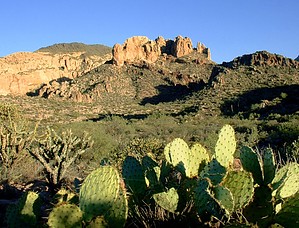
Walk about 0.3 miles down a dirt road to the Dutchman's/Second Water Trail. Take the Second Water Trail east (left). Cross First Water Creek bed (which will most likely be dry) and continue on a well-marked trail to Garden Valley. No route-finding skills are necessary on this trail, and most hikers will enjoy the rock and sometimes boulder-filled paths. You will have no doubt you've arrived in Garden Valley because the entire area is flat and covered with mesquite trees and chain fruit cholla cactus. In the middle of the Valley, you will come to the intersection of Second Water Trail/Black Mesa Trail. Just past the sign, you will see a mound of rocks, overgrown with grass and palo verde trees. This is the ruins of a prehistoric stone house and the place where you can find red pottery shards and metates (grinding holes) on the rock floor.
From here, you can take the unmarked horse trail continuing west to Hackberry Spring. Look toward the hillside when you get below the trail and the ravine to see evidence of old mine diggings. There are alternate return routes you can take, but we did this as an out and back. It's surprising how much beauty you find you missed when you're heading downhill.
WARNING! Hiking and outdoor related sports can be dangerous. Be responsible and prepare for the trip. Study the area you are entering and plan accordingly. Dress for the current and unexpected weather changes. Take plenty of water. Never go alone. Make an itinerary with your plan(s), route(s), destination(s) and expected return time. Give your itinerary to trusted family and/or friends.
Permit $$
None
Directions
Road
FR / Dirt Road / Gravel - Car Okay
To First Water Trailhead From Mesa follow Highway 60 East to Idaho Road. Turn North onto Idaho Road which is SR88 and follow North 2.2 miles. SR88 bends right just past Scenic St. and Idaho continues North. Be sure to go right and stay on SR88. Follow SR88 5.2 miles to the signed turnoff for First Water Trailhead, this is FR-78. Turn right on to FR-78 and follow 2.6 miles to the end.
This trailhead feature restrooms without running water. The large parking area fills up in season. When full utilize the Horse Lot 0.5 miles back.
From PHX (I-10 & AZ-51) 43.1 mi - about 59 mins From TUC (Jct 1-10 & Grant) 136 mi - about 2 hours 16 mins From FLG (Jct I-17 & I-40) 187 mi - about 3 hours 3 mins
 Route Editor

 Walk about 0.3 miles down a dirt road to the Dutchman's/Second Water Trail. Take the Second Water Trail east (left). Cross First Water Creek bed (which will most likely be dry) and continue on a well-marked trail to Garden Valley. No route-finding skills are necessary on this trail, and most hikers will enjoy the rock and sometimes boulder-filled paths. You will have no doubt you've arrived in Garden Valley because the entire area is flat and covered with mesquite trees and chain fruit cholla cactus. In the middle of the Valley, you will come to the intersection of Second Water Trail/Black Mesa Trail. Just past the sign, you will see a mound of rocks, overgrown with grass and palo verde trees. This is the ruins of a prehistoric stone house and the place where you can find red pottery shards and metates (grinding holes) on the rock floor.