Overview: This multi-use trail connects Cactus Trail to Packsaddle Trail. You may see hikers, mountain bikers, horses, quads or jeeps while on this trail. Motorized vehicles must have a Bulldog Canyon OHV permit in possession. As of this report few others use this trail.
When hiking several trails on a single "hike", log it with a generic name that describes the hike. Then link the trails traveled, check out the example.
WARNING! Hiking and outdoor related sports can be dangerous. Be responsible and prepare for the trip. Study the area you are entering and plan accordingly. Dress for the current and unexpected weather changes. Take plenty of water. Never go alone. Make an itinerary with your plan(s), route(s), destination(s) and expected return time. Give your itinerary to trusted family and/or friends.
Permit $$
Special Use
Directions
Road
FR / Dirt Road / Gravel - Car Okay
To hike This Trail is part of the Bull Dog Canyon OHV area and an administrative permit can be obtained at no cost from the Mesa Tonto Forest Office. The permit will allow further access beyond the gate for those with a four wheel drive vehicle. Highway 60 to Apache Junction exit 196, SR 88 ( the Apache Trail )north to milepost 199, turn left on Hackamore, 1.5 miles to Packsaddle trailhead. Go north on Packsaddle Trail 2 miles to the trailhead for the Rock House Trail
 Route Editor

 Overview: This multi-use trail connects Cactus Trail to Packsaddle Trail. You may see hikers, mountain bikers, horses, quads or jeeps while on this trail. Motorized vehicles must have a Bulldog Canyon OHV permit in possession. As of this report few others use this trail.
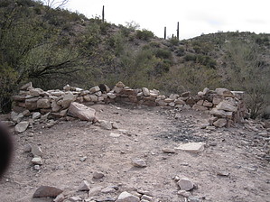


