 Route Editor

| Guide | ♦ | 114 Triplogs | 3 Topics |
details | drive | permit | forecast | route |
stats |
photos | triplogs | topics | location |
| 776 | 114 | 3 |
Hidden Gem by ck_1  Pass Mountain is one of two mountains accessed in the Usery Mountain Recreation Area. Heading north on Ellsworth you enter the recreation area and see Usery Mountain to your left (west) and Pass Mountain to the right (east). Pass Mountain is one of two mountains accessed in the Usery Mountain Recreation Area. Heading north on Ellsworth you enter the recreation area and see Usery Mountain to your left (west) and Pass Mountain to the right (east).History At one time, this area was home to an Indian village as well as Hohokam canals. For a period of time homesteads occupied the area, and today trails are named after those homesteaders (McGill and Coleman). The most famous or perhaps infamous name associated with the area is its namesake, Usery. King Usery was a cattleman who occupied the area in the late 1800s. He apparently wasn't an exceptionally skillful cattleman. In 1891 he and Bill Blevins held up a stagecoach near Globe. They earned themselves 2 silver bullion bars, as well as 7 years in prison at Yuma. Later, Usery would be arrested for horse stealing. For their part in creating the history of the area, the mountain and park were named after Usery, while a trail was named after Blevins.
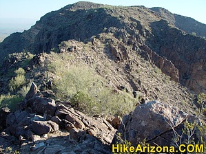
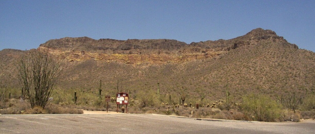
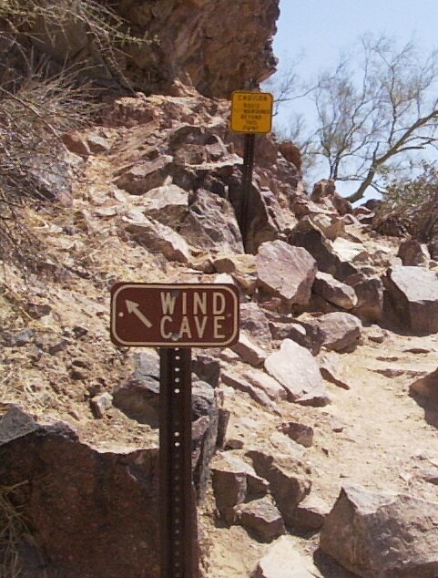
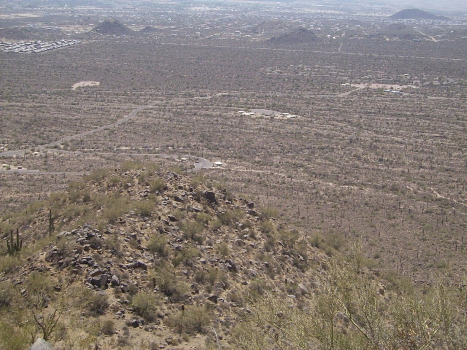
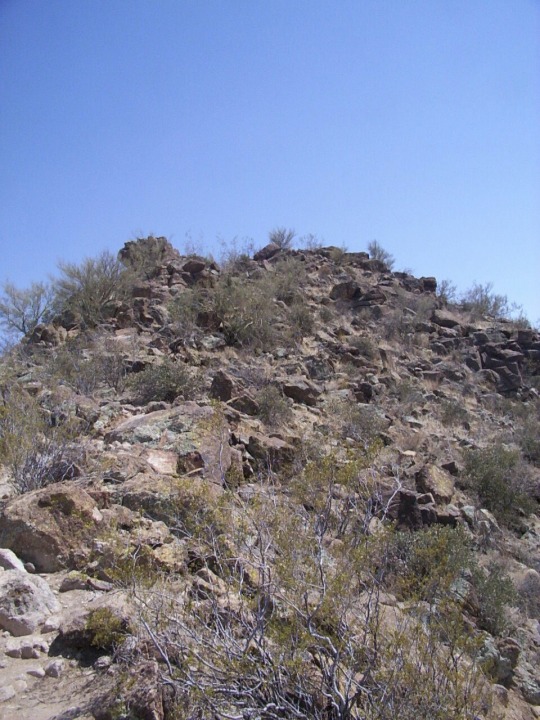
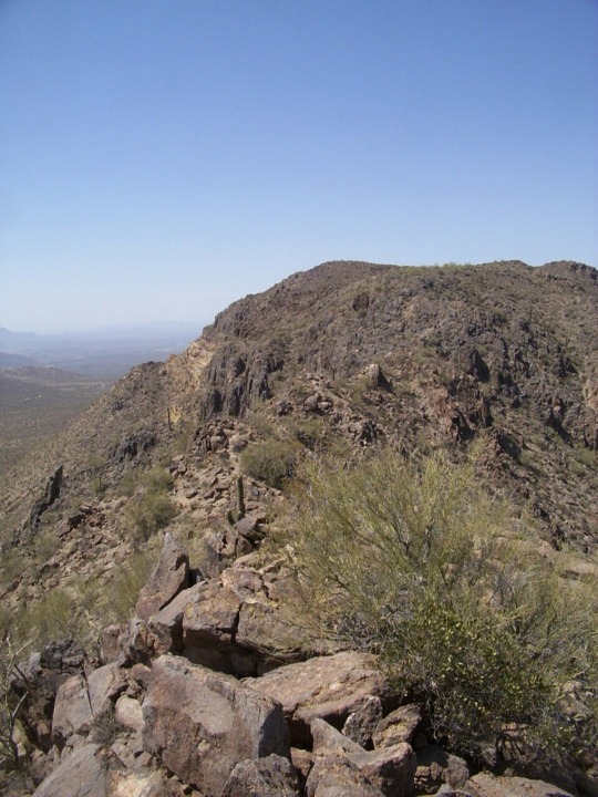
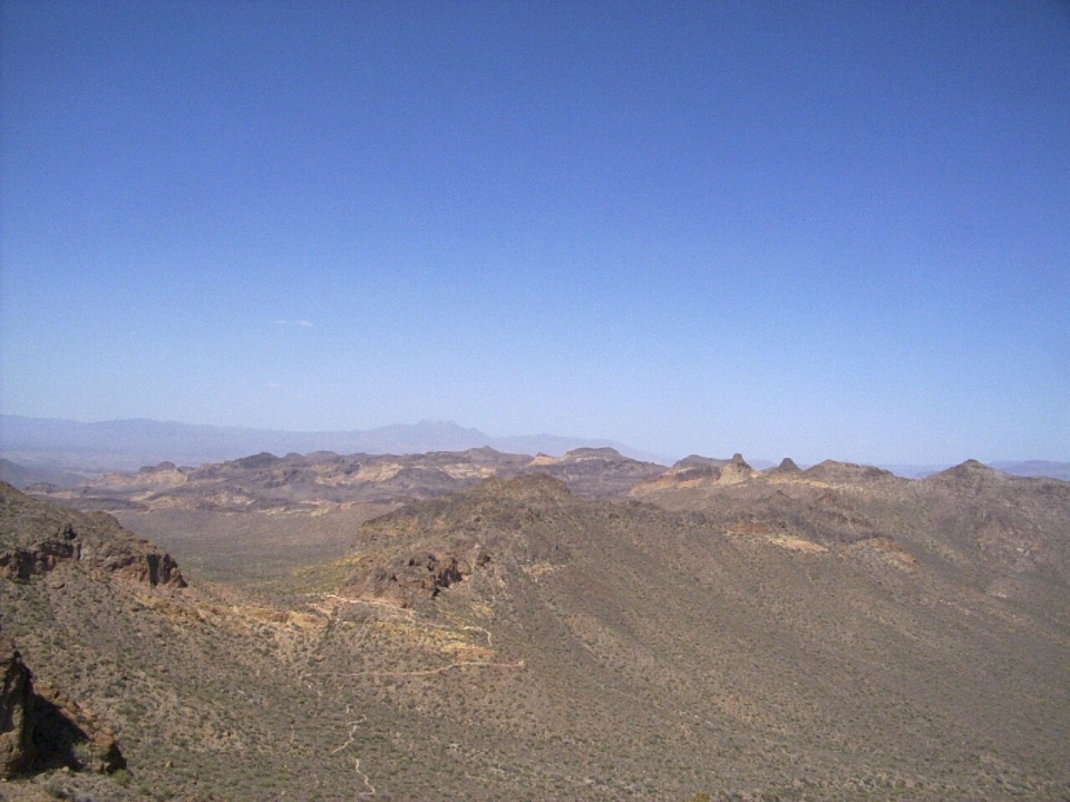
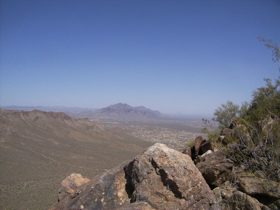
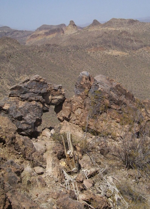
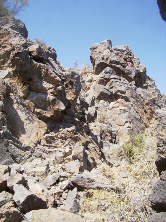
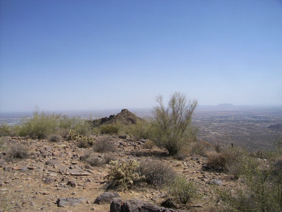
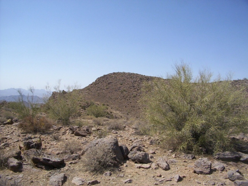
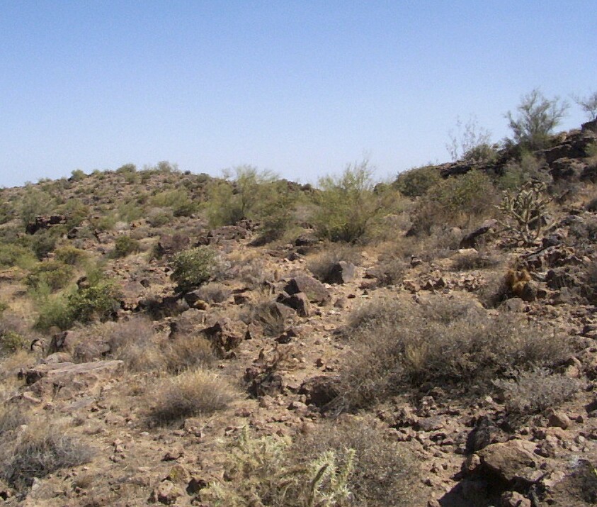
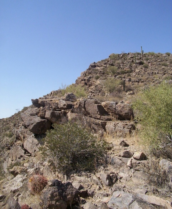
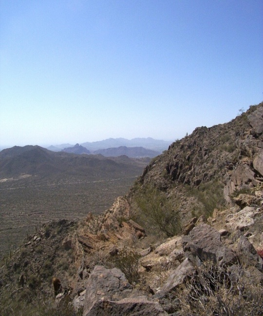
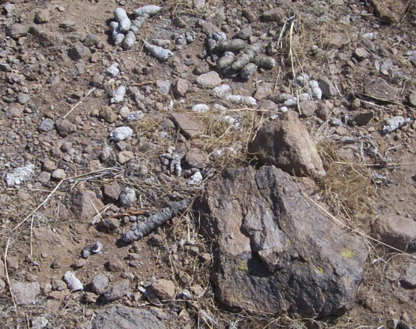
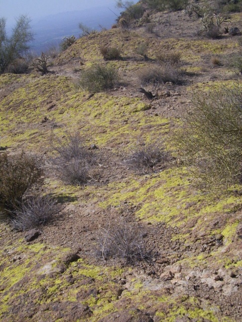
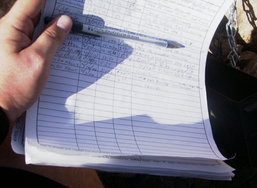
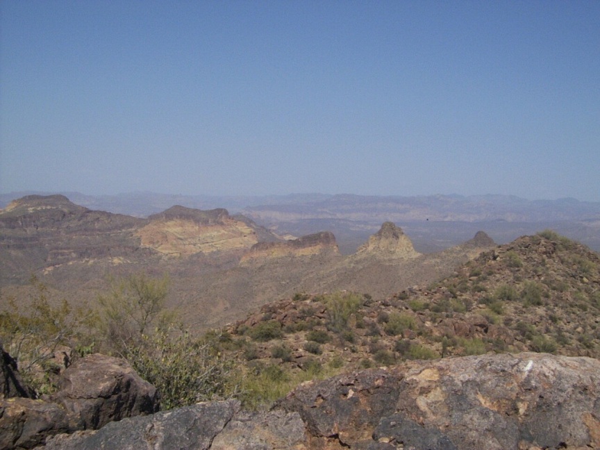
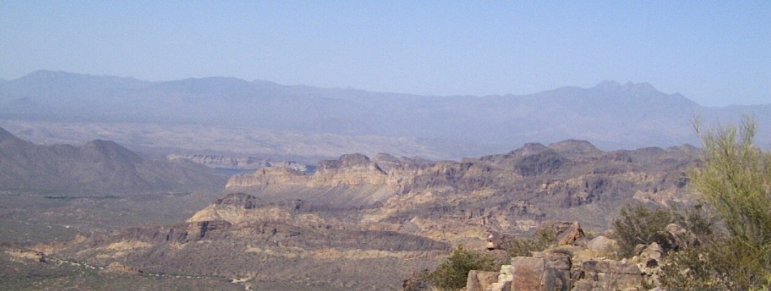
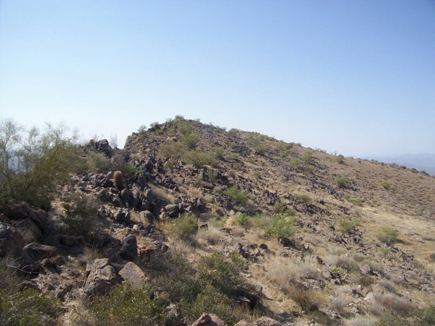
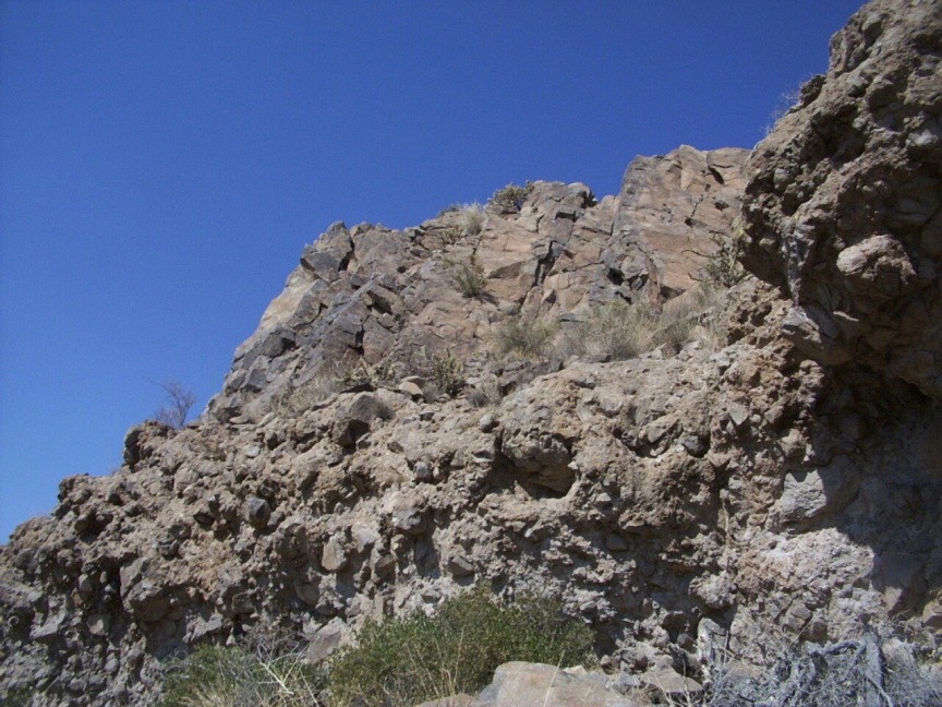
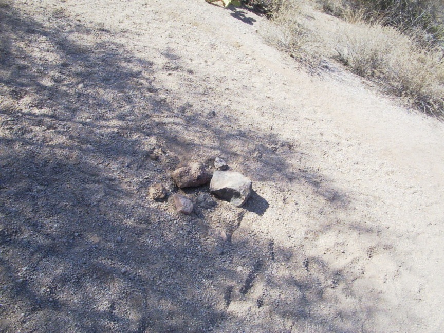
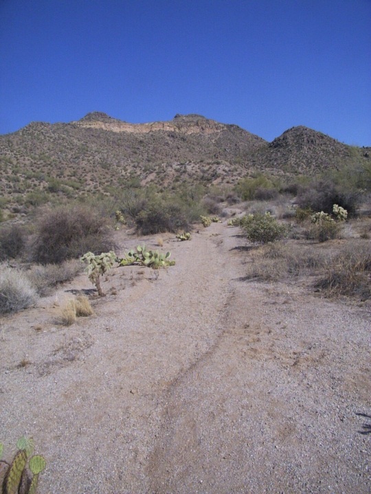
Pass Mountain is most notable for two features, the Wind Cave and its off-color stripe. The stripe called a "tuff layer" is solidified volcanic ash, which turns a shade of green after periods of heavy rain. Usery Mountain is most notable as the mountain with the "<=PHOENIX" sign. It is also home to a shooting range. Nothing enhances a wilderness experience like the sound of semi-automatic gunfire. Warning The Pass Mountain Ridgeline hike is a non-maintained trail. There is not much of a trail at all for most of the hike. Route finding is necessary, as is a basic understanding of the area. One should be familiar with both the Pass Mountain Trail as well as the Wind Cave Trail before attempting this hike. ( Both of which may be found in TrailDEX ) Hike The hike follows the ridgeline of the mountain. Literally. Once you reach the ridgeline, the trail all but disappears and you climb your way along the ridge. The views are stunning on this thrilling hike. The effort required is significant. Keep in mind this is not a high-traffic trail. Help is not nearby. Know your limits. From the Wind Cave Trailhead, follow the Wind Cave trail for the first 1.6 miles of this hike. The Wind Cave trail is well established and easy to navigate. The trail heads to the base of the cliff face and then works east toward the "cave". When you reach the signage for the cave, don't turn left, rather, continue up past the second sign, indicating that the trail is not maintained beyond that point. It took me 38 minutes to reach this point (I hike here often, so that time may be fast). There is still a recognizable trail at this point. Follow the trail. It continues east toward the southeastern slope of the mountain. The trail then climbs turning west. This section of trail has a few spur trails branching off, watch to ensure that you stay on course. Your goal is to reach the ridgeline, high above the Wind Cave. The exposure along this section is pronounced at points. At a few crucial points, a white spray paint blaze marks the route. About 10 minutes after passing the signage I achieved the ridgeline. The views are spectacular. Looking east you can see the route to the southeastern summit of Pass Mountain. If you are a purest, follow the route to access the summit, then backtrack to this point. I'd been up there many times before, so I opted to head west following the ridgeline. There are no trail or trail markings along this section of the hike. Route finding skills are necessary to pick your way along the ridge. The ridge consists of loose boulders and rocks. While the hiking is hard, the views are stunning. To the north, you see the saddle of the Pass Mountain trail, the Goldfield Mtns, the Salt River valley, and Four Peaks way off in the distance. To the East you see the Sups. Soon you will pass a wind hole and encounter a rather large slot followed by your first true climb. While only approx. 20 feet in length, it is climbing (I'd rate it 5.5 for those of you who climb). A fall would cause some serious damage. After ascending this little bugger, you get to descend on the other side. As this is the ridge, there isn't a safe way around it. This is true for several sections of this hike. The ridgeline continues west heading up a rather tough-looking section. Pick your way up this boulder field to one of several highpoints of this hike. Once on top, you will be in an amazing flat area compared to what you just climbed. This mesa-like area is dotted with cacti and other vegetation. The views are inspiring. Looking east you can see the southeastern summit. Looking west you see where you are heading. There is a scant trail periodically along this section. Enjoy the views as you continue westward. You will descend again, entering a basin-like area sloping toward the northeast. Soon, however, you will find yourself climbing the ridgeline to another highpoint, which will have stunning views, landmines and colorful ground cover. You will also discover an oddly placed cairn. As you continue west, you approach another section to be climbed. Head toward the highest point of this rock outcropping. You are climbing to the summit of Pass Mountain. Reaching an elevation of 3312 feet, the highpoint of the hike. The southeastern summit is 3127 feet. Sign in at the register. Use the HikeArizona.COM pen! Reading the register I discovered that no one had signed in since my last summit in April. Look around, the views rock! This is about the halfway point of the hike. From here you pick your way north for a few yards. You eventually cliff out, and need to work your way left (southeast) to descend to the lower level. This gets kind of tricky and requires you to pick your route well. There are few options and mistakes can put you in a bad spot. This section is pretty cool. There is a trail for a bit, the views are stunning, and the geology is impressive. I didn't get to enjoy it much this trip as an annoyingly aggressive bee harassed me. The dam thing wouldn't leave me alone. I ended up jogging down the trail a few hundred yards before the thing stung me in the ear. The ridge continues and descends again and then gives you a final climb. After climbing up and over this section, the descent is steep on loose gravel. You can almost make out the wave-like path you will need to follow. Keep in mind that you are following the ridgeline, head where the ridgeline runs. Start thinking about the Pass Mountain trail. You're aiming to connect with this trail as it runs parallel with Ellsworth/Usery Pass Road. It's way down there and will take you some time to reach. Follow the trail that appears again, this is your route. As long as you are heading west and descending, you're doing all right. You will eventually reach a section with about 5 drops. Each drop is less than 10 feet, but requires you to down climb or do a sit and scoot. You will pick up the trail again and continue descending along the ridge's western foothills. Remember, you should be heading perpendicular to Pass Mtn. Trail/Usery Pass Road. You can see the road, so you shouldn't get lost. Follow the path/game trail/water run-off until you reach a small saddle. You will see signs of human visitors. Descend to the right (northwest) and enter a small wash. Follow the small wash west for a few hundred yards to where it crosses Pass Mtn. Trail. There is a small cairn present. Here is a shot of what you just descended. You can see the wash as well as the rolling foothills on the left. From here, the hike is cake. Follow the Pass Mountain Trail back to the Wind Cave Trailhead. You'll pass through the National Forest fence about 10 minutes after hitting the trail. At this point, you are 1.55 miles from the trailhead. My best estimate as for trail length is approx. 5.5 miles. The only definite distances I have are the 1.6 miles of the Wind Cave trail and the 1.55 miles of the Pass Mtn. Trail. My Suunto watch recorded an elevation gain of 1620 feet. The hike took me 3 hours and 32 minutes when I did it on June 3, 2002. In April the hike took about 4 hours. Enjoy the hike, remember The Journey is the Destination, and as always - Be Safe! Check out the Official Route and Triplogs. Note This is a moderately difficult hike. Leave No Trace and +Add a Triplog after your hike to support this local community. | ||||||||||||||||||||||||||||||||||||||||||||||||||||||||||||||||||||||||||||||||||||||||||||||||||||


