Route Editor

| Guide | ♦ | 3 Triplogs | 0 Topics |
details | drive | no permit | forecast | 🔥 route |
stats |
photos | triplogs | topics | location |
| 26 | 3 | 0 |
Canyons are inherently risky. Flash floods occur without notice on sunny days. Technical skills & surrounding topography knowledge required yet does not eliminate risk.
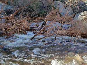
Seldom seen, Rarely pleasant by nonot  Overview OverviewA loop hike down a feeder canyon into Fish creek, looping back to the bridge. Warning You must be certified insane to attempt this hike, especially if you do it carrying 55 pound (dry) packs in class C conditions and 40-degree water! (Which happens to be the only time to do this hike.)
History I'm not sure if we were the first group to descend this canyon but we may be the last for quite a while. We named the canyon for the beautiful waterslide that stretches for 100+ feet down the canyon. I believe you will only find water in this canyon after the rare Arizona heavy rainshower. Hike From Tortilla trailhead at Apache Trail, climb up the road approximately 1 mile and turn left to route find your way down into the upper branch of Minnow Canyon. Once at the junction with the first main feeder coming in on your right, climb up out of the canyon as shown in Joe's "Tortilla-Fish Mesa" hike. Traverse the ridgeline to the south until you find you have to contour around a fairly significant and steep canyon that comes in on your left. If you visit this after a winter rainstorm, be careful as there is ice everywhere! Drop into the head of the canyon and engage in some class B3 bushwhacking. This is not for amateur bushwhackers, you need to hone your skills before attempting this! After 2.5 hours or thereabouts, you will reach a large mossy boulder with the only slightly difficult down-climbing move. After a bit more bushwhacking past this point, assuming you have gone after rain, the canyon becomes less brushy and begins to throw waterfall after waterfall at you. The best one is very close to reaching Fish Creek, which is a slick rock slide over 100 feet long. At the junction with Fish Creek, you will think certain death awaits as you stare at a powerful hydraulic that forms right at the junction. Don your 3mm wetsuits and any extra neoprene you brought and safely cross a bit upstream. Route find your way downstream, fording the class C conditions in the safest spot. Shorter people may struggle in a few spots since the crossing may be somewhat deep at the current very powerful. Pay attention and help out each other, the current can take someone down very quickly, be prepared! Water Sources YES! Camping You won't want to camp if you do this when it's wet! Check out the Official Route and Triplogs. Leave No Trace and +Add a Triplog after your canyon trip to support this local community. | ||||||||||||||||||||||||||||||||||||||||||||||||||||||||||||||||||||||||||||||||||||||||||||||||||||||||||||||||||||||