 Route Editor

| Guide | ♦ | 8 Triplogs | 0 Topics |
details | drive | no permit | forecast | route |
stats |
photos | triplogs | topics | location |
| 108 | 8 | 0 |
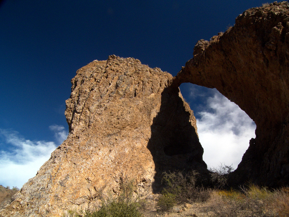
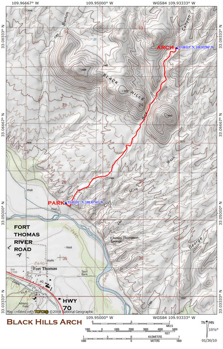
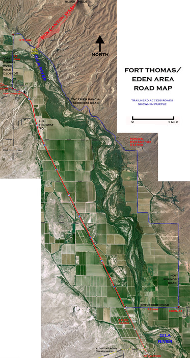
bats 'n bees 'n mesquite trees by PrestonSands  Overview OverviewThis hike takes you up a desert drywash to a natural arch in the foothills of the Gila Mountains, between Globe and Safford. Cliffs of swirled volcanic rock, hoodoos, saguaros, numerous alcoves, and the rugged peaks of the Gila Mountains combine to create a picturesque environment on the way to the thirty-foot arch. Springtime can bring poppies, lupines, and brittlebushes into flower on this eastern fringe of the Sonoran Desert, rain permitting. Getting There North of the little town of Fort Thomas, and directly across the Gila River from it, the small but distinct Black Hills burst forth from the surrounding desert flats. A white "T" for Fort Thomas identifies the hills, and a prominent gash cuts through their east side. This gash, known as Box Canyon, is where you are headed.
Warning Box Canyon seems to be loaded with beehives. Be(e) careful before approaching any alcoves. Hike Once you have located the wide, gravel-filled wash of Box Canyon, start hiking up it. Low terraces of consolidated sediment define the edges of the wash, on a stretch that would otherwise be rather boring if not for views of the surrounding mountains. About a mile in, the first saguaro appears, and Box Canyon comes into view. The wash soon begins a gradual narrowing, that funnels you towards the box. Entering the box, massive walls of intricately sculpted, grayish-brown rhyolite rock hem you in. Saguaro sentinels stand watch from the canyon walls, guarding numerous inaccessible holes and alcoves. The box soon ends at a low wall of dark basalt rock, where Box Canyon forks. Avoid the left fork, and keep going straight. Cactus-covered bluffs continue on this next stretch. Careful observers will notice a couple of small natural windows in the rocks above. The bluffs soon transition into canyon slopes, and Box Canyon wash widens. Slightly over a mile after entering the box, the wash rounds a corner, where it meets a little rounded butte of brownish rock poking out from the canyon floor, just below the 3400-foot contour. The canyon forks again at this little butte, with both forks entering a maze of low bluffs. Take the left fork. You'll immediately come to a cone-shaped rock with a cave in it on your left, above the wash. Look to your right at this point and there is the Black Hills Arch, twenty feet above the wash, on the backside of the little rounded butte (33.0811 N, 109.93303 W). One can stand inside the arch, which forms a perfect window between the two canyon forks. Just up the narrow left fork of the canyon from the arch are several alcoves. One contains a looted prehistoric site, with a few pottery sherds lying around. Another alcove is quite deep and appeared to be a bat cave. Box Canyon narrows into a slot canyon a few hundred yards further, where a couple of small seasonal waterfalls make continued progress difficult. There is plenty to explore. Have fun! Check out the Official Route and Triplogs. Leave No Trace and +Add a Triplog after your hike to support this local community. | |||||||||||||||||||||||||||||||||||||||||||||||||||||||||||||||||||||||||||||||||||||


