 Route Editor

| Guide | ♦ | 11 Triplogs | 0 Topics |
details | drive | no permit | forecast | route |
stats |
photos | triplogs | topics | location |
| 79 | 11 | 0 |
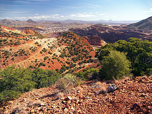
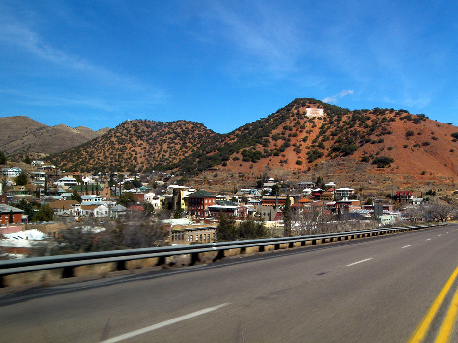
nice view, nice little hike by PrestonSands   Overview OverviewChihuahua Hill is the familiar red hill with the "B" on it, above Bisbee, Arizona. Its summit affords great views of the town of Bisbee, the Lavender Pit, and the surrounding area. A well-traveled informal trail, popular with the locals, provides a short hike to the top of Chihuahua Hill. This hike makes for a nice little side adventure if you are roaming the streets of Bisbee. This trail also makes a convenient starting point for other hikes in the hills above Bisbee. Note The trail to Chihuahua Hill is entirely on private land, so please be respectful, so that the kind landowners continue to allow people to hike across their land.
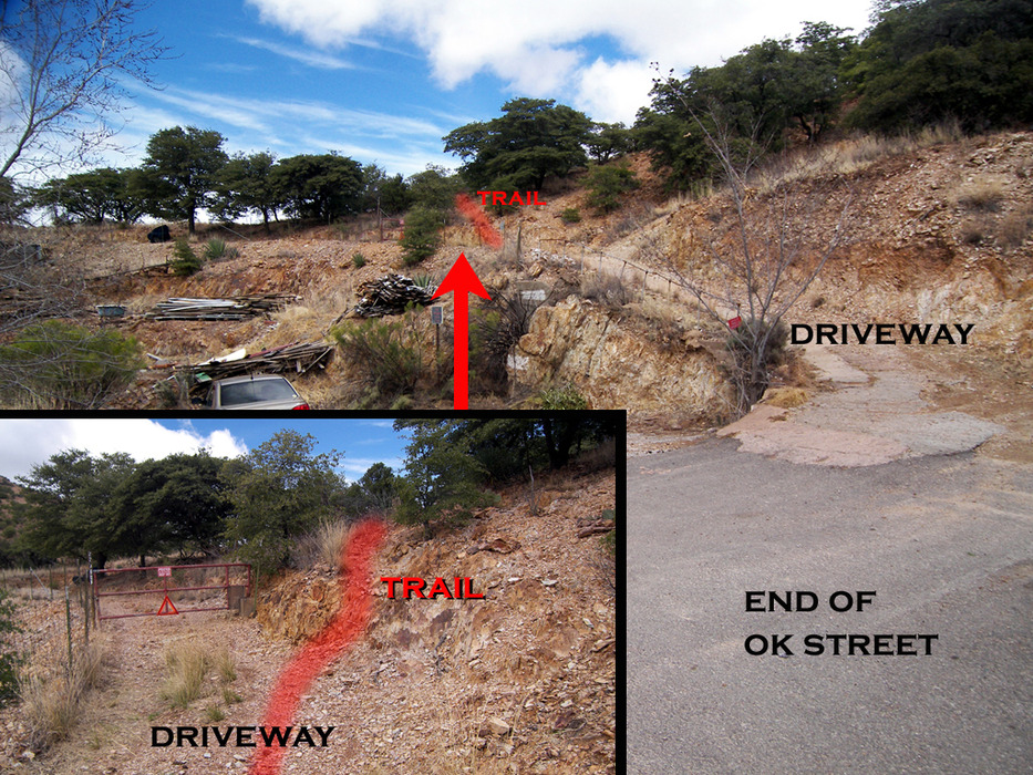
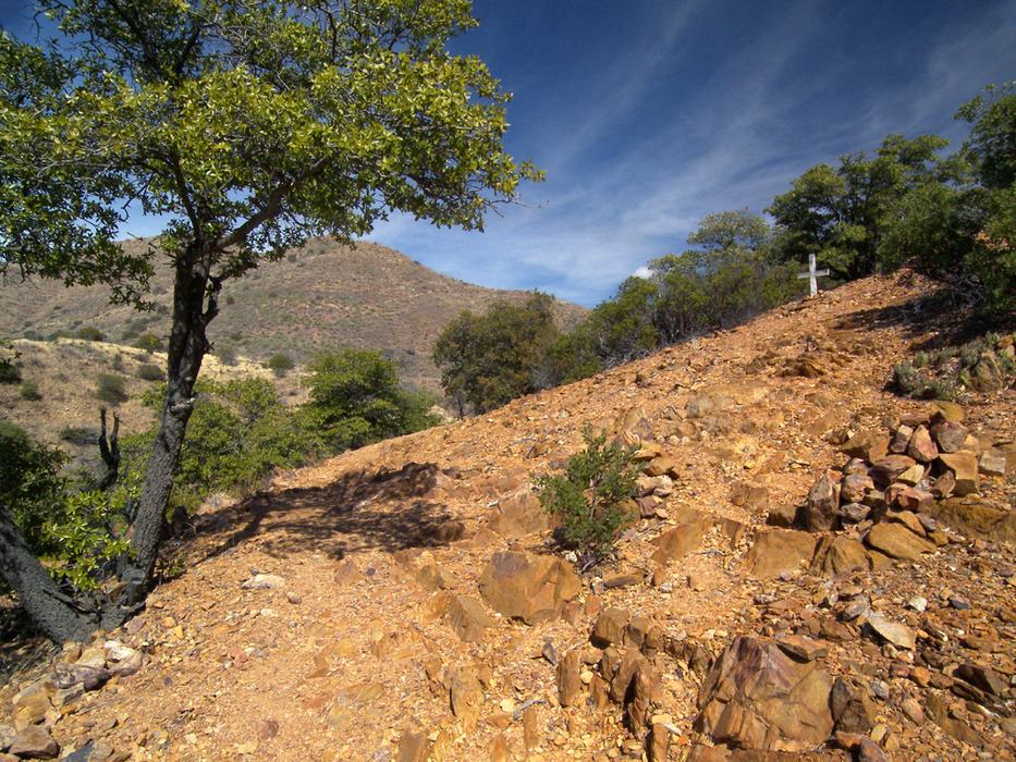
The trail begins at the end of OK Street, which is the easternmost street in downtown Bisbee, paralleling Brewery Avenue. There is no public parking available on the one-lane OK Street, so park at the free public lot on lower Brewery Avenue, which is located one block up from Naco Road/Main Street. Take the stairs up to OK Street from the public lot, or just backtrack to Naco Road and follow OK Street. Follow OK Street to its end in just under a half-mile, and then continue up an old concrete driveway for a hundred feet or so to a red metal gate that reads "Posted-No Trespassing". Just before the gate, our trail climbs the rocks on the right. It is a bit indistinct at first but soon becomes a definite trail. Within a very short distance, the trail forks, with the left branch traveling along a fence. Stay on the right fork. The trail climbs along the rocky western slope of Youngblood Hill, reaching a trail junction at a quarter of a mile, which is marked by cairns and a small white wooden cross anchored into the hillside (GPS coordinates: 31.45001 N, 109.91169 W). Turn right and take the spur trail straight up the hill. This spur trail tops out on the summit of Youngblood Hill in 0.15 miles, next to an elaborate shrine and large white cross, which is visible from the streets of Bisbee below. There are a few scattered benches and numerous rocks from which to admire the bird's eye view of the town and the surrounding mountains. To continue to Chihuahua Hill, which is the next hill to the south, continue following the trail southeast along the crest of Youngblood Hill. The trail drops off the southeast corner of the hill near a very large cairn and makes a brief, steep descent on loose rock to a road located in a saddle between the two hills. Take this rocky abandoned road south, which climbs the side of Chihuahua Hill. As the road nears the top, there is a nice view to the south of Mexico and down into the Lavender Pit. Poke around among the trees for a clear view of Bisbee some five hundred feet below. Enjoy, and return the same way. Gate Policy: If a gate is closed upon arrival, leave it closed after you go through. If it is open, leave it open. Leaving a closed gate open may put cattle in danger. Closing an open gate may cut them off from water. Please be respectful, leave gates as found. The exception is signage on the gate directing you otherwise. Check out the Official Route and Triplogs. Leave No Trace and +Add a Triplog after your hike to support this local community. | |||||||||||||||||||||||||||||||||||||||||||||||||||||||||||||||||||||||||||||||||||||||||


