 Route Editor

| Guide | ♦ | 7 Triplogs | 0 Topics |
details | drive | no permit | forecast | map |
stats |
photos | triplogs | topics | location |
| 161 | 7 | 0 |
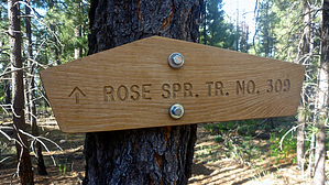
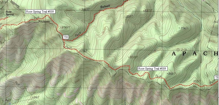
 Details from Apache-Sitgreaves NF: Details from Apache-Sitgreaves NF:You'll enjoy some of Alpine District's most outstanding vistas as you travel this relatively easy walk with its moderate gradient and pleasantly forested surroundings. The magnificent views are yours, courtesy of the Mogollon Rim. This 1500 foot drop-off forms the southern edge of the Colorado Plateau and provides a high perspective for the panorama. This prodigious escarpment towers over the forested canyons of the Eagle Creek, Rose Peak, Maple Mountain, and far in the distance, Mount Graham and the Pinalenos. The Rose Spring Trail, also called the Rim Trail, follows a fence line along the southern boundary of the Bear Wallow Wilderness as it hugs the rim. About 3 miles from the trailhead, the Schell Canyon Trail #316 branches off on a course that leads to the South Fork of Bear Wallow Creek and into the heart of the wilderness. From the junction with Schell Trail, the Rose Spring Trail continues through another mile and a half of conifers and ponderosa to the San Carlos Indian Reservation boundary. A standard stock fence marks that boundary. At this point, a road from the reservation side of the fence crosses on to the Forest side and cuts back to Rose Springs, an intermittent water source.
No motorized or mechanized vehicles (including mountain bikes) are permitted in Wilderness. A special use permit from the tribe is required for entry onto the San Carlos Apache Indian Reservation. Trail Log: 0.0 Trailhead, trail proceeds through a gate in the fence 50 yards below (north) of the parking lot. 0.9 Open saddle. Good view to the south. 1.8 Trail goes through second gate. 2.7 More good views. 3.4 Schell Canyon Trail #316. 4.1 Old trail to right through fence, continue left 4.5 Unsigned junction with Highline Trail to left, continue straight. 4.9 San Carlos Apache Reservation boundary fence. Turn sharp right and proceed on road to Rose Spring. 5.2 Rose Spring. USGS Maps: Baldy Bill
Gate Policy: If a gate is closed upon arrival, leave it closed after you go through. If it is open, leave it open. Leaving a closed gate open may put cattle in danger. Closing an open gate may cut them off from water. Please be respectful, leave gates as found. The exception is signage on the gate directing you otherwise. Check out the Triplogs. Leave No Trace and +Add a Triplog after your hike to support this local community. One-Way Notice This hike is listed as One-Way. When hiking several trails on a single "hike", log it with a generic name that describes the hike. Then link the trails traveled, check out the example. | |||||||||||||||||||||||||||||||||||||||||||||||||||||||||||||||||||||||||||||||||||||


