|
tap row or icons for details
|
| Difficulty |
|
1.5 of 5 |
| Distance |
|
7.4 miles |
| Trailhead Elevation |
|
6,394 feet |
| Elevation Gain |
|
1,000 feet |
| Kokopelli Seeds |
|
10.73 |
| Dogs not allowed |
| | |
|
|
44 |
2023-06-24 |
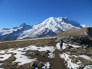
Skyscraper Mountain Trail |
Lucyan |
|
|
|
5 |
2022-09-08 | sagamihara_hiker |
|
|
54 |
2019-08-03 | Lucyan |
|
|
21 |
2018-10-13 | sagamihara_hiker |
|
|
19 |
2017-08-20 | sagamihara_hiker |
|
|
20 |
2016-07-24 | sagamihara_hiker |
|
|
10 |
2015-08-22 | sagamihara_hiker |
|
|
15 |
2014-07-12 | sagamihara_hiker |
| | Page 1, 2 |
| |
|
|
list |
map |
done |
Volcano Region |
| | |
|
| |
|
|
Historical Weather |
| Trailhead Forecast | | |
|
 |
|
|
| Preferred Aug, Jul, Sep, Jun |
|
|
| | |
Named Locations Coordinate Links
| |
|
|
Burroughs Mountain Trail
|
9.75 mi
2,600 ft |
 |
|
Burroughs Mountain Trail
|
11.85 mi
3,191 ft |
|
| Burroughs Mountain Trail
| 2022-09-08 |
sagamihara_hiker |
|
9.4 mi
2,797 ft |
|
|
|
Burroughs Mountain Trail
|
13.58 mi
3,886 ft |
|
|
Burroughs Mountain Trail
|
12.58 mi
4,208 ft |
|
| Burroughs Mountain Trail
| 2018-10-13 |
sagamihara_hiker |
|
9.39 mi
2,736 ft |
|
|
| Burroughs Mountain Trail
| 2017-08-20 |
sagamihara_hiker |
|
9.46 mi
2,744 ft |
|
|
| Burroughs Mountain Trail
| 2016-07-24 |
sagamihara_hiker |
|
8.83 mi
2,530 ft |
|
|
| Burroughs Mountain Trail
| 2015-08-22 |
sagamihara_hiker |
|
9.03 mi
2,592 ft |
|
|
| Burroughs Mountain Trail
| 2014-07-12 |
sagamihara_hiker |
|
8.37 mi
2,026 ft |
|
|
| Burroughs Mountain Trail
| 2013-09-08 |
sagamihara_hiker |
|
6.49 mi
1,415 ft |
|
|
| Burroughs Mountain Trail
| 2013-07-20 |
sagamihara_hiker |
|
8.9 mi
1,931 ft |
|
|
| | |
| |
|
|
 Happy Trails!
|
 Route Editor