Route Editor

| Guide | ♦ | 2 Triplogs | 0 Topics |
details | drive | permit | forecast | route |
stats |
photos | triplogs | topics | location |
| 6 | 2 | 0 |
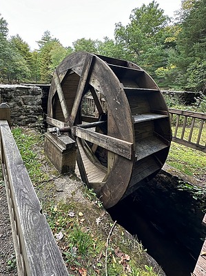
Come CCC this Historic Park by GrangerGuy Chatfield Hollow State Park has something for everyone. There are 18 miles of hiking on well-maintained trails as well as ponds, picnic areas, a boardwalk through the swamp, and a nature museum. The state park is adjacent to the Cockaponset State Forest, and trails seamlessly pass from park to forest. History The CCC built the park during the 1930s.
There are many trails within the park, today principally identified by the color of their blazes. Often, one will chain together parts of several of them to make a nice hike. The posted "official route" is just one of many options for enjoying hiking in the park. That route starts at the west end of the parking area on CT-80, following the Chimney (green) Trail along some spectacular granite bluffs with some impressive caves, possibly used by the Hammonasset Indians. Crossing the main park road, the route continues on the Lookout (white) Trail, the Eastwoods (blue) Trail loop, back to the Lookout Trail, then cutting over an unmarked trail to the Ridge (red) Trail and heading north to the Mill Pond. Where the Ridge Trail begins to parallel the Covered Bridge (purple)Trail, it becomes difficult to follow, and sometimes parties will do a steep bushwhack down the hill to the Covered Bridge Trail, picking up the Ridge Trail again where the Covered Bridge is now missing. Continuing just a little further, one arrives at the Mill Pond, with benches, picnic tables, and outhouses. The return trip to CT-80 is enjoyed upon leaving the pond to the west on a short segment of the West Crest (blue) trail, and then turning south on the Deep Woods (orange) trail. At an intersection, take the Pond Trail (orange-white) over to a small pond, eventually returning to the Deep Woods Trail. A scramble on the orange trail may be avoided by a walk on an unofficial trail up the west side of a large outcropping. One arrives at the road near the west end of the Paul Wildermann Boardwalk, which is labeled with many interesting and informative signs as it meanders across the swamp. Following the main road south, pick up the rest of the Green Trail back to the parking lot.
Check out the Official Route and Triplogs. Leave No Trace and +Add a Triplog after your hike to support this local community. | |||||||||||||||||||||||||||||||||||||||||||||||||||||||||||||||||||||||||||||||||||