Sevenmile Gulch Trail is a serious multi-use trail, allowing everybody and everything to use it, except SUVs. And my suggestion from the start is, do not hike it! Boring and for the serious hikers, too much risk running into other forms of outdoor enthusiasts riding loud, exhaust belching machines. And who does not share the same interest in foot travel racing up and down the trail?
The trailhead is large enough to accommodate several vehicles and offers no amenities. Easy to start the hike, you pass a locked gate and follow an old road about a quarter of a mile into a clearing. Bear to the right where you will note a plastic yellow stake in the ground alerts you to where the trail continues out of the pines and you begin your trek.
I do not encourage this, but I just hiked Trail 9854 right after Christmas. Aside from being chilly in the low 40's with sight winds; the trail offered a variety of challenges. As I worked my way up the gulch, the trail was either frozen solid, covered with large sheets of ice, muddy, from early snowstorms, and in very few places dried! Meandering through scrub oak and manzanita countryside, I got the impression a fire raged through here many years ago, creating a feeling of being bare and naked, working my way up. But, I did make a mental note to enjoy the view on the way back. The San Francisco Peaks and Mingus Mountain are in the distance and the area around promises to be a pleasure for my eyes. You begin to work your way into the pines in the higher elevation after a mile or so.
The highlight of my hike was when I was resting at the end trail making notes in my journal. Storm clouds, which I noted in the west, began dumping snow in earnest. It was fantastic! Visibility dropped from sixty-plus miles to a mile in a matter of minutes! The hike back down was great, the snowfall giving me a warm feeling of nature wrapping her blanket around me and whispering sweet music as it caressed everything around me.
Gate Policy: If a gate is closed upon arrival, leave it closed after you go through. If it is open, leave it open. Leaving a closed gate open may put cattle in danger. Closing an open gate may cut them off from water. Please be respectful, leave gates as found. The exception is signage on the gate directing you otherwise.
When hiking several trails on a single "hike", log it with a generic name that describes the hike. Then link the trails traveled, check out the example.
WARNING! Hiking and outdoor related sports can be dangerous. Be responsible and prepare for the trip. Study the area you are entering and plan accordingly. Dress for the current and unexpected weather changes. Take plenty of water. Never go alone. Make an itinerary with your plan(s), route(s), destination(s) and expected return time. Give your itinerary to trusted family and/or friends.
 Route Editor


 Sevenmile Gulch Trail is a serious multi-use trail, allowing everybody and everything to use it, except SUVs. And my suggestion from the start is, do not hike it! Boring and for the serious hikers, too much risk running into other forms of outdoor enthusiasts riding loud, exhaust belching machines. And who does not share the same interest in foot travel racing up and down the trail?
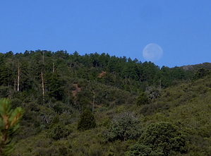


