 Route Editor

| Guide | ♦ | 18 Triplogs | 0 Topics |
details | drive | permit | forecast | route |
stats |
photos | triplogs | topics | location |
| 47 | 18 | 0 |
Rugged by Abe   Note The summary here represents one leg a three-trail loop, hiked in the following order: Note The summary here represents one leg a three-trail loop, hiked in the following order:1) Juniper Springs #2, 3.7 mi 2) Juniper Mesa Trail #20, 5.7 mi 3) Oaks and Willow Trail #3, 3.2 mi 4) 7.5 mi on FR 150 back to trail #2 Caution I strongly recommend hiking this trail in mid-spring or mid-fall.
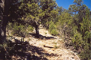
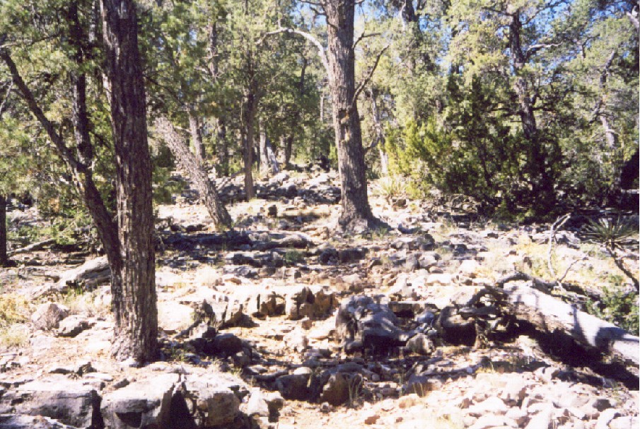
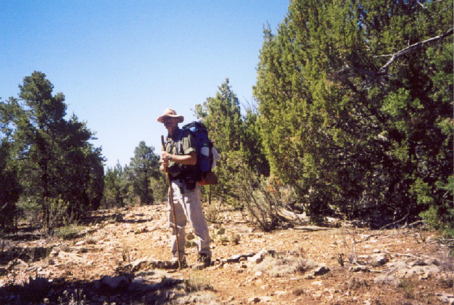
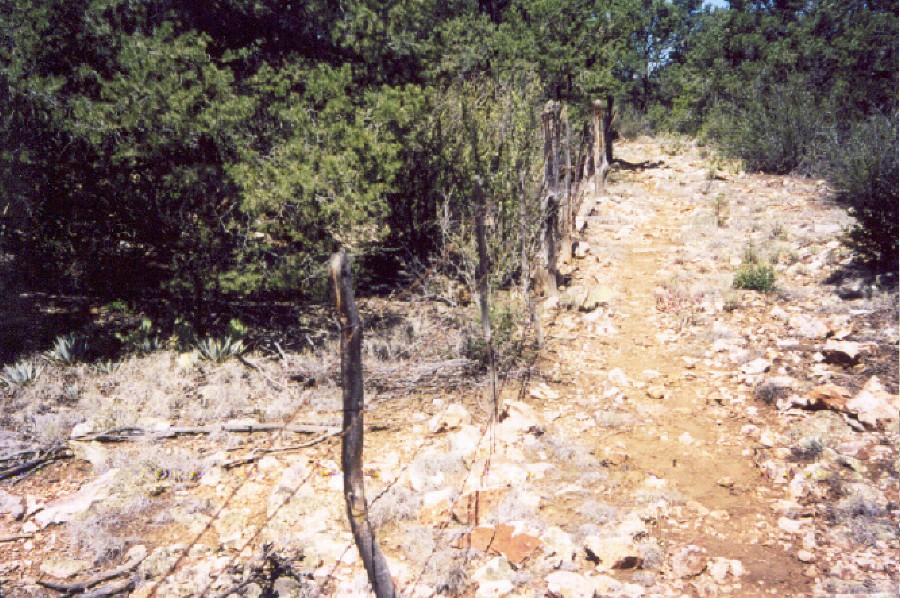
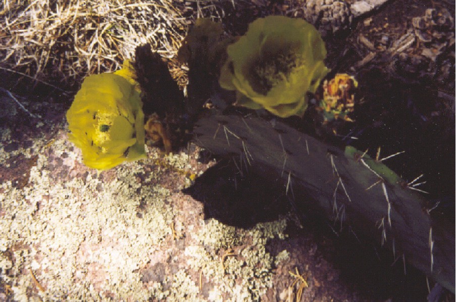
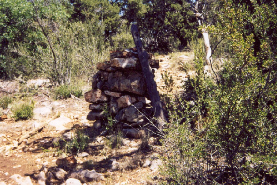
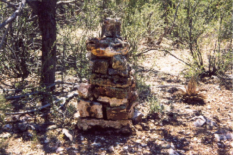
Hike After the brief respite, I decided to take a stroll down the trail and see if I could locate Juniper Springs. The trail comes to a fence marking the wilderness boundary, and I did not find anything other than an empty water tank and empty water trough. Nearby is another trailhead that forest road 9867A comes into. In the area is a broken-down, run-down feed trough for horses that had seen better days. Note I found out later in the evening talking to Jim that if I had gone down past the feed trough, I would have found the spring or at least a pipe with a trickle of water coming out. From my journal, "You can feel the heat; everything is dry. Good gosh, the first half-mile of trail #20 I had an elevation gain of at least 700 feet!! Kicked my butt. Rocky! The trail seems to be made up of broken quartz!" The trail does level off and pretty much remains that way with a few minor dips. And so I walked a leisure pace under the pines and junipers lining the trail. Oddly, I ran into a fence line which pretty much runs parallel to the trail throughout the hike. What the heck is it for? To keep hikers from peering over the ledge or stupid cows from falling off? However, I did come across breaks in the fence, allowing me to stand on rock outcroppings and affording me a panoramic view below. Notwithstanding, even in the harsh environment of rocks, dirt, and heat, I found beauty. Hidden almost shy, tenderly clinging on to life among the giants of pine and junipers. "Lunch! Consisted of cheese and crackers, a peanut butter power bar, and beef jerky. My appetite is slated, and that is good. But if all is well and I read the map right, I have only one hill left to climb. Then it looks fairly easy w/ the trail @ 7000 ft plus & level." A mistaken journal entry. After writing that, I ended up having two hills to climb. So much for my land navigation and map reading skills. We pressed on, eventually coming out on level ground and pleasant pace. About this time, I began to consider my water and wrote, "Ran out in platypus." My first three liters of water were depleted. I had three liters of water remaining and quite a distance to cover before my anticipated campsite. I continue, thinking I can nurse my remaining water. Surprisingly, I ran into another backpacker named Jim and his dog, an Aussie heeler, it looks like. Both heading in the direction I have just traveled. We exchanged formalities, trail conditions, and the likes. Before going our separate ways, he told me about a large pile of rocks which indicates a shortcut off the mesa leading down to Bull Spring. I not only found one pile of rocks but another a few yards down the trail. Standing near the first pile of rocks, though, I considered the option of hiking down at this point, studying what appears to be a trail slipping into the trees, possibly leading down of the mesa. However, my map did not indicate any such trail dropping off the mesa near this point, so I decided not to pursue it. After all, I had trail #20 to finish. From this point, the trail is nice, and after a couple of miles, give or take, you will come upon a fence and trail #3, the Oaks and Willows Trail. A sign nearby points you in the right direction. To my right, trail #3 will take you down to Pine Springs, and I considered hiking down to it. However, this would tack on an additional four or five miles round trip, with no guarantee of water. I am hooking a left. Continue on to Oaks and Willow Trail 3
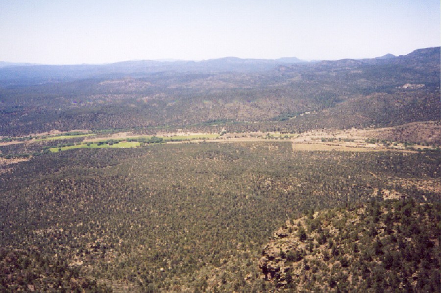
Prescott FS Details Lying entirely within the Juniper Mesa Wilderness, this trail offers magnificent views to the south from the mesa rim. The trial is relatively level at an elevation of about 7,000 ft., traversing through Ponderosa pine, Gambel's oak, and Alligator juniper. In one of the most remote sections of northwestern Arizona, it offers the wilderness traveler an experience of solitude and vast panoramas of this semi-arid region. Maps, other resources: Prescott National Forest, west half; U.S.G.S. topographic 7.5' quads for Juniper Mountain and Indian Peak. Trail layout: The trail begins at Juniper Springs on the east end of Juniper Mesa. It climbs to the top of the mesa and then continues along the southern rim of the mesa for about 6.5 miles. The western end of the trail intersects Trail #3 (Oaks & Willows Trail) from where you can continue on Trail #3 either west to join FR 150 by way of George Wood Canyon or northeast to Pine Springs and FR 7. Precautions: There is no water available along this trail. There is water at Juniper Spring but it has not been tested for quality. Check out the Official Route and Triplogs. Leave No Trace and +Add a Triplog after your hike to support this local community. One-Way Notice This hike is listed as One-Way. When hiking several trails on a single "hike", log it with a generic name that describes the hike. Then link the trails traveled, check out the example. | ||||||||||||||||||||||||||||||||||||||||||||||||||||||||||||||||||||||||||||||||||||||||||||||||||||||||||||||||||||||||||||||||||||||||||||||||||||||||||||||||||||||||||||||||||||||||||||||||||||||


