 Route Editor

| Guide | ♦ | 34 Triplogs | 4 Topics |
details | drive | no permit | forecast | map |
stats |
photos | triplogs | topics | location |
| 287 | 34 | 4 |
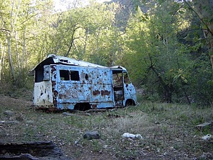
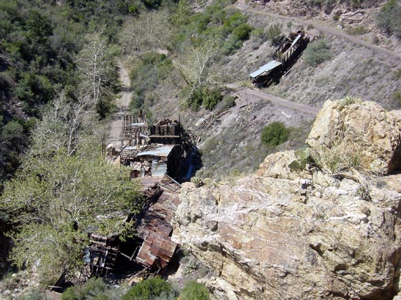
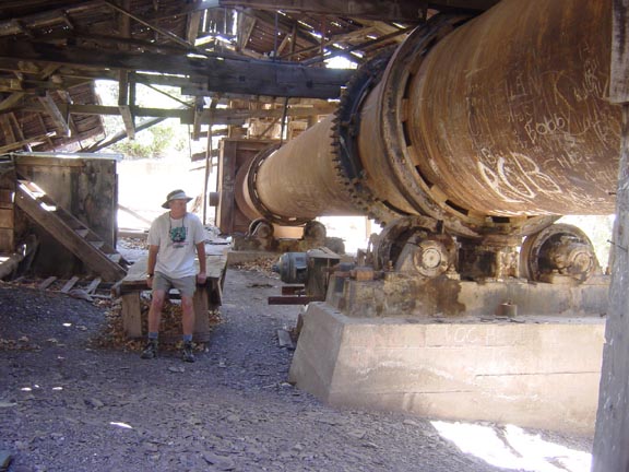
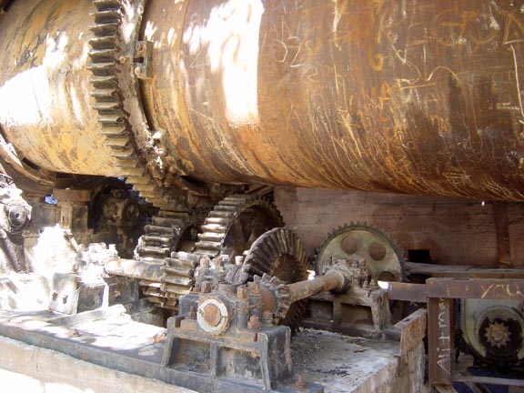
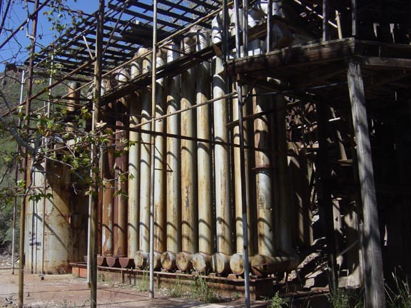
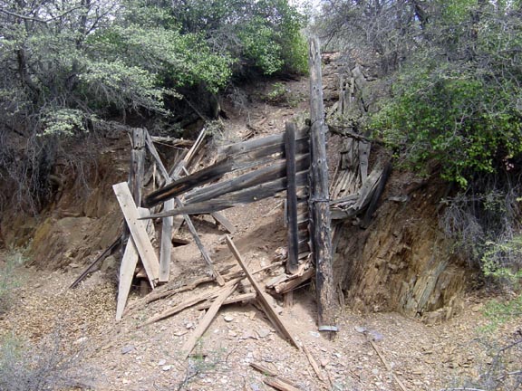
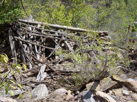
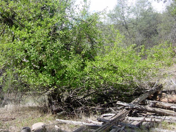
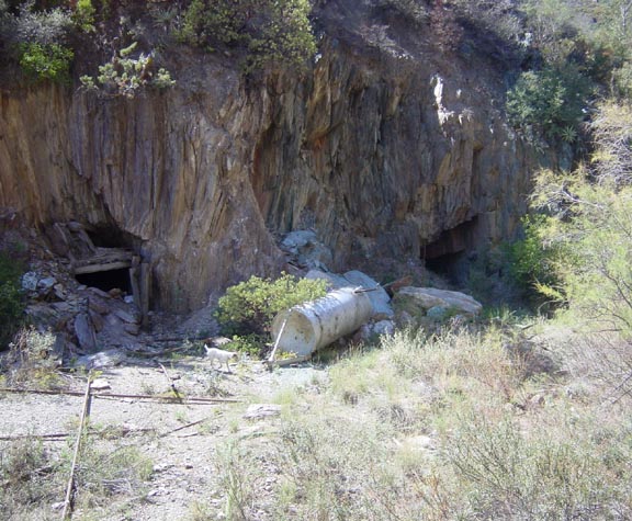
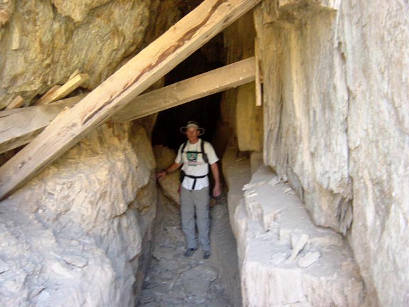
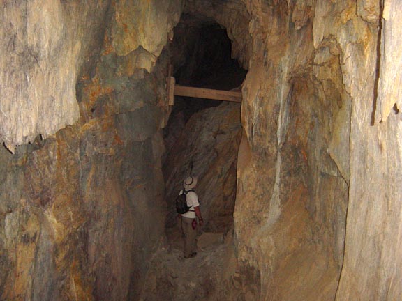
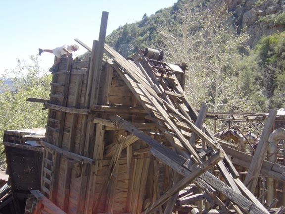
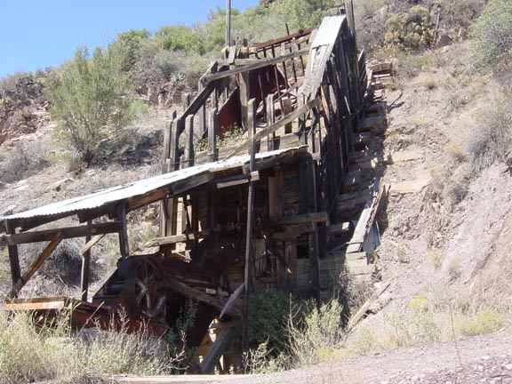
Stroll through a Bygone Era by Fritzski  "A mine is a hole in the ground owned by a liar." Mark Twain "A mine is a hole in the ground owned by a liar." Mark TwainThis loop hike incorporating several somewhat obscure trails in the lower Mazatzals takes you through an area replete with old mines, prospects, and the relics of their workings. Some were noted producers of ore and many others just anonymous testaments to sweat, grit, and unfulfilled hopes. This mineral-rich area south of Mt. Peely seems to be centered around the eastern drainage of the Saddle Mountain sub-peak. This hike starts at a parking spot overlooking the site of the old Sunflower Mine, which produced mercury from a reddish-brown ore called cinnabar, which can be found in abundance lying about. In the processing building which still stands, you'll see the large pipe (smelting tube) used to tumble the cinnabar into fine particles that were then burned in vertical furnaces with coke to produce the mercury gas. The gas was then cooled through a large network of vertical U-shaped tubes to condense into the liquid metal we know as quicksilver. The gold mines down the road at Goldfield, Az may have been a customer for some of this mercury, used in a refining process to extract pure gold from raw ore early last century. Apparently, the Sunflower ceased operations sometime in the 1940s, although some evidence might suggest it may have squeaked on into the early fifties.
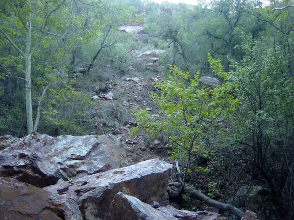
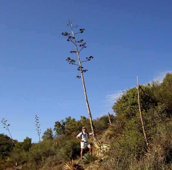
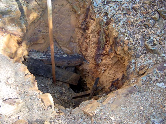
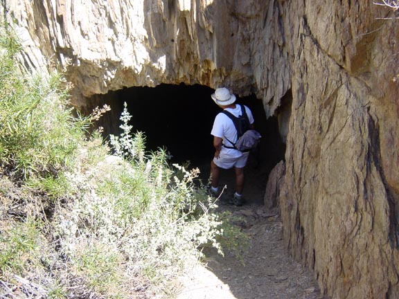
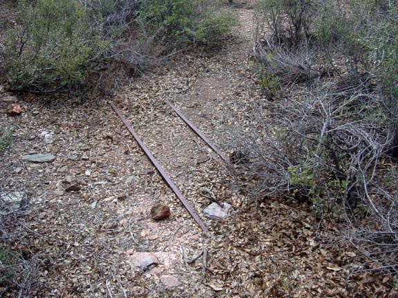
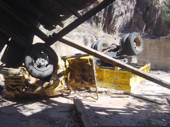
 We chose to complete the hike first, and then spend some time after exploring the Sunflower site. From your parking spot, head back down the short access road to FR25A. Continue north on this road where it enters the West Fork Sycamore Creek bed at the mouth of McFarland Canyon and continues northeast. Along the way, you may notice a group of huge boulders nearly blocking the jeep trail. They appear to have fallen from the slope above quite recently as the vegetation is still scoured from its path. At about 1.3mi, the road hits a wall, which is the unmarked intersection of FR25A, FS3722, and the Cornucopia Trail. Continue to follow the creek bed north on the unmarked Cornucopia Trail. If you look closely to your right, you will see the access road's remains up to the old Cornucopia Mine. Don't bother investigating. The entrance has long since caved in, and there's nothing much left to see. We chose to complete the hike first, and then spend some time after exploring the Sunflower site. From your parking spot, head back down the short access road to FR25A. Continue north on this road where it enters the West Fork Sycamore Creek bed at the mouth of McFarland Canyon and continues northeast. Along the way, you may notice a group of huge boulders nearly blocking the jeep trail. They appear to have fallen from the slope above quite recently as the vegetation is still scoured from its path. At about 1.3mi, the road hits a wall, which is the unmarked intersection of FR25A, FS3722, and the Cornucopia Trail. Continue to follow the creek bed north on the unmarked Cornucopia Trail. If you look closely to your right, you will see the access road's remains up to the old Cornucopia Mine. Don't bother investigating. The entrance has long since caved in, and there's nothing much left to see.Continue north past the hulk of an old service vehicle that makes one wonder "how they ever got things like this up here?", and on to the signed intersection of West Fork Tr. at about 2mi. Head west on the W.Fork Tr. and begin an aggressive climb to the top of a small saddle. Proceeding down the opposite side, you quickly come to the Thicket Spring Trail intersection at about 2.5mi. Take it to the left and down through the bottom of a drainage heading into McFarland Canyon. Along this area, you will encounter not only blue ribbon century plant stalks, but what appears to be numerous prospects and at least one vertical shaft near a creek bed complete with the requisite remains of a sump pump. At about 3.6mi, you will come to an intersection with the Copper Camp and Sheep Crossing Trails. This is a nice shady area and an excellent spot for a lunch break. This appears to once have been the living site for those that dug the numerous bat-filled holes nearby. From here, head south on Sheep Crossing trail, which consists of another fairly healthy climb to a ridge overlooking the Story Mine area. At about 4.2mi, you will come to the signed Saddle Mountain Trail (#91) intersection showing "Story Mine 1 mile" to the left. Even though the mine site is no more than 1/4mi as the crow flies, a thick carpet of manzanita prevents any direct approach. Instead, bear to the left through a series of abandoned jeep trails to cross over to the east bank of the ravine then down to the bottom for an approach to the mine (@5mi) from beneath the south side. Not surprisingly, this mine too has collapsed given the extremely loose shale in the area. There are however relics and ruins lying about such as the old tracks for the ore carts still running from the entrance to the remains of the old ore chute. Continue down the old jeep trail as it descends deeper into the canyon, finally reaching the creek bed where a footpath then heads downstream a short distance to where the miners evidently resided. The ruins of an old cabin with a gnarly old apple tree still growing remains. The path continues to the bottom of the ravine, where it begins to fade, resulting in a significant but relatively short bushwhack through the narrow canyon back to the Sunflower Mine site. As you approach the Sunflower area from the west, the canyon begins to open up into an area littered with old diggings and abandoned equipment. Some of the old tunnels were quite large with the timbers still holding, while another had a house-sized boulder dislodged from above forming a cavernous ceiling. Of course, it goes without saying to be very careful when exploring these areas. Old access roads abound in a mazelike fashion, but if you stay on the main one, your parking area (@6.5mi) is just around the bend. Back at the Sunflower, make sure and spend some time looking around this fascinating old site, but again be very careful. It never ceases to amaze me the backbreaking work these old-timers put in to erect an operation such as this in such a remote area. I hope you enjoy it as much as we did because this little piece of Arizona history won't be there forever. BTW: I have seen a photo of this dump truck dated 1999 that had it still intact and sitting upright on the access road directly above the mine where we parked. Oh well. Check out the Triplogs. Leave No Trace and +Add a Triplog after your hike to support this local community. | ||||||||||||||||||||||||||||||||||||||||||||||||||||||||||||||||||||||||||||||||||||||||||||||||||||||||||||||||||||||||||||||||||||||||||||||||||||||||||||||||||||||||||||||||||||


