 Route Editor

| Guide | ♦ | 106 Triplogs | 0 Topics |
details | drive | permit | forecast | route |
stats |
photos | triplogs | topics | location |
| 316 | 106 | 0 |
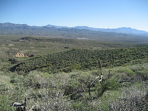
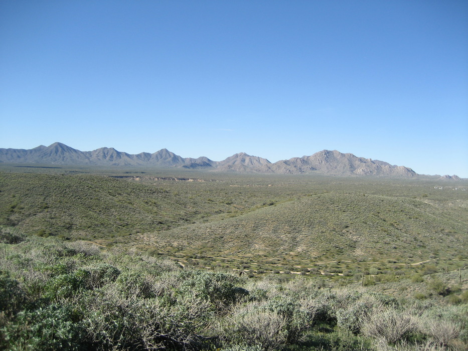
Those people up there look like ants ... by paulshikleejr   Overview OverviewNestled in the lower Verde River basin, the 21,099-acre park known as McDowell Mountain Regional Park is a desert jewel in the northeast Valley. Elevations in the park rise to 3,000 feet along the western boundary at the base of the McDowell Mountains. Visitors enjoy a full program schedule, over 50 miles of multi-use trails, and spectacular views of the surrounding mountain ranges. A stroll through the park will allow visitors to likely see deer, javelina, birds, and coyotes. The park includes 22 named and measured trails and trail legs. Park amenities are numerous and include restrooms, drinking fountains, a nature center, picnic areas, tent campsites, RV facilities, and more.
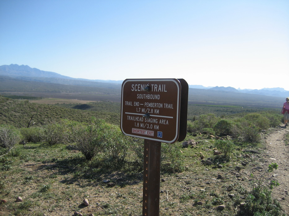
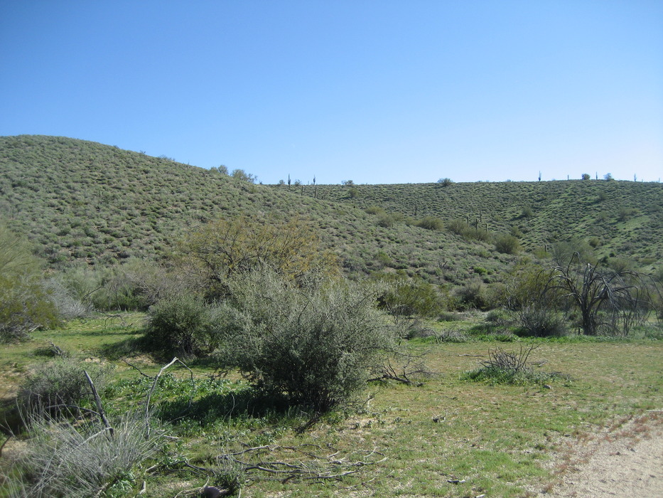
From central Phoenix, to get to the park, take Loop 202 east to Beeline Highway (SR 87). Continue northeast on SR 87 to Shea Blvd. Travel west on Shea Blvd. to Saguaro Blvd.; turn north. Continue through Town of Fountain Hills to Fountain Hills Blvd; turn right and travel four miles to the McDowell Mountain Regional Park entrance. Hike This description is of the loop hike comprised primarily of the Scenic Trail as accessed via the Pemberton Trail. My desire to hike this in a clockwise manner was bolstered by the host at the entrance station, who coincidentally suggested a clockwise hike of this trail. It has been noted by another hiker (perhaps Joe) that, "The 1995 Rio Fire scorched this area. Nutrients returned to the ground now nourish spectacular wildflower displays after a wet winter." This hike begins at the place known as the "Trailhead Staging Area". The actual insertion point onto the Pemberton Trail (which takes you to the clockwise startpoint of the Scenic Trail) is at (33.69088, -111.718422). From the insertion point to the Scenic Trail turn off is about 0.90 mile with an elevation change of 45 feet and a very minimal 60 AEG. This piece of the loop can arguably be divided into five small legs. The first leg is about 0.10 mile and takes you from the insertion point to the fork with the Pemberton Trail heading north and the Scenic Trail heading east. Follow the Pemberton Trail 0.11 mile north to a bend to the left which curves to the right until the next bend to the left in 0.22 mile. In 0.17 mile, there is a bend to the right and, in 0.30 mile, you arrive at the northern trail end/start point of the Scenic Trail. The Scenic Trail is a 3.57 mile trail with an elevation differential of 268 feet and an AEG of 418 feet. It can be divided into five legs of varying length. The first leg is 0.56 mile in length (AEG 131) and takes you from the northern startpoint to the crest of the ridge. The second leg is really the "Scenic" part of the Scenic Trail. This leg is a 1.07 mile hike along most of the ridge of the Lousley Hills, which run near the eastern border of the regional park. Although there is a net drop of 25 feet from the start of this leg to the endpoint of this leg, because of its gentle bounciness, with a max/min elevation differential of 59 feet, it manages to achieve an AEG of 119 feet. Along the way, to the east, you'll see Native American land under cultivation and, to the west, you can look onto the leg of the trail that runs below the ridge between the two sets of ridges. At (33.687152, -111.704460), the trail veers to the left, off the ridge, and starts a descent down the eastern flank of the ridge. This leg is 0.45 mile in length and loses a net of 171 feet (AEG 2 feet). A bit less than half way along this leg, you'll encounter a seemingly randomly placed sign providing interesting, but seemingly irrelevant, information. The next leg is short (0.16 mile), also downhill (elevation change of 79 feet and AEG of 3 feet), and begins when the trail crosses over what's left of the ridge (from the east side to the west side) and ends at the base of the rise. The next leg is the Scenic Trail's final leg and the penultimate leg of the loop overall. This recovery leg is also the longest at 1.21 miles. I term it a "recovery" leg because the last two legs took you to an elevation below that of the trailhead, and over the course of the leg, you rise 125 feet with an AEG of 131 feet. This leg runs between two ridges and as you traverse the "floor" of the depression, if you look up and to the west, you might be able to see fellow hikers making their way along the crest of the western ridge. The final, very short leg is one you've seen before: it is that first, short (0.10 mile) leg that took you from the insertion point to the first fork of this loop.
Check out the Official Route and Triplogs. Leave No Trace and +Add a Triplog after your hike to support this local community. | ||||||||||||||||||||||||||||||||||||||||||||||||||||||||||||||||||||||||||||||||||||||||||||||||||||||||||||||||||||||||||||||||||||||||||||||||||||||||||||||||||||||||||||||||||||||||||||||||||||||||||


