 Route Editor

| Guide | ♦ | 47 Triplogs | 2 Topics |
details | drive | no permit | forecast | 🔥 route |
stats |
photos | triplogs | topics | location |
| 587 | 47 | 2 |
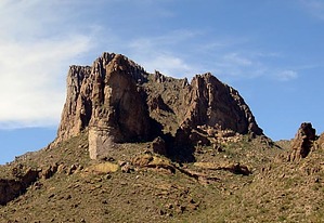
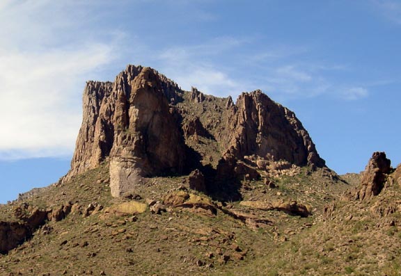
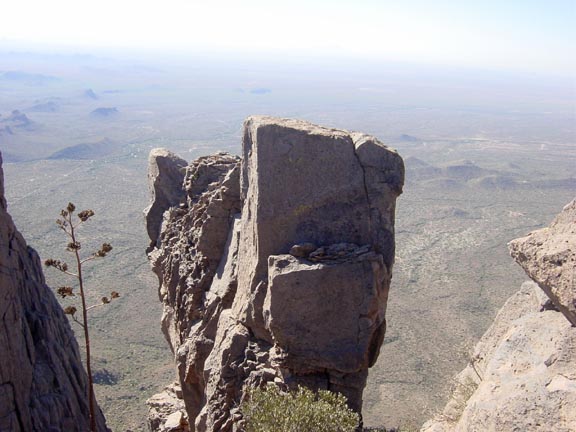
A great Carney alternative by Fritzski  2026 March Changes 2026 March ChangesThe Carney Spring Trailhead is closed. This hike now begins at the Lost Goldmine TH. It is 0.5 mile longer one-way and 16 feet less AEG. Prologue Want to avoid the crowds at Peralta? The Carney Springs trailhead lies just around the corner and sees but a fraction of the traffic, but what are your options? The Dacite Loop puts you right back on Peralta and may require a shuttle, the trail through W. Boulder Canyon has all but disappeared over the years, and you don't have a whole day required for the entire Ridgeline. The Three Sisters makes for another nice option out of Carney. It offers a nice compact package of over 2400' vertical feet gained in about 3.1 miles and spectacular views from a very rarely visited perch.
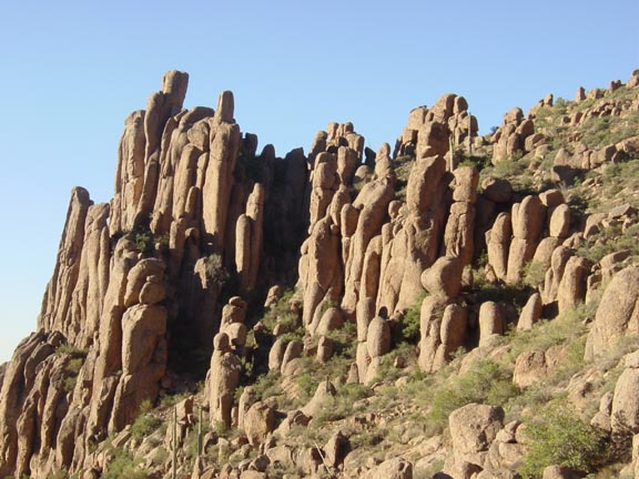
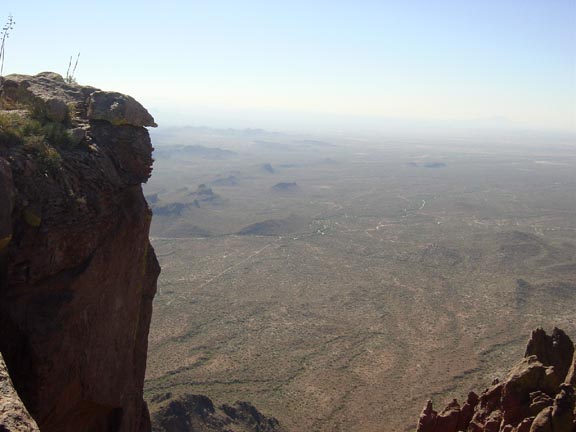
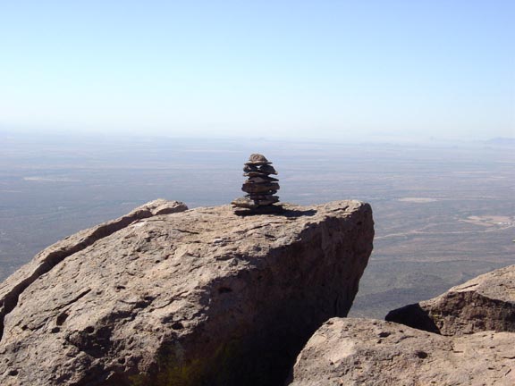
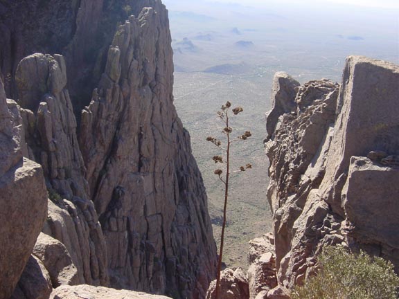
The Three Sisters is the massive rock formation looming high above to your left as you approach the Carney trailhead. I was initially tempted to name it "Carney Butte" until I was informed by Jack Carlson, author of the excellent book "Hiker's Guide to the Superstition Wilderness", that it has been called the "Three Sisters" according to the now out of print rock climbing guide "Phoenix Rock"(Ver. I). The three prominent buttresses that form its namesake are not readily apparent from some angles but are indeed there. Hike For the steep, but well-traveled first 1.85mi from the trailhead into a land of enchanting hoodoos and on to the top of West Boulder Saddle, refer to the HAZ database for Dacite Super Loop, West Boulder Canyon, or the Superstition Ridgeline. From the W. Boulder Saddle, continue west on the Ridgeline trail that has become ever more well worn as its popularity has boomed over recent years. There are also abundant cairns and old white paint marks on some rocks to help in route finding. As you reach about the 1.5-mile point, you will see the slopes rising to the obscured peak ahead just slightly left of your line of travel. As tempting as it looks to just pick any given ridge for a direct assault unless you're some kind of sadomasochistic freak, this would be a major mistake. Unfortunately, I'll get back to that later. In any event, remain on the Ridgeline trail that generally follows a path of least resistance to the 2mi point which basically takes you past your target on the north side. This allows for an approach from the northwest which takes the fullest advantage of the Ridgeline trail for gaining as much elevation before departing off-trail. As the Ridgeline trail approaches the top of the ridge at about the 2.25mi point, look for a nice open area in the rapidly thinning vegetation to start making your way back southeast along the highest terrain. The summit area should be become apparent ahead. The grade is moderate, the terrain is relatively smooth, and the vegetation is sparse. As you approach the summit (2.75mi) you will be rewarded with sudden breathtaking views amongst striking rock formations, sheer cliffs, and total solitude. Take plenty of time to explore the bizarre area comprising the three distinct fingers of rock that jut out into space to form the massive formation. Contemplating your return, from this vantage point it is plain to see the Ridgeline trail as it heads back east directly below you. Now I have preached to others about the pitfalls awaiting any poor soul who chooses a "shortcut" when there is a trail available no matter how tempting it may look. If only I were smart enough to heed my advice I would have avoided one of the nastiest short bushwhacks I have ever endured, let alone the fact that I was wearing shorts to make things worse. I had never until this point encountered a bush and boulder choked ravine so thick my little Jack Russell terrier Rusty could not even get through. Anyhow, although I once again needlessly turned a potentially pleasant hike into a meat grinder, it is a very cool hike if you stick to the trail. (Just a quick note here, Carlson's topo route depiction for the Ridgeline Trail happens to be this very same shortcut - heading directly up from the head of the major ravine separating Carney from the Sisters. The actual trail departs his depiction at about the 1.5mi point and stays north basically following the contour lines until at about 2 miles where it begins a steep southwest climb up the slope to the top of the ridge about 1/2 mile to the west of the Sisters.) Check out the Official Route and Triplogs. Note This is a more difficult hike. It would be unwise to attempt this without prior experience hiking. Leave No Trace and +Add a Triplog after your hike to support this local community. One-Way Notice This hike is listed as One-Way. When hiking several trails on a single "hike", log it with a generic name that describes the hike. Then link the trails traveled, check out the example. | |||||||||||||||||||||||||||||||||||||||||||||||||||||||||||||||||||||||||||||||||||||||||||||||||||||||||||||||||||||||||||||||||||||||||||||||||||||||||||||||||||||||||||||||||||||||||||||||||||||||||||||||||||


