 Route Editor

| Guide | ♦ | 25 Triplogs | 1 Topic |
details | drive | no permit | forecast | 🔥 route |
stats |
photos | triplogs | topic | location |
| 280 | 25 | 1 |
Canyons are inherently risky. Flash floods occur without notice on sunny days. Technical skills & surrounding topography knowledge required yet does not eliminate risk.
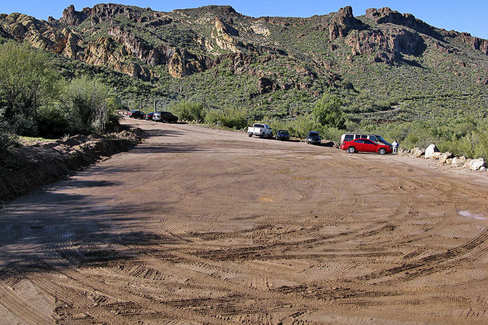
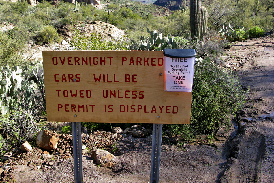
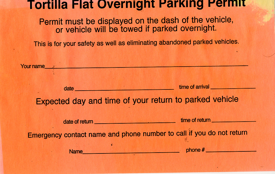
Superwishin Wilderness by arizonaheat   In continuance of the quest for water after the recent rains, Cactuscat and Arizonaheat set off for Tortilla Creek, which was at flood stage a week prior to today and unhikeable. We parked my truck in a pullout about one-tenth of a mile beyond Tortilla Flat. ( The parking spaces at Tortilla Flat are posted against hikers so beware of leaving your vehicle there, it may be towed.). We gathered our gear and dropped off the bank toward the creek. There was still a respectable amount of water flowing down Tortilla Creek and we knew we were going to have our work cut out for us. In continuance of the quest for water after the recent rains, Cactuscat and Arizonaheat set off for Tortilla Creek, which was at flood stage a week prior to today and unhikeable. We parked my truck in a pullout about one-tenth of a mile beyond Tortilla Flat. ( The parking spaces at Tortilla Flat are posted against hikers so beware of leaving your vehicle there, it may be towed.). We gathered our gear and dropped off the bank toward the creek. There was still a respectable amount of water flowing down Tortilla Creek and we knew we were going to have our work cut out for us.We began to work our way up the Creek, first along the shoreline then hopping rocks. We hadn't gone far when Cactuscat found a nice folding knife with a 4-inch blade laying along the creek, blade unfolded. A few more steps and she found a brand new two-person tent still in the box. Her lucky day! Someone must have been smoking too much wacky tabaccy or eating magic mushrooms or something to lose that much of their gear and not no it.
The hike was much more difficult than it normally would be since Tortilla Creek was flowing. The water definitely made navigation interesting and we had to call on many skills such as rock hopping, bouldering, climbing, and bushwhacking. ( I really wouldn't call bushwhacking a skill, just a necessary evil, especially when it involves as much cat claw as we went through today) We also did some wading and came close to swimming both by accident and by choice. The water was nippy but refreshing. We worked our way up Tortilla Creek to where it intersected with Peters Canyon and stopped and took a break before forging ahead. On our way, we passed numerous large deep pools of water, most with small waterfalls cascading into them. We soon entered a very narrow section of Canyon, through which Tortilla Creek flowed. It was like a totally different hike when we reached this point as the shoreline was overgrown with lush green grass and other flora. We even passed by a fairly large stand of bamboo growing in the middle of the creek. It is this section that required bouldering. Some of the boulders were huge, several times larger than a house. We worked our way up Tortilla Creek until we came to a point where we were boxed in by water, our only option to work around was a wicked bushwhack that probably would have left us skinless, so we chose to turn around at this point. On the way back we took several opportunities to stop and enjoy the sights and sounds of the flowing water. We found a nice sandy beach and removed our shoes and socks and went wading. The water would make your legs and feet ache after a short exposure time. I came very close to diving in our private pool, but couldn't quite make myself do it. It was a very pleasant day and the challenge the water presented was well worth it. I feel very blessed over these last two weeks, getting to see Reavis Falls flowing at capacity last Saturday ( this will probably be the highlight of my hiking career for quite some time to come), and hiking both Lower Barks and Tortilla Creek while they were both flowing water. It is such a rare occurrence. Check out the Official Route and Triplogs. Leave No Trace and +Add a Triplog after your canyon trip to support this local community. | |||||||||||||||||||||||||||||||||||||||||||||||||||||||||||||||||||||||||||||||||||||||||||||||||||||||||||||||||||||||||||||||||||||||||||||||||||||||||||||||||||||||||||||||||||||||||||||||||||||||||||||||


