Route Editor

| Guide | ♦ | 419 Triplogs | 0 Topics |
details | drive | no permit | forecast | route |
stats |
photos | triplogs | topics | location |
| 933 | 419 | 0 |
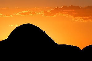
multi purpose by mttgilbert  Papago Park is mostly for mountain biking, though it gets some equine use also. I use the park as a proving ground for new backpacks, boots, etc... The park stretches from the north side of Tempe Town Lake to the Phoenix Zoo. From the zoo, you can also get to the Papago Buttes trails. There are so many trails cut through this area that you need not worry about losing your way. Eventually, all these trails find their way to the zoo or the actual park at the southern part of the range. These trails are heavily used, especially on weekends, and are easy to find and follow. There are facilities (bathrooms and drinking fountains) at the southern end of the park and the zoo. Papago Park is mostly for mountain biking, though it gets some equine use also. I use the park as a proving ground for new backpacks, boots, etc... The park stretches from the north side of Tempe Town Lake to the Phoenix Zoo. From the zoo, you can also get to the Papago Buttes trails. There are so many trails cut through this area that you need not worry about losing your way. Eventually, all these trails find their way to the zoo or the actual park at the southern part of the range. These trails are heavily used, especially on weekends, and are easy to find and follow. There are facilities (bathrooms and drinking fountains) at the southern end of the park and the zoo.There are various difficulty levels of trails available; it all depends on how hard you want to work. Even though this area is in the middle of the city, there are still several wildlife viewing opportunities. If you are out early in the morning, close to sunset, or any time few people are around, you can see coyotes, jackrabbits, ground squirrels, and various plant life along the trails.
Check out the Official Route and Triplogs. Leave No Trace and +Add a Triplog after your hike to support this local community. | |||||||||||||||||||||||||||||||||||||||||||||||||||||||||||||||||||||||||||||||||||||||||||||||||||||||||||||||||||||||||||||||||||||||||||||||||||||||||||||||||||||||||||||||||||||||