 Route Editor

| Guide | ♦ | 11 Triplogs | 0 Topics |
details | drive | permit | forecast | route |
stats |
photos | triplogs | topics | location |
| 59 | 11 | 0 |
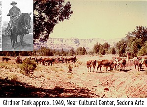
West Sedona With Views by Trishness   This was the first trail I hiked on my weekend in Sedona and I was looking for something a little off the beaten path and not loaded with people on Columbus Day weekend. This was just the ticket! It's located in the Dry Creek Basin of Sedona and links with the Cockscomb area trails: Rupp Trail, Cockscomb Trail, and Arizona Cypress Trail. It can be hiked as a loop with these other trails, out and back, or as a shuttle hike with the terminus on FS 152. This was the first trail I hiked on my weekend in Sedona and I was looking for something a little off the beaten path and not loaded with people on Columbus Day weekend. This was just the ticket! It's located in the Dry Creek Basin of Sedona and links with the Cockscomb area trails: Rupp Trail, Cockscomb Trail, and Arizona Cypress Trail. It can be hiked as a loop with these other trails, out and back, or as a shuttle hike with the terminus on FS 152.I decided to start this trail near the Sedona Cultural Park. Parking is ample and easily accessible by car. The trail begins at the north end of the ramada and immediately crosses the Centennial Trail. This area is a mess with a ton of broken glass, garbage, and cigarette butts everywhere. It appears this is a major party spot. After leaving this area, you have marvelous views of Cockscomb to the north and Capitol Butte to the east for about a mile before it starts a moderate descent into the Dry Creek drainage area through a semi-shaded area of Pinyon pine & cypress. The creek is normally dry but it wasn't this morning due to heavy rains the night before. Even so, the creek was not much more than 5 or 6 inches deep. After exploring the creek area for a little bit I got back on the trail and had to cross the creek twice before the trail meets the gas pipeline access road for another quarter mile before veering off to the north. It then crosses the creek again several times in a narrow canyon eventually intersecting the Rupp Trail at about 2.8 miles. Turned around here and headed back but after checking with the Coconino National Forest service, I found that the trail eventually climbs out of the drainage to the northeast and then climbs moderately to a ridge with nice views of the mountains to the north and then descends east to Capitol Butte. After 3.5 miles, it intersects the AZ Cypress Trail then crosses a wash twice before intersecting with Two Fence Trail. The trail then ascends moderately and levels out for the last leg before reaching the trailhead at Dry Creek Road.
All in all, this was a decent hike. It would be a great shuttle hike taking the Girdner Trail to the Rupp trail and then getting closer to Cockscomb.
Coconino FS Details The trail may be hiked one-way with arranged transportation and would be rated moderate. The route north from the Cultural Park Trailhead to the Dry Creek Road Trailhead is described here. The trail begins near the ramada and interpretive signs and descends gradually to the north, then northwest, with good views. At 1 mile, it begins a moderate descent to the west, bends north and enters the Dry Creek drainage. After two crossings of the drainage, the trail meets the gas pipeline access road (closed to motor vehicles) at 1.5 miles. It follows the road for about 1/8 mile, then branches north and rejoins Dry Creek which it follows for the next 1.2 miles. This portion of the trail involves crossing the normally dry creek many times in a rather narrow, shallow canyon and should not be hiked following heavy rain. The trail intersects the Rupp Trail branching uphill to the left following an old roadbed at 2.8 miles. Cross the creek and follow the same road (closed) as it climbs out of the drainage to the northeast and circles to the southeast for 1/4 mile. Here at the road blockage, the trail forks left and climbs moderately to the crest of a ridge with nice views of the mountains to the north. It now descends to the east toward Capitol Butte. At 3.5 miles, the Arizona Cypress trail branches left. Continue east for 1/8 mile and after crossing a wash the second time, bear left at the intersection with the Two Fence Trail (not shown on map) which goes right. The trail climbs moderately, tops out, then descends to the east and levels out. As it approaches Dry Creek Road, the trail bears right and parallels the road a short way and ends at the signed trailhead about 50 feet north of the intersection with unpaved FS 152. Check out the Official Route and Triplogs. Leave No Trace and +Add a Triplog after your hike to support this local community. One-Way Notice This hike is listed as One-Way. When hiking several trails on a single "hike", log it with a generic name that describes the hike. Then link the trails traveled, check out the example. | |||||||||||||||||||||||||||||||||||||||||||||||||||||||||||||||||||||||||||||||||||||||||


