Route Editor

| Guide | ♦ | 3 Triplogs | 0 Topics |
details | drive | no permit | forecast | route |
stats |
photos | triplogs | topics | location |
| 53 | 3 | 0 |
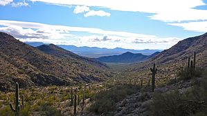
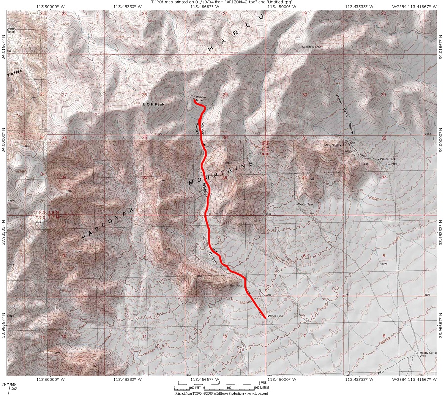
Remote and peaceful by Ksorensen  It's a long drive to get to this hike, but the peacefulness combined with the natural beauty of the trail is worth the effort. The trail begins at the Harcuvar Mountains Wilderness at Webber Canyon, near a wildlife spring. The trail follows an old mining road up to, you guessed it, Webber mine. The typical Sonoran Desert vegetation is somehow even more pleasant than that on the Harquahala trail on the other side of the valley. We saw many healthy saguaros of all sizes and ages, pincushion cactus, hedgehog cactus, and of course cholla. The vegetation sits in geology that is diverse, colorful, and interesting. Unfortunately, there is a fair amount of cat-claw on the trail but because the trail is an old road, it is relatively easy to get around most of it. The hike climbs 1,190 feet gradually over three miles and is never so steep as to be uncomfortable. It mostly follows a high ridge between two surprisingly large arroyos that deserve to be explored in their own right. After the first couple of miles sits the remnants of an old mining camp or homestead. Must have been a great view from the front porch. We wondered if the pile of rocks at the homestead hides an old gravesite. It's a long drive to get to this hike, but the peacefulness combined with the natural beauty of the trail is worth the effort. The trail begins at the Harcuvar Mountains Wilderness at Webber Canyon, near a wildlife spring. The trail follows an old mining road up to, you guessed it, Webber mine. The typical Sonoran Desert vegetation is somehow even more pleasant than that on the Harquahala trail on the other side of the valley. We saw many healthy saguaros of all sizes and ages, pincushion cactus, hedgehog cactus, and of course cholla. The vegetation sits in geology that is diverse, colorful, and interesting. Unfortunately, there is a fair amount of cat-claw on the trail but because the trail is an old road, it is relatively easy to get around most of it. The hike climbs 1,190 feet gradually over three miles and is never so steep as to be uncomfortable. It mostly follows a high ridge between two surprisingly large arroyos that deserve to be explored in their own right. After the first couple of miles sits the remnants of an old mining camp or homestead. Must have been a great view from the front porch. We wondered if the pile of rocks at the homestead hides an old gravesite.It took us only an hour and fifteen minutes to reach the old mine. There is a spooky old mineshaft sporting wooden beams and all that, we of course did not dare to enter. Nor did we bushwack up to the ridge above. Choosing the lazy approach to an afternoon of hiking, we stopped at the mine, made a makeshift bench out of old mining logs, and ate our lunch while enjoying the spectacular view of McMullen Valley and Harquahala Peak.
Check out the Official Route and Triplogs. Leave No Trace and +Add a Triplog after your hike to support this local community. | ||||||||||||||||||||||||||||||||||||||||||||||||||||||||||||||||||||||||||||||||||||||||||||