Route Editor

| Guide | ♦ | 40 Triplogs | 0 Topics |
details | drive | no permit | forecast | 🔥 route |
stats |
photos | triplogs | topics | location |
| 370 | 40 | 0 |
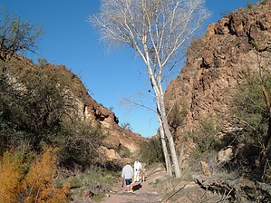
Easy & Scenic by OhOh7  Overview OverviewFrom SR88, hike through upper Willow Springs Canyon following an old jeep road over to Bagley Tank. Return by the same route or make up your off-trail loop back to the trailhead. I wondered what was north of the Apache Trail having driven by many times. I looked up the Goldfield Mountains on the computer and found a great deal of information about the area. For example, there are very few actual trails and only some jeep trails to follow. Most of the fantastic scenery is off-trail. There are many natural arches in the area, but all have to be reached by off-trail hikes. I selected the Willow Springs Trailhead. As a reference point, Needle Vista Viewpoint is on the south side of the highway. The trailhead is not marked, but it's a clear pull-off area just before mile marker 204.
A locked iron fence blocks the road from vehicle use (maybe by permission, but we are hikers), and once through it, the jeep trail winds down into the Canyon to Willow Springs Well that looks to be quite deep with a cement frame around it. Our objective was Bagley Tank, which is roughly 3.5 miles from the highway. We found some caves, pipe flashings, cement troughs, and lots of evidence of years ago cattle areas. There also were many "waterholes" with lots of water. The dogs loved that. Much of the roadbed is sand, and it makes for difficult walking. You pass some lovely meadows and a grave with a beautiful cross. We wondered who and what and how. Once we left the creek bed-road bed, we began to climb slightly more northerly toward the Bagley Tank. Once we arrived, we were quite amazed at all the work that had once gone into that water catch. Some of my photos show how big a catch basin is and how the berms have been built around it with inlet and outlet trenches. So this is a "tank" out here! Interesting. The terrain up and back is quite beautiful and quite different from the stark, jagged Superstition range nearby. Even the color is varied in the cliffs and surface rocks. We went beyond the Bagley tank a few hundred yards and had a great lunch in a canyon. Although a bit rocky in places, this is a relatively easy hike (except for the sand sections like walking on a beach). It opened me up to the Goldfield Mountains. Now I've arranged to see some of the arches in the area. Over ten have been identified, but all are off-trail. It was a good day. A bit windy. However, the temperatures were great! There were 4 of us and two dogs. Great fun for me as I did not have the fear of heavy steep climbing. Now I've discovered a new area near my home with some interesting terrain.
Check out the Official Route and Triplogs. Leave No Trace and +Add a Triplog after your hike to support this local community. | |||||||||||||||||||||||||||||||||||||||||||||||||||||||||||||||||||||||||||||||||||||||||||||||||||||||||||||||||||||||||||||||||||||||||||||||||||||||||||||||||||||||||||||||||||||