 Route Editor

| Guide | ♦ | 20 Triplogs | 2 Topics |
details | drive | permit | forecast | route |
stats |
photos | triplogs | topics | location |
| 51 | 20 | 2 |
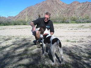
moderate (for distance) by Randal_Schulhauser  2019 2019Motorized access to the trailhead is currently not permitted, most likely due to smuggling activity. The trail itself is open and may be accessed from Margie's Cove Western Trailhead. Prologue The brittlebush is a member of the sunflower family and grows two to five feet tall, covered with brilliant yellow blooms from March to June. The long, ovate, silver-gray leaves are one to four inches long. Brittle, woody branches contain a fragrant resin. This flower lends its name to this trail due to its abundance along the hillsides adjacent to the trail.
Overview The Brittlebush Trail follows a combination of former jeep trails and wide, unmarked desert washes. The BLM kiosk warns that there is infrequent trail signage or directional marker and the warning is quite correct. We found the occasional rock cairn to help keep you on the trail but found ourselves doubling back at the occasional wash junction when we couldn't find a cairn! Although the trail did not appear on our topographic map, my trusty Magellan GPS showed the path. Be prepared for self-sufficiency on this hike. Having experienced multiple hikes within the North Maricopa Mountain Wilderness, I've yet to encounter a fellow hiker on the trail. If you are searching for solitude close to the city, this may be the hike for you! I'll describe a recent "south to north" complete trail hike; Hike Mile 0.0 - At the south trailhead parking lot (GPS: N33o02.223' W112o33.264'), there is a BLM trail kiosk and trail logbook to sign-in. If we are to believe the logbook, we are the first trail travelers in over ten days! The trailhead represents a natural boundary between a flat expanse of a wide-open desert and the western boundary of the North Maricopa Mountains. The trail at this point follows an old jeep path. The recent January rains have made the desert VERY green! Mile 2.8 - Deep sandy washes have long since replaced the old packed jeep path. Low mountains on all sides surround us. Although the elevation gain is minimal, the sand is affecting our thighs! We decide it is time for lunch on a large sandy flat (GPS: N33o03.350' W112o31.324') beside some conveniently placed shade. Bob and Mike break out a spread... Mile 3.8 - Multiple washes converge along the path. Watch for the rock cairns to keep you on the correct route. I took the occasional wrong path and had to double back. The sand continues to pound on the thighs! Some rest and water beside the huge boulders (GPS: N33o04.010' W112o30.895') is required. Buster is drinking more than usual. Good thing both Bob and Mike have extra bottles of water... Mile 4.5 - The trail walks out of the wash and onto a ridge. The solid footing is a relief to the thighs! An appearance by one of the infrequent trail markers (GPS: N33o04.733' W112o31.112') shows the way. Mile 6.0 - The trail meanders down from the ridge and into the wash joining Margies Cove East Trail. No signage exists, but a stake is driven into the ground with a neon orange flag (GPS: N33o05.481' W112o30.843') to mark the north trailhead. At this point, you may want to head back to the Brittlebush South Trailhead to complete a 12.0-mile "in-and-out" hike. Other options include heading 3.3 miles east to Margies Cove East Trailhead or heading 5.7 miles west to Margies Cove West Trailhead. Leaving a 2nd vehicle at the Margies Cove East Trailhead will make for a combined 9.3-mile hike. It is possible to loop back to the Brittlebush South Trailhead via the Butterfield Stage Route Trail (15.1-mile off-road drive) described elsewhere. Synopsis This trail offers multiple recreational possibilities, and I try to take advantage as often as possible. Enjoy! Check out the Official Route and Triplogs. Leave No Trace and +Add a Triplog after your hike to support this local community. One-Way Notice This hike is listed as One-Way. When hiking several trails on a single "hike", log it with a generic name that describes the hike. Then link the trails traveled, check out the example. | |||||||||||||||||||||||||||||||||||||||||||||||||||||||||||||||||||||||||||||||||||||||||||||||||||||||||||||||||||||||||||||||||||||||||||||||||||||||||||||||||||||||||||||||||


