 Route Editor

| Guide | ♦ | 50 Triplogs | 9 Topics |
details | drive | permit | forecast | 🔥 route |
stats |
photos | triplogs | topics | location |
| 488 | 50 | 9 |
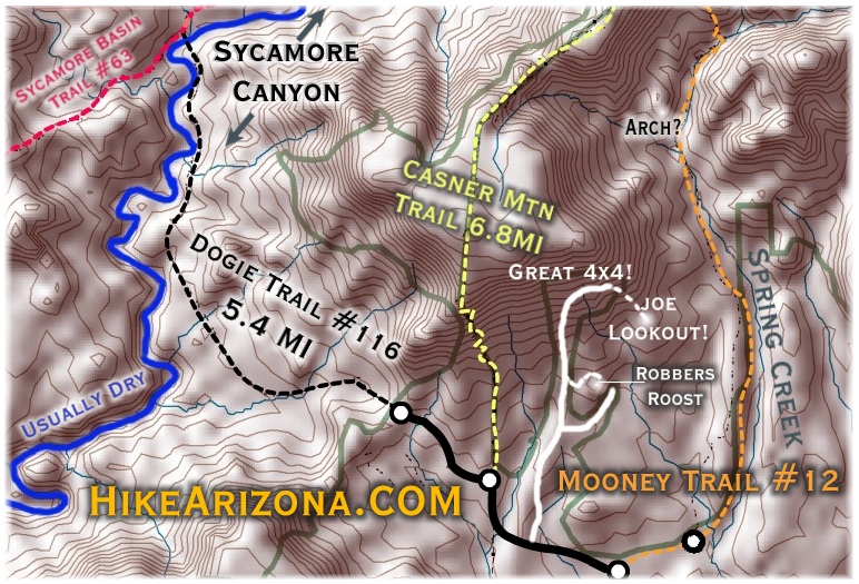
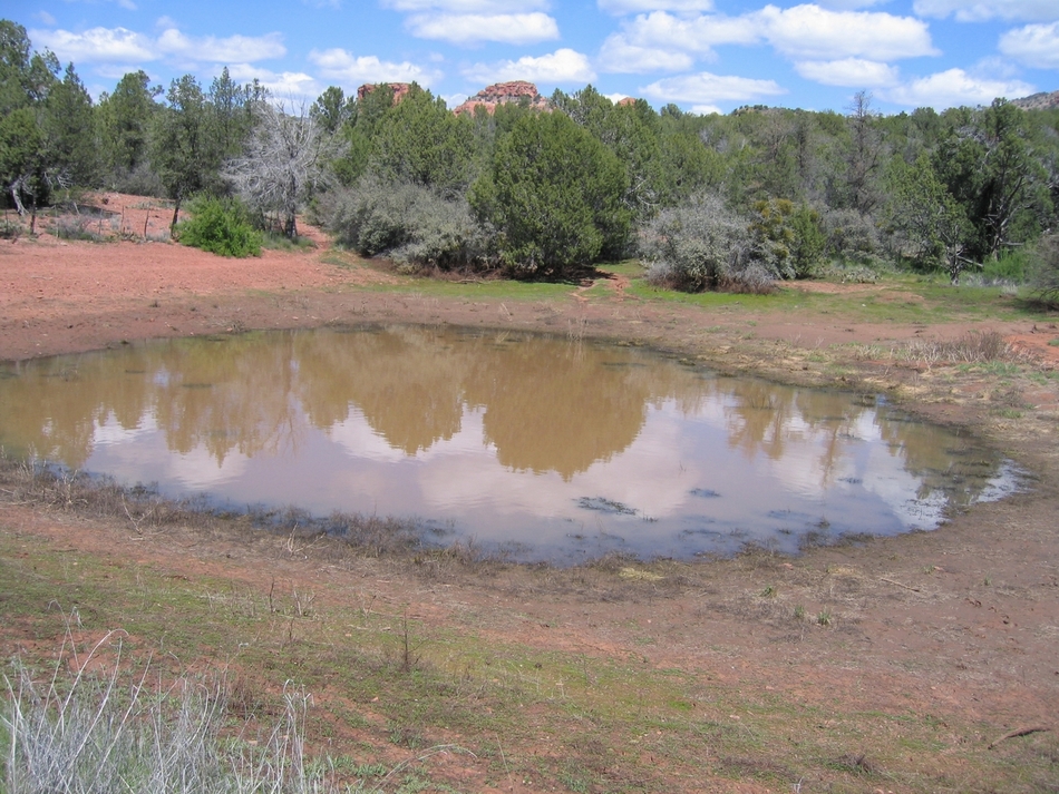
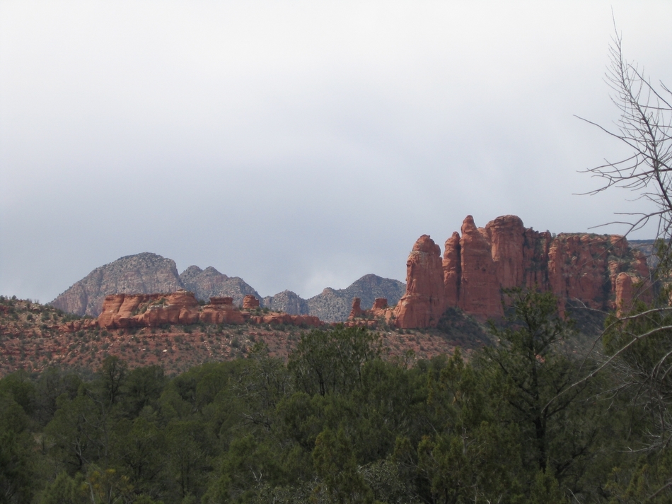
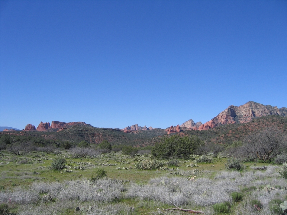
Amazing destination & route! by Vashti   The Dogie Trailhead is at the end of forest road 525C, which is ~12 miles from highway 89A outside Sedona. The road itself was in good condition. The Dogie Trailhead is at the end of forest road 525C, which is ~12 miles from highway 89A outside Sedona. The road itself was in good condition.The trail ascends immediately from the trailhead until it reaches the sign-in, "register here" book, and a metal gate. After walking through the metal gate in the barbed-wire fence, the trail descends immediately. The trail continues down until reaching a level area. There is another gate in a barbed-wire fence, just before Dogie Tank at the 2 miles mark. While there was water in Dogie Tank, the stock pond has many animal prints going toward it, and by the murky look of the water, I wouldn't recommend it for any human consumption. Interestingly, I read the original trail description mentioned two other tanks before Dogie, but we could not find/see either one.
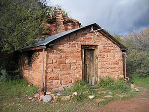
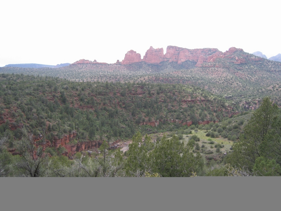
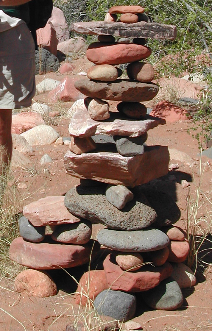
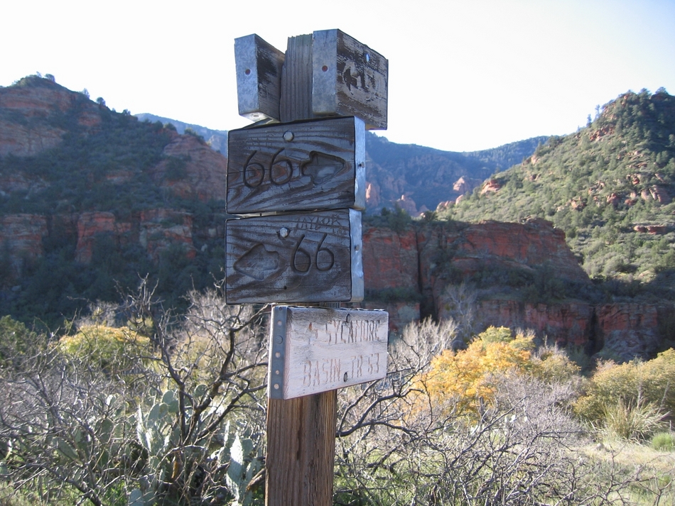
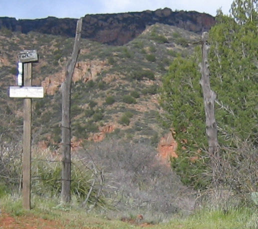
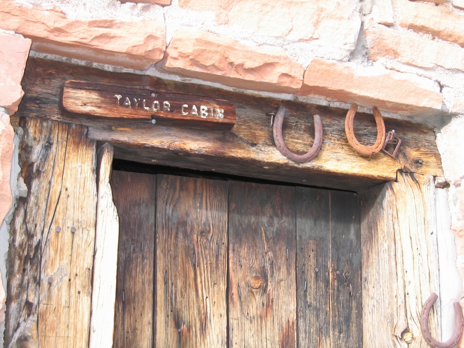
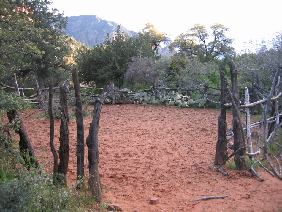
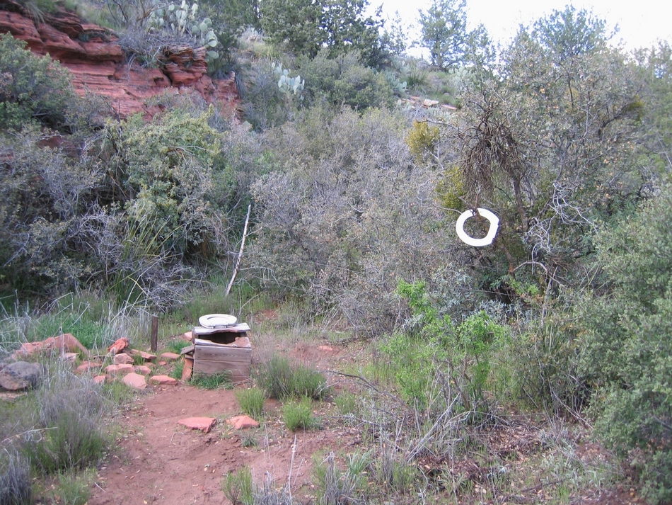
Eventually, Sycamore creek comes into view. After this year's wet spring, there were many large pools of water visible from the trail. In an earlier visit, this hike looked much different. Neither green nor lush with lots of water, but brown and red desert with no water! Granted, our last hike on this trail was in May 2002, during the drought. The canyon's final descent leads to a sandy area just before the river rock-filled sycamore creek bed, which is dry except for some pools (as mentioned previously, depending on the weather and season). In our previous trip, the creek bed had enormous cairns set up to "lead" the way. Either by way of people or weather, these extremely large cairns are no longer present. The cairns I speak of were approximately 3 feet in height! Speaking of cairns, this trail is exceedingly well cairned. Cairned to a ridiculous point, yet the trail is well defined, almost 95% of its entirety. The silliness comes in putting cairns next to a very-well defined trail, where it doesn't turn, etc. I suppose excessive cairns can give one a feeling of security if it is needed. The trail crosses the creek bed and picks up on the other side. From here, the trail climbs and follows along a flat area with many nice campsites. Shortly, the trail encounters another gate through a barb-wired fence leads into an area of many cacti. Soon, the trail comes to the trail junction with the Sycamore Trail. This trip turns right onto Sycamore Creek, leading to Taylor Cabin, which is 3.5 miles off. The Dogie Trail is 5.4 miles from the trailhead to this junction. After the trail junction, the trail descends, and there are good views of Sycamore Creek on the right side. The trail goes up and down some amount of times before ending up on a flat area called Airport Mesa. Airport Mesa has several good campsites, but no water supply. After a couple of miles, the trail drops down into a drainage, comes up again, and then descends into Jack's Canyon. After ascending the other side of Jack's Canyon, the trail goes through another gate in a barbed-wire fence. The trail continues for another mile or so, ascending and descending until you reach another trail junction. There is a gate and barbed-wire fence to the left through which is Taylor Cabin trail 66. To the right a short trail descends down to Taylor Cabin. The Taylor Cabin site has a historic cabin used by cowboys in the 19xxs along with a corral, a cave storage area, a toilet area (!!!), and pools said by others encountered on the trail to be rather reliable. The pools themselves are beautiful, clear, and deep with large stones at the bottom. There are many nice campsites by Taylor Cabin, but this trip, we were fortunate to have the site all to ourselves (due to several hailstorms on our hike in, :P). Be sure to sign the guest book in the Cabin cupboard! The cabin also has a working stove and heater. Both were installed in 1997 thanks to the Forest Service. The cabin has some things that people have left, from folding chairs to small Coleman propane tanks in the cupboard. The cabin has a large wooden table, and even a slew of wrought iron pots and pans to use on the stove. We highly recommend this hike. Sycamore Canyon is beautiful, with many spectacular views. The Taylor Cabin area has lots of intriguing places to investigate. Enjoy! Gate Policy: If a gate is closed upon arrival, leave it closed after you go through. If it is open, leave it open. Leaving a closed gate open may put cattle in danger. Closing an open gate may cut them off from water. Please be respectful, leave gates as found. The exception is signage on the gate directing you otherwise.
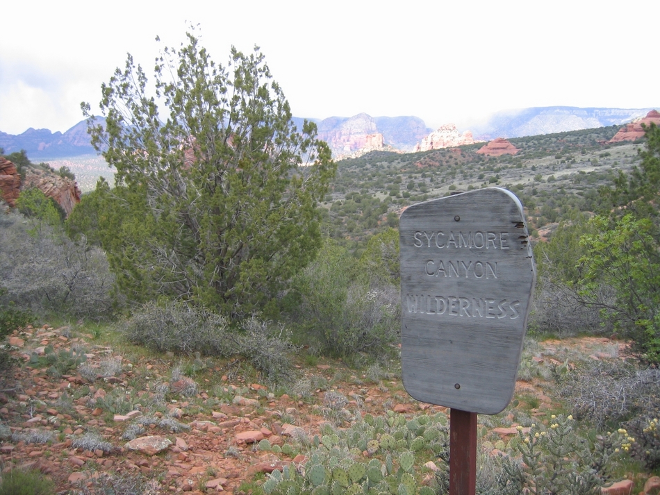
Coconino FS Details The Dogie Trail offers hikers and horsebackers a chance to experience on of Arizona's spectacuns without all of the crowds. If solitude is what you seek, this could be the trail for you. The trail descends into the heart of the Sycamore Canyon Wilderness. For those who long for rugged beauty unspoiled and untamed by man, Sycamore is one of the few paces in the southwest that can lay claim to such a lack of man's accomplishments. The trail into this primitive area begins at a saddle 200 yards from where you should park your vehicle. Expect a panoraic view of the canyon from this pass. Javalina, deer, quail, and numerous other animals call this country home. Pinyon pine, juniper, Arizona cypress, brush fields and wildflowers are abundant. Make sure you take lots of water for this hike especially during late spring to early fall months. Temperatures quite often exceed 110 degrees in the canyon bottom.
Check out the Official Route and Triplogs. Leave No Trace and +Add a Triplog after your hike to support this local community. | ||||||||||||||||||||||||||||||||||||||||||||||||||||||||||||||||||||||||||||||||||||||||||||||||||||||||||||||||||||||||||||||||||||||||||||||||||||||||||||||||||||||||||||||||||||||||||||||||||||||||||||


