username
X
password
register
for free!
help
  

Mistle Toe Canyon, AZ

Guide 0 Triplogs  0 Topics
  0 of 5  
Fav
Wish
1
details
drive
permit
forecast
map
stats
photos
triplogs
topics
location
0 0 0
Statistics
tap row or icons for details
Difficulty 3.5 of 5
Route Finding 4 of 5
Distance Round Trip 5 miles
Trailhead Elevation 4,670 feet
Elevation Gain 1,834 feet
Avg Time Round Trip 4 hours
Kokopelli Seeds 14.17
 Backpack No
unreported if dogs are allowed
editedit > ops > dogs to adjust
Post the 1st photoset!
Author
author avatar Guides 2
Routes 0
Photos 0
Trips 18 map ( 114 miles )
Age 51 Male Gender
Location Chandler, AZ
Associated Areas
list map done
Sedona Region
Historical Weather
Trailhead Forecast
Expand Map
Preferred Apr, Oct, Mar, Nov → 7 AM
Seasons   ALL
Sun  6:03am - 6:49pm
0 Route
 
0 Alternative


Red Rock Thriller
by jkern15674

Here's an alternative route up Bear Mountain through little traveled red rock canyon. This route is an access point to bear canyon from the west side of red rock secret mountian wilderness.


From car, park, avoid trespassing on any private land and travel cross country north to the prominant canyon entrance and this alternative route up the west side of bear mtn. Once in drainage travel uphill (east) towards canyon entrance for about 200 yards ( minimal bushwacking). Then skirt up the hill on the northside of the drainage (again bushwaking but minimal) Once onto the solid red rocks the route stays on the north side of the canyon until the canyon splits in two. From the split take the south side of the canyon this will lead to several climbs up dry waterfalls the first is the most problematic. The route is right up the crack using the natural features for holds. The next two are mild and easy routes are to the right side. The remaining falls will present no problems if fall #1 was acheived. The route continues uphill until eventually leading you to the saddle. From here you can explore the castle to the south or continue uphill to the top of bear mounain. The easiest route is just north of mistle toe canyon.
remove free decal offer
Warning this route REQUIRES route finding skills, 4-5th class gully climbs with some exposure. If unsure of your ability please stay home, if you do decide to venture out tell 2 persons where you are and bring a partner. With that said the veiws uptop are great and the canyon leaves you begging for more. There was not water at that particular time although during wet weather the route should be considered unpassable and would not be suggested by this author.

2005-11-28 jkern15674
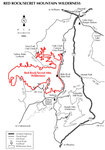
  • Wilderness Map
    area related
    Wilderness Map
  • wilderness related
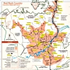
  • 2021 Verde Valley Trails
    region related
    2021 Verde Valley Trails
  • 2021 Verde Valley Area
    region related
    2021 Verde Valley Area
  • 2021 Sedona Trails Map
    region related
    2021 Sedona Trails Map

Leave No Trace and +Add a Triplog after your hike to support this local community.
WARNING! Hiking and outdoor related sports can be dangerous. Be responsible and prepare for the trip. Study the area you are entering and plan accordingly. Dress for the current and unexpected weather changes. Take plenty of water. Never go alone. Make an itinerary with your plan(s), route(s), destination(s) and expected return time. Give your itinerary to trusted family and/or friends.

 Permit $$
Red Rock Pass - may or may not be required. Go to Red Rock Pass then check "When is a Red Rock Pass Required?". If you have questions contact the Coconino forest service.

Red Rock - Secret Mountain Wilderness
see map for camping restrictions


 Directions
or
 Road
FR / Jeep Road - Car possible when dry

To hike
See Bear Mtn description. From bear mtn trailhead cont south on 152c to the first right. Take that road back to TH
 90+° 8am - 6pm kills
helpcorrectionissue

end of page marker