 Route Editor

| Guide | ♦ | 22 Triplogs | 1 Topic |
details | drive | no permit | forecast | 🔥 route |
stats |
photos | triplogs | topic | location |
| 149 | 22 | 1 |
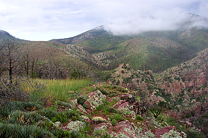
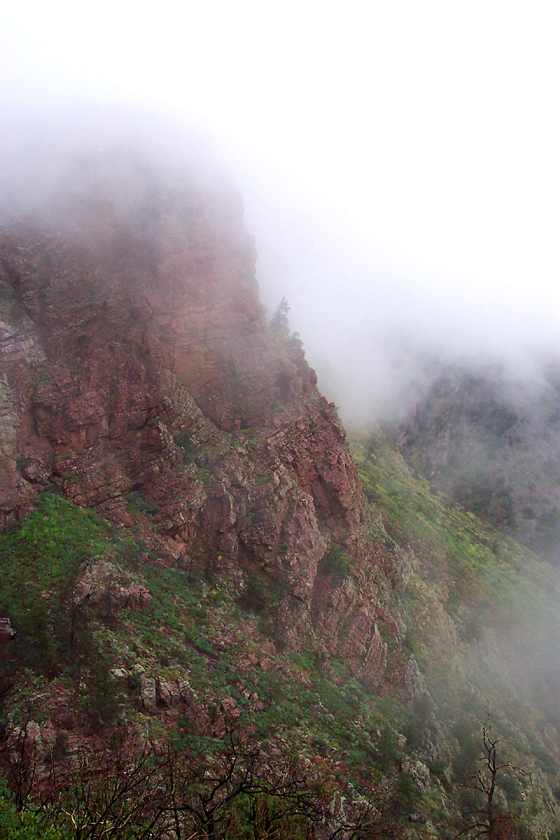
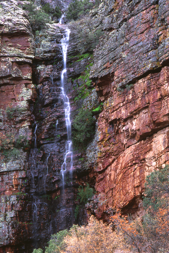
  Beginning at the Barnhardt Trailhead, follow the Barnhardt Trail #43 west as it climbs up rugged Barnhardt Canyon beneath enormous cliffs of red Mazatzal Quartzite. This area of the Mazatzals is recovering well from the Willow Fire, with new trees and bushes creating an increasingly green landscape. At about the 1.5-mile mark, the trail turns south and ascends a side canyon through a series of switchbacks. Suicide Ridge looms high above you here, as does the famous seasonal waterfall (which turns to ice during the winter). A half-mile beyond the first waterfall, a second is encountered, partially hidden by a wall of rock. Above the waterfalls, the trail loops around the 6044-foot ridge that was once covered in a thicket of giant manzanitas. A short section of the huge manzanitas survived the fire along the trail here. At about 3.5 miles, the Barnhardt Trail arrives at the junction with the Sandy Saddle Trail #231. The sign burned away and has yet to be replaced as of this writing, but the blackened signpost and side trail leading north make the junction easy to identify. Beginning at the Barnhardt Trailhead, follow the Barnhardt Trail #43 west as it climbs up rugged Barnhardt Canyon beneath enormous cliffs of red Mazatzal Quartzite. This area of the Mazatzals is recovering well from the Willow Fire, with new trees and bushes creating an increasingly green landscape. At about the 1.5-mile mark, the trail turns south and ascends a side canyon through a series of switchbacks. Suicide Ridge looms high above you here, as does the famous seasonal waterfall (which turns to ice during the winter). A half-mile beyond the first waterfall, a second is encountered, partially hidden by a wall of rock. Above the waterfalls, the trail loops around the 6044-foot ridge that was once covered in a thicket of giant manzanitas. A short section of the huge manzanitas survived the fire along the trail here. At about 3.5 miles, the Barnhardt Trail arrives at the junction with the Sandy Saddle Trail #231. The sign burned away and has yet to be replaced as of this writing, but the blackened signpost and side trail leading north make the junction easy to identify.Turn right onto the Sandy Saddle Trail, and get ready to put your route-finding skills to the test! From here to the Mazatzal Divide Trail 3 miles farther on, the trail is non-existent, to very faint at best. Trust the route shown on the Mazatzal Peak topo map, and follow the trail down to Castersen Seep. The trail shows itself briefly as it climbs the slope north of the seep, and makes a steep drop into the north fork of Barnhardt Canyon. Head upstream until the canyon forks, and begin climbing the ridge between the canyon's forks. Soon you will see faint patches of the trail as it makes a shadeless 800 foot climb up to Sandy Saddle.
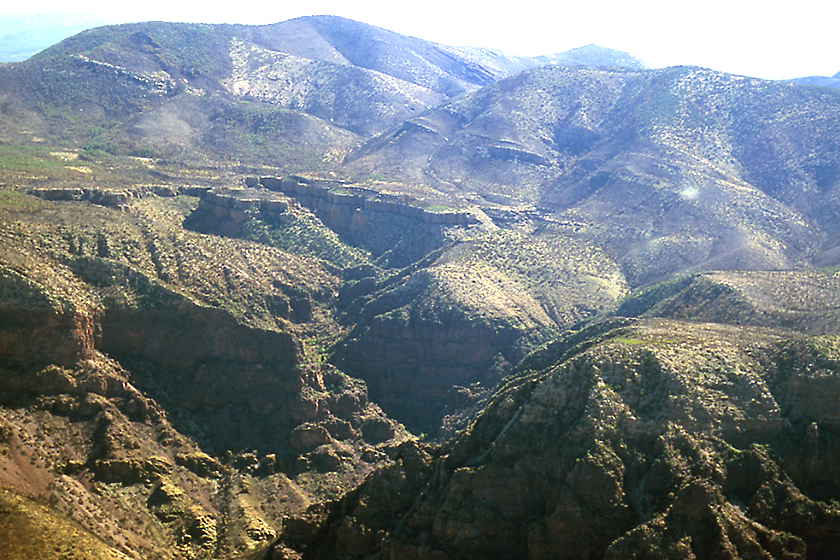
Once you have found the Mazatzal Divide Trail, turn and follow it south (it will seem like a freeway compared to the Sandy Saddle "Trail"). To your right (west) for the next mile, there are some great views of the deep and incredibly rugged Deadman Canyon. The Mazatzal Divide Trail provides great views to the west and south as you follow it along the western slopes of the Mazatzal Mountains. After about 1.8 miles on the Mazatzal Divide Trail, you will arrive at the junction of the Brody Seep Trail. A short distance down this trail is Chilson Camp, an old cowboy camp in a grassy saddle. Continuing past the Brody Seep Trail, the Mazatzal Divide Trail begins climbing towards Barnhardt Saddle and soon passes the melted plastic pipe leading downhill from Chilson Spring. Along here you can see the colorful cliffs of the west face of Mazatzal Peak. Just before arriving at the junction with the Barnhardt Trail, the Mazatzal Divide Trail passes through a pleasant, unburned area, covered in grass and juniper trees. This would make a nice area to camp if water is available at nearby Chilson Spring. At Barnhardt Saddle (elevation 6000 feet), turn left onto the Barnhardt Trail, and follow it east as it contours along the northern slopes of Mazatzal Peak, through millions of new Gambel oak trees. The Barnhardt Trail gradually descends through the new growth, crossing little side drainages along the way, until you arrive back at the junction with the Sandy Saddle Trail. Continue on the Barnhardt Trail as you retrace your steps, and descend Barnhardt Canyon back to Barnhardt Trailhead. Check out the Official Route and Triplogs. Note This is a more difficult hike. It would be unwise to attempt this without prior experience hiking. Leave No Trace and +Add a Triplog after your hike to support this local community. | |||||||||||||||||||||||||||||||||||||||||||||||||||||||||||||||||||||||||||||||||||||||||||||||||||||||||||||||||||


