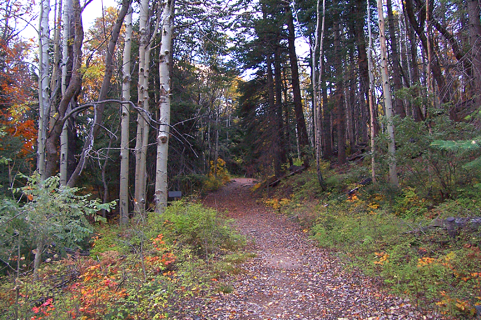
The Ferndell Trail #204 is a short connector trail that runs between the Sixshooter Trail #197 and the Squaw Spring Trail #196 near the top of 7848 foot Pinal Peak, in the Pinal Mountains near Globe. This trail doesn't appear to see much traffic, but it is maintained and relatively easy to follow. Although short, it is a great trail to see fall colors on and would be easy enough for children to hike.
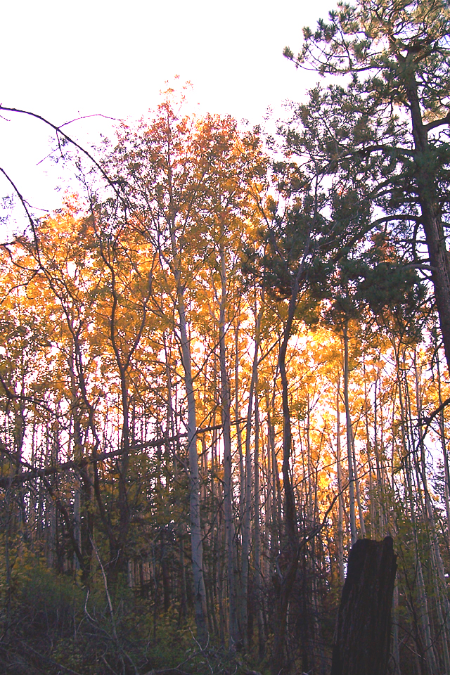
Beginning at the Pinal Peak Trailhead at the end of forest road 651F, the Ferndell Trail leaves the north side of the parking lot and enters a small burned area of short locust trees and Gambel Oaks. The trail begins to descend past rounded boulders of lichen-covered granite as it leaves the burned area and soon comes to the first aspen grove on the left side of the trail. Beyond the aspen grove, the trail continues north and west through a forest of rocky mountain maple, Gambel Oak, and fir, with a fair amount of aspen. A few short breaks in the forest cover offer some glimpses down Sixshooter Canyon. At the 0.25 mile point, the Ferndell Trail encounters a side trail on the left that heads uphill to the Upper Pinal Campground. Now on the north side of Pinal Peak, the fern shrouded Ferndell Trail makes a short downhill drop before leveling out. As the trail contours along through the shady forest, it becomes an old road and passes another grove of tall aspens, mixed with maple trees. Keep going straight, where an old road crosses a short distance later. Soon you will arrive at the junction with the scenic Sixshooter Trail. Just past the Sixshooter junction, the trail passes an old rock foundation, and then a locked gate, before coming to an end at the parking area of the Ferndell Trailhead (0.8 miles one way). Somewhere in this area is Ferndell Spring. There is an open meadow-like area on the south side of the trailhead here, where new aspen shoots abound.
Return the way you came, or create a loop by taking one of the branches of road 651 back to the Pinal Peak Trailhead.
Gate Policy: If a gate is closed upon arrival, leave it closed after you go through. If it is open, leave it open. Leaving a closed gate open may put cattle in danger. Closing an open gate may cut them off from water. Please be respectful, leave gates as found. The exception is signage on the gate directing you otherwise.
WARNING! Hiking and outdoor related sports can be dangerous. Be responsible and prepare for the trip. Study the area you are entering and plan accordingly. Dress for the current and unexpected weather changes. Take plenty of water. Never go alone. Make an itinerary with your plan(s), route(s), destination(s) and expected return time. Give your itinerary to trusted family and/or friends.
At the junction of highways 60 & 188 in Claypool, turn right (south) onto Russell Road
Odometer 0.0
- South on Russell Road for 0.35 miles
- DO NOT continue on Golden Hill, Russell turns right
- Continue to 0.65 miles
- DO NOT continue on Rose Mofford Way, Russell turns left
- At 6.3 miles you reach FR 651
Odometer 0.0
- Turn right (south) on FR 651 ( dirt road )
- Continue to 10.25 mi with FR 651C junction
Either
- Left on FR 651C 0.3 miles to Ferndell Trail ( lower )
OR
- Continue on FR 651 to 11.2 miles
- Right on FR 651F, just 0.7 miles to the Pinal Peak Trailhead at the end
From PHX (I-10 & AZ-51) 2 h 19 min without traffic From TUC (Jct 1-10 & Grant) 2 h 49 min without traffic From FLG (Jct I-17 & I-40) 3 h 59 min without traffic
 Route Editor

 The Ferndell Trail #204 is a short connector trail that runs between the Sixshooter Trail #197 and the Squaw Spring Trail #196 near the top of 7848 foot Pinal Peak, in the Pinal Mountains near Globe. This trail doesn't appear to see much traffic, but it is maintained and relatively easy to follow. Although short, it is a great trail to see fall colors on and would be easy enough for children to hike.
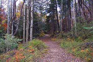


