 Route Editor

| Guide | ♦ | 5 Triplogs | 0 Topics |
details | drive | permit | forecast | route |
stats |
photos | triplogs | topics | location |
| 56 | 5 | 0 |
Getty Up by Zort   The Route The RouteAs with finding the trailhead, getting started on the route required a wee bit of looking. A cairn is visible from the parking area that leads you west and down to a flat layer above the drainage. I was tempted to contour left toward the top of the obvious drainage to the south, but that's not the cairned route. Instead, stay pretty much west until hitting the edge of the drainage and possibly seeing another cairn on the way. It might take a bit of glassing the terrain for cairns, but they are there, and they will take you down to the gravel in the wash/creek bed. From there, the route will be quite evident for folks familiar with traveling down washes and canyons. There are a couple of pour offs that will force a go-around to one side or the other. The main obstacle is a considerable pour off that is maybe a third of the way down the canyon. The trail stays creek right and traverses quite a ways until it is necessarily heading steeply down into the creek bed again. (This is strenuous on the hike out!) You'll cross over to creek left again, half to 2/3 of the way down, and then just above the river, you come to the odd bridge of small logs and flat stones that presumably protects a semi-technical move of stepping left around a protruding rock/wall and then down to a ledge. Below that, you end up crossing to creek-right again, traversing above the river for a bit and then finally making the last drop through a steep layer to the river. My moving time on this round-trip hike was about 2h 10m, but that was double-timing it down the canyon with a mostly empty pack with no time spent for photos or much drinking in of the steep, jagged beauty of the place. Unless you have a train to catch, I would recommend spending four hours or so, depending on fitness, pack, etc. It's a strenuous climb out.
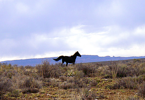
As others have said in triplogs, this is the easiest route to reach the LCR from atop the impressive gorge. It is hard to picture horses going down it, but it is child's play compared to Blue Spring Trail, and both easier and shorter than Hopi Salt Trail. I plan to use it as access for caching, but others have used it to connect with Salt Trail as a loop hike, and that would be quite pleasant, too. I love the idea of using mountain bikes to shuttle between trailheads! Be sure to pack enough water for the return/continued trip. Any water found in this part of LCR is sure to be nothing but chocolate silt. Check out the Official Route and Triplogs. Leave No Trace and +Add a Triplog after your hike to support this local community. One-Way Notice This hike is listed as One-Way. When hiking several trails on a single "hike", log it with a generic name that describes the hike. Then link the trails traveled, check out the example. | ||||||||||||||||||||||||||||||||||||||||||||||||||||||||||||||||||||||||||||||


