 Route Editor

| Guide | ♦ | 27 Triplogs | 1 Topic |
details | drive | no permit | forecast | 🔥 route |
stats |
photos | triplogs | topic | location |
| 254 | 27 | 1 |
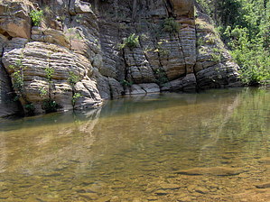
Crystal loves a clear creek by HAZ_Hikebot   East Clear Creek is what gets crossed in this case. It's a perennial stream that flows through a picturesque canyon and eventually ends up in the Little Colorado River. The trail that leads to the crossing drops down a gradual slope through an open forest of ponderosa pine and Gambel oak. East Clear Creek is what gets crossed in this case. It's a perennial stream that flows through a picturesque canyon and eventually ends up in the Little Colorado River. The trail that leads to the crossing drops down a gradual slope through an open forest of ponderosa pine and Gambel oak.East Clear Creek is small but great for wading and splashing around. A few of the deeper pools are big enough for swimming and fishing. All of them make great reflecting pools for the rock bluffs that form the canyon walls, so bring your camera.
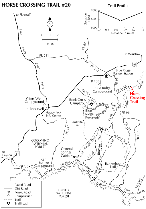
Check out the Official Route and Triplogs. Leave No Trace and +Add a Triplog after your hike to support this local community. One-Way Notice This hike is listed as One-Way. When hiking several trails on a single "hike", log it with a generic name that describes the hike. Then link the trails traveled, check out the example. | ||||||||||||||||||||||||||||||||||||||||||||||||||||||||||||||||||||||||||||||||||||||||||||||||||||||||||||||||||||||||||||||||||||||||||||||||||||||||||||||||||||||||||||||||||||||||||||||


