 Route Editor

Interesting article on AZCentral today about how Payson is finally going to get water from CC Cragin Reservoir (when exactly did it change it's name from Blue Ridge?).
In the meantime, it seems that SRP is taking water from the reservoir and releasing it into the East Verde at Washington Park, so that there's a regular flow that has more commonly been associated with spring runoff. This water is draining all the way down to Horseshoe and Bartlett lakes.
Payson will be building a new pipeline from Washington Park to a new water treatment plant somewhere near town, so it will be interesting to see how the pipeline/construction affects the area in the next few years.
It will also be interesting to see how the water levels on the reservoir are affected by the use of the water in higher quantities than recent years.
Recommended reading.
( 2018-08-28 dead link removed )
( 2018-08-28 damn smart thinking ahead - HAZ_Hikebot out! )
Edit: Added PDF since azc links expire within a couple of weeks.
C. C. Cragin Reservoir
Moderator: HAZ - Moderators
Linked Area, etc none
-
 chumleyGuides: 94 | Official Routes: 239Triplogs Last: 4 d | RS: 73Water Reports 1Y: 95 | Last: 3 d
 - Joined: Sep 18 2002 8:59 am
- City, State: Tempe, AZ
C. C. Cragin Reservoir
- Attachments
-
- azc_cccragin.pdf
- (124.06 KiB) Downloaded 202 times
I'm not sure what my spirit animal is, but I'm confident it has rabies.
contribute to this member driven resource
ie: RS > Save/Share after hikes 

-
 PrestonSandsGuides: 170 | Official Routes: 86Triplogs Last: 499 d | RS: 0Water Reports 1Y: 0 | Last: 507 d
 - Joined: Apr 12 2004 10:59 pm
- City, State: Tucson, AZ
- Contact:
Re: C. C. Cragin Reservoir
I refuse to call it anything but Blue Ridge. 
"…you never know when a hike might break out" -Jim Gaffigan
contribute to this member driven resource
ie: RS > Save/Share after hikes
-
 Alston_NealGuides: 1 | Official Routes: 0Triplogs Last: 156 d | RS: 0Water Reports 1Y: 0 | Last: never
 - Joined: Apr 19 2008 5:53 pm
- City, State: Phoenix, AZ
Re: C. C. Cragin Reservoir
That is the reason a certain peak here will always be Squaw Peak to me.The Hippy wrote: There should be a name change cut off time, if its been named one thing for over ten years....don't change.
contribute to this member driven resource
ie: RS > Save/Share after hikes
-
 paulhubbardGuides: 8 | Official Routes: 1Triplogs Last: 165 d | RS: 0Water Reports 1Y: 0 | Last: 4,399 d
 - Joined: Jun 01 2010 9:54 am
- City, State: Mesa, AZ
- Contact:
Re: C. C. Cragin Reservoir
My grandfather, who spent the vast majority of his life in AZ, told me years ago that it used to be called "Squaw T i t Peak", but was renamed for obvious political correctness...Alston Neal wrote:That is the reason a certain peak here will always be Squaw Peak to me.
Good judgement comes from experience. Experience comes from bad judgement.
contribute to this member driven resource
ie: RS > Save/Share after hikes
-
Alston_NealGuides: 1 | Official Routes: 0Triplogs Last: 156 d | RS: 0Water Reports 1Y: 0 | Last: never
- Joined: Apr 19 2008 5:53 pm
- City, State: Phoenix, AZ
Re: C. C. Cragin Reservoir
Ah yes the good old days when men were men and women were....well not allowed to name things.paulhubbard wrote:My grandfather, who spent the vast majority of his life in AZ, told me years ago that it used to be called "Squaw T i t Peak", but was renamed for obvious political correctness...Alston Neal wrote:That is the reason a certain peak here will always be Squaw Peak to me.
Which is why today we don't have a Superstion landmark named Weaver's Wienner.
contribute to this member driven resource
ie: RS > Save/Share after hikes
-
 SredfieldGuides: 4 | Official Routes: 4Triplogs Last: 102 d | RS: 0Water Reports 1Y: 0 | Last: 731 d
 - Joined: Sep 08 2002 1:07 pm
- City, State: Ahwatukee, AZ
Re: C. C. Cragin Reservoir
Plug 44.10930°N -108.5766°W into Mapdex
Oh the joys of Political Correctness
Oh the joys of Political Correctness
Shawn
The bear went over the mountain to see what he could see.
The bear went over the mountain to see what he could see.
contribute to this member driven resource
ie: RS > Save/Share after hikes
-
Alston_NealGuides: 1 | Official Routes: 0Triplogs Last: 156 d | RS: 0Water Reports 1Y: 0 | Last: never
- Joined: Apr 19 2008 5:53 pm
- City, State: Phoenix, AZ
Re: C. C. Cragin Reservoir
I at least had comfort in knowing there were 2 of them.Sredfield wrote:Plug 44.10930°N -108.5766°W into Mapdex
Oh the joys of Political Correctness
contribute to this member driven resource
ie: RS > Save/Share after hikes
-
 azbackpackrGuides: 34 | Official Routes: 30Triplogs Last: 35 d | RS: 0Water Reports 1Y: 8 | Last: 45 d
 - Joined: Jan 21 2006 6:46 am
- City, State: Eagar AZ
Re: C. C. Cragin Reservoir
Heading to this place with my kayak on Monday night, paddling on Tuesday, maybe on Wed., too. Have never been there. Hope it has some water in it!
If you play around with the settings, set it to show you data for one year, you can see that the level has dropped a great deal over the past year. http://waterdata.usgs.gov/az/nwis/uv/?s ... 0065,00060
One thing no one pointed out on this thread is the watershed it is a part of. It's on East Clear Creek (which is not connected to West Clear Creek, but both arise near each other in the same mountains, they just go in opposite directions.)
East Clear Creek runs into the Little Colorado River at Winslow. The LCR runs north-northwest from Mount Baldy in the White Mountains all the way to Grand Canyon, to the big Colorado River. On its way to the LCR, East Clear Creek also is impounded in another reservoir suitable for kayaking and swimming, at McHood Park outside of Winslow.
Compare this with the West Clear Creek watershed. West Clear Creek runs into the Verde, which runs into the Salt, which runs into the Gila, which runs into the big Colorado River within the town limits of Yuma. Well, that is, when it does run, that's where it runs.
There is a point of no return unremarked at the time in most lives. Graham Greene The Comedians
A clean house is a sign of a misspent life.
A clean house is a sign of a misspent life.
contribute to this member driven resource
ie: RS > Save/Share after hikes
-
 JoelHazeltonGuides: 16 | Official Routes: 1Triplogs Last: 144 d | RS: 1Water Reports 1Y: 2 | Last: 304 d
 - Joined: Mar 22 2006 7:45 am
- City, State: Phoenix, AZ
- Contact:
Re: C. C. Cragin Reservoir
My girlfriend and I backpacked ECC via Mack's Crossing a couple weeks back. Did lots of swimming while there. A couple days after getting back, what originally looked like bug bites expanded and spread into a rash all over her legs, which then spread up to her torso. It took 2 weeks, 3 visits to urgent care, 2 different antibiotics, prescription antihistamines, a steroid shot and some other shot to finally kick whatever was going on. Pretty bizarre, and still nobody knows what it was or what caused it. I can also vouch for the fact that her immune system is far inferior to the average person's. Just thought I'd throw that nasty bit of info in there as long as we're talking about ECC... ;)
"Arizona is the land of contrast... You can go from Minnesota to California in a matter of minutes, then have Mexican food that night." -Jack Dykinga
http://www.joelhazelton.com
http://www.joelhazelton.com
contribute to this member driven resource
ie: RS > Save/Share after hikes
-
 NatureKopelliGuides: 3 | Official Routes: 1Triplogs Last: none | RS: 0Water Reports 1Y: 0 | Last: never
 - Joined: Oct 26 2010 7:51 am
- City, State: Arizona
Re: C. C. Cragin Reservoir
"To me, a lush carpet of pine needles or spongy grass is more welcome than the most luxurious Persian rug." ~Helen Keller
"You have to touch a tree and feel it..." ~Dr Alex Shigo...Touch Trees! Hug Trees!
Lizards make me smile
"You have to touch a tree and feel it..." ~Dr Alex Shigo...Touch Trees! Hug Trees!
Lizards make me smile
contribute to this member driven resource
ie: RS > Save/Share after hikes
-
JoelHazeltonGuides: 16 | Official Routes: 1Triplogs Last: 144 d | RS: 1Water Reports 1Y: 2 | Last: 304 d
- Joined: Mar 22 2006 7:45 am
- City, State: Phoenix, AZ
- Contact:
Re: C. C. Cragin Reservoir
@nahimana222
Hmm... Looks suspiciously close to what she had at first. Then I'm pretty sure the "scratching can cause bacterial infections" passage happened to her.
Hmm... Looks suspiciously close to what she had at first. Then I'm pretty sure the "scratching can cause bacterial infections" passage happened to her.
"Arizona is the land of contrast... You can go from Minnesota to California in a matter of minutes, then have Mexican food that night." -Jack Dykinga
http://www.joelhazelton.com
http://www.joelhazelton.com
contribute to this member driven resource
ie: RS > Save/Share after hikes
-
 FOTGGuides: 37 | Official Routes: 103Triplogs Last: 4 d | RS: 204Water Reports 1Y: 71 | Last: 10 d
 - Joined: Jan 21 2013 10:47 am
- City, State: AZ
- Contact:
Re: C. C. Cragin Reservoir
@azpride
I actually almost said swimmers itch myself, but thought it was more of a Midwest thing? caused by geese?
I actually almost said swimmers itch myself, but thought it was more of a Midwest thing? caused by geese?
contribute to this member driven resource
ie: RS > Save/Share after hikes
-
 NighthikerGuides: 0 | Official Routes: 0Triplogs Last: 1,643 d | RS: 0Water Reports 1Y: 0 | Last: never
 - Joined: Feb 03 2002 6:59 am
- City, State: Payson
Re: C. C. Cragin Reservoir
My new 2013 Coconino National Forest Visitors map now lists the former Blue Ridge Reservoir as C. C. Cragin Reservoir.
jk
contribute to this member driven resource
ie: RS > Save/Share after hikes
-
 The_EagleGuides: 42 | Official Routes: 365Triplogs Last: 7 d | RS: 763Water Reports 1Y: 76 | Last: 15 d
 - Joined: Jan 20 2009 2:46 pm
- City, State: Far NE Phoenix, Az
- Contact:
Re: C. C. Cragin Reservoir
Sorry It'll always be Blue Ridge Reservoir for me. A great place to go to and relax after hiking Squaw Peak!
There is a very fine line between "hobby" and "mental illness."
Dave Barry
Dave Barry

contribute to this member driven resource
ie: RS > Save/Share after hikes
-
 ALMALGuides: 0 | Official Routes: 0Triplogs Last: 257 d | RS: 0Water Reports 1Y: 0 | Last: 1,173 d
 - Joined: Oct 17 2010 8:02 pm
- City, State: GILBERT
Re: C. C. Cragin Reservoir
Huh? I was considering taking my canoe there this coming weekend and camping for a few nights. I spoke to someone in the Blue Ridge ranger office this morning and she said the lake is at 42% full.
I asked her if it was all green and nasty looking, but she said not bad. I wonder, down so low with no water coming into it, it is likely getting pretty funky...
Sounds like it will get lower as the summer continues.
I asked her if it was all green and nasty looking, but she said not bad. I wonder, down so low with no water coming into it, it is likely getting pretty funky...
Sounds like it will get lower as the summer continues.
You aren't late if you don't show up!
contribute to this member driven resource
ie: RS > Save/Share after hikes
-
ALMALGuides: 0 | Official Routes: 0Triplogs Last: 257 d | RS: 0Water Reports 1Y: 0 | Last: 1,173 d
- Joined: Oct 17 2010 8:02 pm
- City, State: GILBERT
Re: C. C. Cragin Reservoir
@azbackpackr
I see you're going to Blue Ridge / Cragin today and tomorrow. Could you let me know what the water conditions are like. I was considering taking my canoe up there over the weekend. The last time I was there I paddled all the way to the mouth of ECC and camped. This time I was think about going around the other side where Bear Canyon and General Springs Canyon enter the lake, maybe camp around in there. Any info on the conditions and available camping would be appreciated.
I see you're going to Blue Ridge / Cragin today and tomorrow. Could you let me know what the water conditions are like. I was considering taking my canoe up there over the weekend. The last time I was there I paddled all the way to the mouth of ECC and camped. This time I was think about going around the other side where Bear Canyon and General Springs Canyon enter the lake, maybe camp around in there. Any info on the conditions and available camping would be appreciated.
You aren't late if you don't show up!
contribute to this member driven resource
ie: RS > Save/Share after hikes
-
azbackpackrGuides: 34 | Official Routes: 30Triplogs Last: 35 d | RS: 0Water Reports 1Y: 8 | Last: 45 d
- Joined: Jan 21 2006 6:46 am
- City, State: Eagar AZ
Re: C. C. Cragin Reservoir
It was fun! The lake is low but not horrible. The water is about as murky as any lake in Arizona, but not muddy like Lake Mary. The wind was very, very strong, probably approaching 40 mph gusts, and provided we two kayakers with a lot of fun. I really enjoyed working on my skills navigating into a headwind, and also sudden side winds that came up. The best part was "sailing" back, holding both arms vertical with paddle up over my head for greater affect. We camped at Rock Crossing, which was super nice. We checked out a couple of potential boat-in campsites. Look for triplog, GPS route and photos later today when I get around to posting them.ALMAL wrote:@azbackpackr
I see you're going to Blue Ridge / Cragin today and tomorrow. Could you let me know what the water conditions are like. I was considering taking my canoe up there over the weekend. The last time I was there I paddled all the way to the mouth of ECC and camped. This time I was think about going around the other side where Bear Canyon and General Springs Canyon enter the lake, maybe camp around in there. Any info on the conditions and available camping would be appreciated.
If you don't like gusty winds, though, watch the forecast. Looks to me like it is going to be a lot better. Forecast for Monday and Tuesday was for 50 mph gusts.
There is a point of no return unremarked at the time in most lives. Graham Greene The Comedians
A clean house is a sign of a misspent life.
A clean house is a sign of a misspent life.
contribute to this member driven resource
ie: RS > Save/Share after hikes
-
 DschurGuides: 13 | Official Routes: 0Triplogs Last: 3,427 d | RS: 0Water Reports 1Y: 0 | Last: never
 - Joined: Oct 25 2002 4:29 pm
- City, State: Payson, AZ
- Contact:
Re: C. C. Cragin Reservoir
About a week or so Rock Crossing CG was closed due to bear problems....
Dawn
--On the loose to climb a mountain, on the loose where I am free. On the loose to live my life the way I think my life should be...For we only have a moment and a whole world yet to see...I'll be looking for tomorrow on the loose. ---unknown--
--On the loose to climb a mountain, on the loose where I am free. On the loose to live my life the way I think my life should be...For we only have a moment and a whole world yet to see...I'll be looking for tomorrow on the loose. ---unknown--
contribute to this member driven resource
ie: RS > Save/Share after hikes
-
azbackpackrGuides: 34 | Official Routes: 30Triplogs Last: 35 d | RS: 0Water Reports 1Y: 8 | Last: 45 d
- Joined: Jan 21 2006 6:46 am
- City, State: Eagar AZ
Re: C. C. Cragin Reservoir
I heard about bears, but never saw one there.
There is a point of no return unremarked at the time in most lives. Graham Greene The Comedians
A clean house is a sign of a misspent life.
A clean house is a sign of a misspent life.
contribute to this member driven resource
ie: RS > Save/Share after hikes
-
chumleyGuides: 94 | Official Routes: 239Triplogs Last: 4 d | RS: 73Water Reports 1Y: 95 | Last: 3 d
- Joined: Sep 18 2002 8:59 am
- City, State: Tempe, AZ
Re: C. C. Cragin Reservoir
Update on the status of CC Cragin (Blue Ridge) Reservoir from SRP.
The water level has dropped to just 27% of capacity, and SRP continues to draw down the lake level to do maintenance on the pump intake. The water level must drop an additional 26 feet from its current level, and SRP expects that to occur by August 18th. Inspection of the tunnel inlet should be complete by Aug. 20.
SRP indicates that an above normal winter season can fill the reservoir by next spring.
Read all about how the water is currently being pumped into the East Verde, and ultimately being stored in Horseshoe Reservoir, as well as how Payson will use the water in future years:
http://www.srpnet.com/newsroom/releases/071714.aspx
- Attachments
-
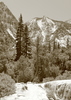
- Image from Coconino NF, Blue Ridge Ranger Station
I'm not sure what my spirit animal is, but I'm confident it has rabies.
contribute to this member driven resource
ie: RS > Save/Share after hikes
-
azbackpackrGuides: 34 | Official Routes: 30Triplogs Last: 35 d | RS: 0Water Reports 1Y: 8 | Last: 45 d
- Joined: Jan 21 2006 6:46 am
- City, State: Eagar AZ
Re: C. C. Cragin Reservoir
Thanks for the info. It was definitely lower when I was there last on July 22nd. I had been there about a month prior to that and noticed a drop.
There is a point of no return unremarked at the time in most lives. Graham Greene The Comedians
A clean house is a sign of a misspent life.
A clean house is a sign of a misspent life.
contribute to this member driven resource
ie: RS > Save/Share after hikes