 Route Editor

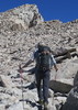
I am looking for areas that are mid to moderate in difficulty to take a buddy so I can teach him more about rope work, rappel, general techniques etc... I am looking for fairly close in to Phoenix/Scottsdale area (within 2- 2 1/2 hour drive). Prefer either loop trips or down and back (no through trips this time), prefer 1 night camp.
I am thinking of Christopher Creek as a starting place, however, in reading about it, looks busy. Any suggestions? My buddy has only done simple indoor rope work and I need to get him used to outside rock drop offs, slippery terrain and how to create anchors etc.
Appreciate any help.
Rappel Sites
Moderator: HAZ - Moderators
Linked Guides none
Linked Area, etc none
-
 pdevinGuides: 0 | Official Routes: 0Triplogs Last: 6,107 d | RS: 0Water Reports 1Y: 0 | Last: never
 - Joined: Sep 20 2007 10:00 am
- City, State: Phoenix, AZ
contribute to this member driven resource
ie: RS > Save/Share after hikes 

-
 fairweather8588Guides: 1 | Official Routes: 0Triplogs Last: 178 d | RS: 0Water Reports 1Y: 1 | Last: 178 d
 - Joined: Jul 22 2003 6:35 pm
- City, State: Scottsdale
- Contact:
Re: Rappel Sites
The northern end of the McDowell Mountains has some places where you could do some practice, go to the McDowell Sonoran Conservancy's website for some more infor
No man should go through life without once experiencing healthy, even bored solitude in the wilderness, finding himself depending solely on himself and thereby learning his true and hidden strength
Kerouac
Kerouac
contribute to this member driven resource
ie: RS > Save/Share after hikes
-
 JeffshadowsGuides: 28 | Official Routes: 7Triplogs Last: 4,274 d | RS: 0Water Reports 1Y: 0 | Last: 4,432 d
 - Joined: Jan 30 2008 8:46 am
- City, State: Old Pueblo
Re: Rappel Sites
McDowell\Queen Creek used to be the spot for that up that way.
AD-AVGVSTA-PER-ANGVSTA
contribute to this member driven resource
ie: RS > Save/Share after hikes
-
 HoffmasterGuides: 0 | Official Routes: 0Triplogs Last: 6,319 d | RS: 0Water Reports 1Y: 0 | Last: never
 - Joined: Oct 04 2002 11:13 pm
- City, State: Canton, OH
- Contact:
Re: Rappel Sites
There is a huge boulder a short distance up the Echo Canyon trail at Camelback with anchors on the top. I have seen groups using it as a practice spot for rappelling. Same goes with a spot in Papago Park off the west side of Galvin Parkway. If you want it to be wet, then I would go to Christopher Creek for ease of access or The Jug (Salome Creek) for a bit more adventure. There are some waterfalls that are really fun to rappel in Crystal Canyon (not its real name) on the San Carlos Apache Res, but I don't remember how to get there.
"I'm not a vegetarian because I love animals; I'm a vegetarian because I hate plants." A. Whitney Brown
contribute to this member driven resource
ie: RS > Save/Share after hikes
-
pdevinGuides: 0 | Official Routes: 0Triplogs Last: 6,107 d | RS: 0Water Reports 1Y: 0 | Last: never
- Joined: Sep 20 2007 10:00 am
- City, State: Phoenix, AZ
Re: Rappel Sites
Thank you all for the help and advice, much appreciated.
contribute to this member driven resource
ie: RS > Save/Share after hikes
-
 Dave1Guides: 0 | Official Routes: 2Triplogs Last: 3,252 d | RS: 0Water Reports 1Y: 0 | Last: 3,252 d
 - Joined: Jan 25 2009 12:36 am
- City, State: Phoenix, AZ
Re: Rappel Sites
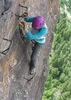
Looking for some rappel sites to practice at. Somewhere between 100' and 200'. Something I can scramble to the top of without any technical climbing. 1-2 hours from Phoenix. Thanks for any ideas.
contribute to this member driven resource
ie: RS > Save/Share after hikes
-
 KBKBGuides: 3 | Official Routes: 13Triplogs Last: 1,885 d | RS: 0Water Reports 1Y: 0 | Last: 2,942 d
 - Joined: Apr 22 2012 4:52 pm
- City, State: Fountain Hills, AZ
Re: Rappel Sites
Atlantis. This is a climbing area that's just east of Superior. From Phoenix, drive through Superior and then continue on towards Globe on US 60. Shortly after leaving Superior, you will drive through a tunnel. At the end of the tunnel, pull off to the right and park in the large pullout. Walk over to the edge of the canyon (which will be below you) and look for some rappel anchors. Climbers will sometimes set up a rope for getting down to the bottom of the canyon, so be on the lookout for a rope too. You can hike / scramble back to the top by hiking west down-canyon until you see a trail of use leading back to the top.Dave1 wrote:Looking for some rappel sites to practice at. Somewhere between 100' and 200'. Something I can scramble to the top of without any technical climbing. 1-2 hours from Phoenix.
As I recall, it takes most of a climbing rope, single line, to get to the bottom, so either bring two ropes, one rope and a pull cord, or just one rope that you set up single line which you'll then retrieve when you hike back to the top. I think there are also some rappel anchors midway down, so you could also do it as a two stage rappel with just a single standard length climbing rope. You'll be rappelling down a route named Neptune, 5.10a. Watch out for climbers when you're rappelling and make sure that they know that you'll be tossing a rope, etc.
Last edited by KBKB on Mar 18 2018 12:52 am, edited 3 times in total.
contribute to this member driven resource
ie: RS > Save/Share after hikes
-
KBKBGuides: 3 | Official Routes: 13Triplogs Last: 1,885 d | RS: 0Water Reports 1Y: 0 | Last: 2,942 d
- Joined: Apr 22 2012 4:52 pm
- City, State: Fountain Hills, AZ
Re: Rappel Sites
@Dave1
Another idea... Hike to Tom's Thumb and do the class 4 route on the West Corner (which is the name of the route). I'd suggest bringing a few slings and stoppers to protect the route just in case.
According to the page at summitpost.org, you rap down the west face. They say that a single 60 meter rope makes it with a few feet to spare.
When I did it back in the day, we used two ropes, but ropes were shorter back then.
contribute to this member driven resource
ie: RS > Save/Share after hikes
-
 toddakGuides: 13 | Official Routes: 7Triplogs Last: 7 d | RS: 0Water Reports 1Y: 0 | Last: 1,718 d
 - Joined: Nov 15 2005 8:46 pm
- City, State: Jackson, CA
Re: Rappel Sites
Dave - I recently posted on 2 climbs at McDowell Mountains Sven Slab, "One for the Road" and "The Chute". Both have double bolt/chain anchors at the top and there's a moderate 3rd class scramble route just to the east of One for the Road (left side as you're facing the rock) that will get you to the top anchor. From there you can also traverse west on a brushy ledge system to get you to the top anchor on The Chute. Both rappels would be in the 150' range, moderately steep, no overhangs, straightforward rope pulls.
contribute to this member driven resource
ie: RS > Save/Share after hikes
-
 mazatzalGuides: 0 | Official Routes: 6Triplogs Last: 9 d | RS: 1Water Reports 1Y: 0 | Last: 845 d
 - Joined: Jul 28 2004 2:18 pm
- City, State: Scottsdale, AZ
Re: Rappel Sites
Gardeners Wall is another option.
[ McDowell Mountains / Gardeners Wall ]
[ McDowell Mountains / Gardeners Wall ]
contribute to this member driven resource
ie: RS > Save/Share after hikes
-
 rcorfmanGuides: 1 | Official Routes: 4Triplogs Last: 665 d | RS: 2Water Reports 1Y: 0 | Last: 1,116 d
 - Joined: Oct 17 2008 11:19 pm
- City, State: Phoenix, AZ
- Contact:
Re: Rappel Sites
I know there are a lot of chains and bolts on the WSW face of 13 mile Butte off of Hwy 260. You might give that a try.
Go find a LonelyCache
contribute to this member driven resource
ie: RS > Save/Share after hikes
-
 outdoor_loverGuides: 7 | Official Routes: 6Triplogs Last: 110 d | RS: 2Water Reports 1Y: 29 | Last: 123 d
 - Joined: Aug 19 2011 7:49 pm
- City, State: Scottsdale, AZ
Re: Rappel Sites
Papago Park, Coon's Bluff near the Salt River, Flowing Springs just outside of Payson, I guess there's one at South Mountain, but I'm not sure where that one is.
Life is not a journey to the grave with the intention of arriving safely in a pretty & well preserved body, but rather to skid in broadside, totally worn out & proclaiming, "Wow What a Ride!"
contribute to this member driven resource
ie: RS > Save/Share after hikes
-
 chumleyGuides: 94 | Official Routes: 239Triplogs Last: 3 d | RS: 73Water Reports 1Y: 95 | Last: 2 d
 - Joined: Sep 18 2002 8:59 am
- City, State: Tempe, AZ
Re: Rappel Sites
I'm not sure what my spirit animal is, but I'm confident it has rabies.
contribute to this member driven resource
ie: RS > Save/Share after hikes
-
 syoungGuides: 6 | Official Routes: 4Triplogs Last: 2,945 d | RS: 0Water Reports 1Y: 0 | Last: 3,006 d
 - Joined: May 23 2012 9:31 pm
- City, State: Mesa, AZ
Re: Rappel Sites
Last edited by joebartels on Mar 20 2018 7:38 am, edited 1 time in total.
Reason: linked reference
Reason: linked reference
contribute to this member driven resource
ie: RS > Save/Share after hikes
-
 oceanwithinGuides: 0 | Official Routes: 0Triplogs Last: 9 d | RS: 0Water Reports 1Y: 0 | Last: never
 - Joined: Jun 19 2009 10:19 am
- City, State: AZ
Re: Rappel Sites
Papago has a 120’ partially free-hanging one near the amphitheater, bolted at the top.
contribute to this member driven resource
ie: RS > Save/Share after hikes