 Route Editor

EDIT 9-13-10: After hiking Kachina Trail with Jake yesterday, we determined the original planned photographing spot isn't very good in the evening... Nearby ridges block the best of the evening light. So, the new, tentative plan is Hart Prairie Saturday evening. After shooting through sunset there, we'll hop on fr522 off Snowbowl road and find a place to car camp near Freidlen Prairie. Sunday morning we'll wake up bright and early (more like dark and early) and hike no more than 2 miles on the Kachina Trail to find some aspens and meadows. Plans still subject to change, of course, as we do more scouting.
Hey HAZ photographers!
Jake (hippiepunkpirate), Jon (jonnybackpack) and I are putting together an autumn photography workshop/group hike/camping trip at the Peaks, October 9th and 10th.
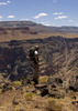
The plan, as of now, is to meet up late morning on Saturday, October 9th, and drive to the Freidlein Prairie trailhead. Hike the lower portion of the Kachina Trail and photograph the beautiful Kachina meadows in the evening. Car-camp somewhere nearby Saturday night, wake up pre-sunrise Sunday morning and head to Lockett Meadow. Photograph the Lockett Meadow area for sunrise, then head into the Inner Basin to capture the rest of the morning light.
Although this is obviously organized like a normal group hike, the focus will be on photography. Bring a camera and tripod! We'll be visiting prime locations during the best light, so there should be plenty of opportunity for some awesome photos... Not to mention the sharing of knowledge from fellow photographers ;)
I hope some of you are interested!
HAZ Fall Photo Workshop
Moderators: HAZ Group Coordinators, HAZ - Moderators
-
 JoelHazeltonGuides: 16 | Official Routes: 1Triplogs Last: 144 d | RS: 1Water Reports 1Y: 2 | Last: 304 d
 - Joined: Mar 22 2006 7:45 am
- City, State: Phoenix, AZ
- Contact:
HAZ Fall Photo Workshop
Last edited by JoelHazelton on Sep 13 2010 5:45 pm, edited 5 times in total.
"Arizona is the land of contrast... You can go from Minnesota to California in a matter of minutes, then have Mexican food that night." -Jack Dykinga
http://www.joelhazelton.com
http://www.joelhazelton.com
contribute to this member driven resource
ie: RS > Save/Share after hikes 

-
JoelHazeltonGuides: 16 | Official Routes: 1Triplogs Last: 144 d | RS: 1Water Reports 1Y: 2 | Last: 304 d
- Joined: Mar 22 2006 7:45 am
- City, State: Phoenix, AZ
- Contact:
Re: HAZ Fall Photo Workshop
That sucks Ambika... On the plus side, if it goes well, there will certainly be more of the same in the future! 
"Arizona is the land of contrast... You can go from Minnesota to California in a matter of minutes, then have Mexican food that night." -Jack Dykinga
http://www.joelhazelton.com
http://www.joelhazelton.com
contribute to this member driven resource
ie: RS > Save/Share after hikes
-
 JonnybackpackGuides: 0 | Official Routes: 0Triplogs Last: 3,710 d | RS: 0Water Reports 1Y: 0 | Last: 4,526 d
 - Joined: May 30 2008 10:17 pm
- City, State: queen creek, az
- Contact:
Re: HAZ Fall Photo Workshop
yes unfortunately we've all learned from our tri
pod mistakes. I will tell you this much, I'm on my fourth one in 2 years and I've spent as much on those as one good one!
pod mistakes. I will tell you this much, I'm on my fourth one in 2 years and I've spent as much on those as one good one!
contribute to this member driven resource
ie: RS > Save/Share after hikes
-
 desertgirlGuides: 20 | Official Routes: 0Triplogs Last: 429 d | RS: 8Water Reports 1Y: 0 | Last: 4,027 d
 - Joined: Mar 31 2002 5:44 pm
- City, State: Chandler, AZ
Re: HAZ Fall Photo Workshop
azpride wrote:That sucks Ambika... On the plus side, if it goes well, there will certainly be more of the same in the future!
contribute to this member driven resource
ie: RS > Save/Share after hikes
-
 hippiepunkpirateGuides: 25 | Official Routes: 23Triplogs Last: 500 d | RS: 0Water Reports 1Y: 0 | Last: 3,873 d
 - Joined: May 30 2008 7:43 am
- City, State: Peoria, AZ
- Contact:
Re: HAZ Fall Photo Workshop
With the new semester starting today, this is the only thing I am really looking forward to in the near future.
contribute to this member driven resource
ie: RS > Save/Share after hikes
-
 JimGuides: 76 | Official Routes: 39Triplogs Last: 32 d | RS: 93Water Reports 1Y: 6 | Last: 44 d
 - Joined: Sep 08 2006 8:14 pm
Re: HAZ Fall Photo Workshop
I thought you had some Peaks Plans, among other things. Will I be soloing some things?hippiepunkpirate wrote:With the new semester starting today, this is the only thing I am really looking forward to in the near future.
contribute to this member driven resource
ie: RS > Save/Share after hikes
-
hippiepunkpirateGuides: 25 | Official Routes: 23Triplogs Last: 500 d | RS: 0Water Reports 1Y: 0 | Last: 3,873 d
- Joined: May 30 2008 7:43 am
- City, State: Peoria, AZ
- Contact:
Re: HAZ Fall Photo Workshop
I'd still like to knock out Doyle, X, and Sitgreaves...but honestly I'm not super enthused on any of them. I really wish the Inner Basin was open, actually. Maybe I'm inheriting your boredom of the Peaks, Jim? Also, today is really windy and I'm not very happy about it. It's making me all emo. Maybe on a sunny day I'll be happier about peak bagging. Anyway, I have Sundays off so we can talk via PM about setting up something.Jim_H wrote:I thought you had some Peaks Plans, among other things. Will I be soloing some things?
contribute to this member driven resource
ie: RS > Save/Share after hikes
-
JoelHazeltonGuides: 16 | Official Routes: 1Triplogs Last: 144 d | RS: 1Water Reports 1Y: 2 | Last: 304 d
- Joined: Mar 22 2006 7:45 am
- City, State: Phoenix, AZ
- Contact:
Re: HAZ Fall Photo Workshop
Agreed. Only my new semester (which started a few weeks ago) involves supporting computers at a high school, not going to NAU.hippiepunkpirate wrote:With the new semester starting today, this is the only thing I am really looking forward to in the near future.
"Arizona is the land of contrast... You can go from Minnesota to California in a matter of minutes, then have Mexican food that night." -Jack Dykinga
http://www.joelhazelton.com
http://www.joelhazelton.com
contribute to this member driven resource
ie: RS > Save/Share after hikes
-
JimGuides: 76 | Official Routes: 39Triplogs Last: 32 d | RS: 93Water Reports 1Y: 6 | Last: 44 d
- Joined: Sep 08 2006 8:14 pm
Re: HAZ Fall Photo Workshop
I just PMed Jake to see if he was interested in doing Fremont and Doyle on Sunday the 10th. I then read the plan for this event. Oh well.
We had discussed that as a Weatheford Hike from Schultz Tank to Doyle Saddle, and then hike to both Fremont and Doyle. My guess is that you are set with your plans to drive to Lockett and Hike the Inner Basin that day, but if you are open to it, the Weatherford has great color and the views from both Peaks are good. If not, then we can plan on another Sunday for the twin peaks. I chose that day because judging by the photo sets from past years, the color seems to peak around 10-10.
Some people who are in on this event have expressed interest in the Doyle and Fremont hike, so if you do it, you'll be making the drive twice to Flag in a week. I guess worse things can happen. Unless there is something else going on, and the current event goes as planned, I prefer 10-3 for Doyle and Fremont.
contribute to this member driven resource
ie: RS > Save/Share after hikes
-
JoelHazeltonGuides: 16 | Official Routes: 1Triplogs Last: 144 d | RS: 1Water Reports 1Y: 2 | Last: 304 d
- Joined: Mar 22 2006 7:45 am
- City, State: Phoenix, AZ
- Contact:
Re: HAZ Fall Photo Workshop
Jim- From things you've said in this forum on the past, I've gather you're a late-morning/early-afternoon sorta guy.
The planned hiking/photography on Sunday, for this event, will start before sunrise and probably end somewhere around mid-morning. Maybe if you worked something out late morning/early afternoon that day people would already be in the area to hike it? Personally, I'll be napping then driving back down to Phoenix, because by then I will have spent several days in the area and will have had my fill of the peaks. I'm guessing most others won't be in the same situation.
The planned hiking/photography on Sunday, for this event, will start before sunrise and probably end somewhere around mid-morning. Maybe if you worked something out late morning/early afternoon that day people would already be in the area to hike it? Personally, I'll be napping then driving back down to Phoenix, because by then I will have spent several days in the area and will have had my fill of the peaks. I'm guessing most others won't be in the same situation.
"Arizona is the land of contrast... You can go from Minnesota to California in a matter of minutes, then have Mexican food that night." -Jack Dykinga
http://www.joelhazelton.com
http://www.joelhazelton.com
contribute to this member driven resource
ie: RS > Save/Share after hikes
-
 tibberGuides: 21 | Official Routes: 51Triplogs Last: 8 d | RS: 547Water Reports 1Y: 0 | Last: 1,008 d
 - Joined: Feb 26 2004 1:27 pm
- City, State: Phoenix, AZ
Re: HAZ Fall Photo Workshop
azpride wrote: will start before sunrise ... and probably end somewhere around mid-morning.
uh oh, before sunrise... ask desertgirl and snakemarks about that with me.
But I'll guess I'll have to get rolling early to see what all the fuss is about regarding a sunrise shoot.
Now that "napping" thing... THAT appeals to me!
For me, sometimes it's just as much about the journey as the destination.
Oh, and once in awhile, don't forget to look back at the trail you've traveled.
Oh, and once in awhile, don't forget to look back at the trail you've traveled.
contribute to this member driven resource
ie: RS > Save/Share after hikes
-
JimGuides: 76 | Official Routes: 39Triplogs Last: 32 d | RS: 93Water Reports 1Y: 6 | Last: 44 d
- Joined: Sep 08 2006 8:14 pm
Re: HAZ Fall Photo Workshop
Yeah, I was thinking about starting the Fremont and Doyle hike from Schultz Tank around 10 to 1030. It isn't very long to the saddle and each peak won't be that long. Probably get back to the trail head close to dark.
I am more of a late morning starter for hikes. If folks are interested in doing both, go ahead and voice that opinion here. It would make for a long day, though.
I am more of a late morning starter for hikes. If folks are interested in doing both, go ahead and voice that opinion here. It would make for a long day, though.
contribute to this member driven resource
ie: RS > Save/Share after hikes
-
JoelHazeltonGuides: 16 | Official Routes: 1Triplogs Last: 144 d | RS: 1Water Reports 1Y: 2 | Last: 304 d
- Joined: Mar 22 2006 7:45 am
- City, State: Phoenix, AZ
- Contact:
Re: HAZ Fall Photo Workshop
Trust me, early morning light is something worth fussing over. Either way, I'll just stand outside and shake your tent until you're up ;)tibber wrote:azpride wrote: will start before sunrise ... and probably end somewhere around mid-morning.
uh oh, before sunrise... ask desertgirl and snakemarks about that with me.Yikes.
But I'll guess I'll have to get rolling early to see what all the fuss is about regarding a sunrise shoot.
Now that "napping" thing... THAT appeals to me!...along with the easier hike.
"Arizona is the land of contrast... You can go from Minnesota to California in a matter of minutes, then have Mexican food that night." -Jack Dykinga
http://www.joelhazelton.com
http://www.joelhazelton.com
contribute to this member driven resource
ie: RS > Save/Share after hikes
-
 cindylGuides: 0 | Official Routes: 0Triplogs Last: 1,186 d | RS: 10Water Reports 1Y: 0 | Last: 1,425 d
 - Joined: May 15 2009 12:28 pm
- City, State: Phoenix and Tucson, AZ
- Contact:
Re: HAZ Fall Photo Workshop
I'm interested in a longer hike, but I think Saturday is the day for it, since I have to drive back to Tucson on Sunday. Are you free on Saturday? I'm thinking of coming up on Friday night to stay in Flag at a hotel, so I could be at the TH by 10 no problem... Then I could meet the group to photograph Kachina meadows in the evening. Randy, what are your plans? Since we're both coming from Tucson, it'd be silly to take two cars...Jim_H wrote:It would make for a long day, though.
There are just two switchbacks left. And another half-mile to the destination...
contribute to this member driven resource
ie: RS > Save/Share after hikes
-
 PaleoRobGuides: 171 | Official Routes: 78Triplogs Last: 671 d | RS: 24Water Reports 1Y: 0 | Last: 1,059 d
 - Joined: Apr 03 2006 12:21 pm
- City, State: Pocatello, ID
- Contact:
Re: HAZ Fall Photo Workshop
When we start talking about a longer hike, that decreases photography-workshop time, right? So what is it going to be about? Photos or miles/elevation?
contribute to this member driven resource
ie: RS > Save/Share after hikes
-
cindylGuides: 0 | Official Routes: 0Triplogs Last: 1,186 d | RS: 10Water Reports 1Y: 0 | Last: 1,425 d
- Joined: May 15 2009 12:28 pm
- City, State: Phoenix and Tucson, AZ
- Contact:
Re: HAZ Fall Photo Workshop
@PageRob I was hoping for both. And getting up there before the rest of the group might do that for me.
There are just two switchbacks left. And another half-mile to the destination...
contribute to this member driven resource
ie: RS > Save/Share after hikes
-
PaleoRobGuides: 171 | Official Routes: 78Triplogs Last: 671 d | RS: 24Water Reports 1Y: 0 | Last: 1,059 d
- Joined: Apr 03 2006 12:21 pm
- City, State: Pocatello, ID
- Contact:
Re: HAZ Fall Photo Workshop
@cindyl
I was more referring to this:
I was more referring to this:
That is a significant departure from the original itinerary. I'm not trying to cause issues or confusion, just trying to see what this trip is going to be like.Yeah, I was thinking about starting the Fremont and Doyle hike from Schultz Tank around 10 to 1030. It isn't very long to the saddle and each peak won't be that long. Probably get back to the trail head close to dark.
contribute to this member driven resource
ie: RS > Save/Share after hikes
-
hippiepunkpirateGuides: 25 | Official Routes: 23Triplogs Last: 500 d | RS: 0Water Reports 1Y: 0 | Last: 3,873 d
- Joined: May 30 2008 7:43 am
- City, State: Peoria, AZ
- Contact:
Re: HAZ Fall Photo Workshop
Well, I think Joel, Jon and I will be dedicating the entire weekend to running the workshop based on nabbing great photos and discussing photography. If anyone wants to take on a longer hike, that's totally cool, but that's not what our take on the workshop weekend will be. If anyone is planning on sticking around the full day Sunday, I'm not going anywhere, and would be happy to work out an additional photo session for the Sunday sunset....PageRob wrote:That is a significant departure from the original itinerary. I'm not trying to cause issues or confusion, just trying to see what this trip is going to be like.
contribute to this member driven resource
ie: RS > Save/Share after hikes
-
JoelHazeltonGuides: 16 | Official Routes: 1Triplogs Last: 144 d | RS: 1Water Reports 1Y: 2 | Last: 304 d
- Joined: Mar 22 2006 7:45 am
- City, State: Phoenix, AZ
- Contact:
Re: HAZ Fall Photo Workshop
I agree that it complicates things, so unless area closures influence it, I'll plan on sticking to the original plan. Just keep in mind I'm not a "show up just in time for the light" type of person- I think it's important to show up to an area with ample time to soak in the scenery and watch the light change. I'm pretty sure Jake and Jon feel the same way. Watching the afternoon light slowly tranform the landscape helps alot with composing an evening photo. Basically, I'm going to try as hard as I can to get everyone to the planned evening photo location AT LEAST an hour or two before the light does anything special, which would be around 3-4 PM. Personally, I'm of the opinion that earlier is better. Spending the entire afternoon exploring the aspen groves and meadows in the immediate vicinty is ideal.PageRob wrote:When we start talking about a longer hike, that decreases photography-workshop time, right? So what is it going to be about? Photos or miles/elevation?
That said, the meadow is about a mile west of the Kachina/Weatherford junction, on the Kachina Trail. If you decided to do a Doyle/Fremont hike, the meadow would be a fairly convenient side-trip on a return hike from Doyle Saddle. Of course, planning to attend two consecutive events, the first being a pretty hefty hike, I believe lowers the potential success of the second one.
Last edited by JoelHazelton on Sep 01 2010 4:53 pm, edited 2 times in total.
"Arizona is the land of contrast... You can go from Minnesota to California in a matter of minutes, then have Mexican food that night." -Jack Dykinga
http://www.joelhazelton.com
http://www.joelhazelton.com
contribute to this member driven resource
ie: RS > Save/Share after hikes
-
hippiepunkpirateGuides: 25 | Official Routes: 23Triplogs Last: 500 d | RS: 0Water Reports 1Y: 0 | Last: 3,873 d
- Joined: May 30 2008 7:43 am
- City, State: Peoria, AZ
- Contact:
Re: HAZ Fall Photo Workshop
Agreed. It should be pretty in depth and intensive, with quite a bit of exploring off-trail to find the best compositions. There will be quite a bit more going on than simply hiking a short ways up the Kachina Trail.azpride wrote:I agree that it complicates things, so unless area closures influence it, I'll plan on sticking to the original plan. Just keep in mind I'm not a "show up just in time for the light" type of person- I think it's important to show up to an area with ample time to soak in the scenery and watch the light change. I'm pretty sure Jake and Jon feel the same way. Watching the afternoon light slowly tranform the landscape helps alot with composing an evening photo.
contribute to this member driven resource
ie: RS > Save/Share after hikes
-
 rwstormGuides: 1 | Official Routes: 12Triplogs Last: 603 d | RS: 1Water Reports 1Y: 0 | Last: 2,817 d
 - Joined: Feb 28 2003 5:45 pm
- City, State: Tucson, AZ
- Contact:
Re: HAZ Fall Photo Workshop
This certainly is no problem for me, as I am definitely a morning person!azpride wrote:The planned hiking/photography on Sunday, for this event, will start before sunrise and probably end somewhere around mid-morning.
contribute to this member driven resource
ie: RS > Save/Share after hikes