Four Peaks Mother Lode (10/24)

Find & Add Hiking Events!

Moderators: HAZ Group Coordinators, HAZ - Moderators

 Linked Guides none
Type Standard Hike, Climb, etc
 
Start Date 2010-10-24
 
# of days 1

User avatar
rally_toad
Guides: 22 | Official Routes: 3
Triplogs Last: 828 d | RS: 60
Water Reports 1Y: 0 | Last: never
Joined: May 17 2007 8:06 pm
City, State: CA

Four Peaks Mother Lode (10/24)

Post by rally_toad »

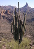
Well back in AZ and anxious to do some more hiking in the superstitions, I've been looking at a South to north shuttle hike from Peralta to Canyon lake, not too bad, just about 16-17 miles I think depending on the exact trails we opt to take.
I'm going to put this on the calendar for sometime in October, hopefully it will have started to cool down by then. Hop in, in order to do this one we need at least two vehicles. Start early, and get out in the afternoon, and then maybe get some Dirtwater Springs afterwards! Tentatively scheduled for October 24th.

Edit: Changing this one to the Lode! Lets limit this to 5-6 capable hikers. :scared:
Last edited by rally_toad on Sep 08 2010 9:23 am, edited 1 time in total.
"Who are you guys??!!" -Farnsworth
contribute to this member driven resource
ie: RS > Save/Share after hikes Route Scout GPS Topo Mapper on the App Store Route Scout GPS Topo Mapper on Google Play
User avatar
Tough_Boots
Guides: 0 | Official Routes: 6
Triplogs Last: 2,457 d | RS: 20
Water Reports 1Y: 0 | Last: 2,597 d
Joined: Mar 28 2008 7:08 pm
City, State: Phoenix, AZ

Re: Trans- Supes (south to north day hike)

Post by Tough_Boots »

I vote to hit Black Top Mesa and Marsh Valley on the way-- keep it interesting. Just doing Dutchman to Boulder Canyon might get a little tiresome.
contribute to this member driven resource
ie: RS > Save/Share after hikes Route Scout GPS Topo Mapper on the App Store Route Scout GPS Topo Mapper on Google Play
User avatar
SuperstitionGuy
Triplogs Last: 1,596 d | RS: 0
Water Reports 1Y: 0 | Last: never
Joined: Dec 25 2005 8:24 pm
City, State: Queen Creek, Arizona

Re: Trans- Supes (south to north day hike)

Post by SuperstitionGuy »

If you do hike south to north you can climb up the south south/east corner of Black Top Mesa, cross over it to the north and take the trail down. If you do it correctly you will top out at the sunburst or slightly to the east of it. Have fun, wish I could be there.....
A man's body may grow old, but inside his spirit can still be as young and restless as ever.
- Garth McCann from the movie Second Hand Lions

Another victim of Pixel Trivia.

Current avatar courtesy of Snakemarks
contribute to this member driven resource
ie: RS > Save/Share after hikes Route Scout GPS Topo Mapper on the App Store Route Scout GPS Topo Mapper on Google Play
User avatar
dround
Triplogs Last: 4,402 d | RS: 0
Water Reports 1Y: 0 | Last: never
Joined: Jul 15 2010 2:19 pm
City, State: Gilbert,az

Re: Trans- Supes (south to north day hike)

Post by dround »

I am interested in this one, having come in a few miles from both trailheads I have allways wanted to do this hike. Any route will be good for me. If nothing has happened to the Peralta road in the last year I may drive. (4 door sedan) Its a lease so I kind have to take care of it. My max hike is only 12 miles, but I shouldn't need to be carried out and that hike was in about 105 degree temps.
contribute to this member driven resource
ie: RS > Save/Share after hikes Route Scout GPS Topo Mapper on the App Store Route Scout GPS Topo Mapper on Google Play
User avatar
rally_toad
Guides: 22 | Official Routes: 3
Triplogs Last: 828 d | RS: 60
Water Reports 1Y: 0 | Last: never
Joined: May 17 2007 8:06 pm
City, State: CA

Re: Trans- Supes (south to north day hike)

Post by rally_toad »

I was thinking maybe, Dutchman to Whiskey to Red Tanks, and then making our way past La Barge and Charlebois and maybe finding the master map before heading out to Canyon Lake. That would be around 18 miles. Any other suggestions for routes? I haven't done Black Top Mesa so we could also go stright towards black top, climb it, and then continue on to Canyon lake as well.
"Who are you guys??!!" -Farnsworth
contribute to this member driven resource
ie: RS > Save/Share after hikes Route Scout GPS Topo Mapper on the App Store Route Scout GPS Topo Mapper on Google Play
User avatar
dround
Triplogs Last: 4,402 d | RS: 0
Water Reports 1Y: 0 | Last: never
Joined: Jul 15 2010 2:19 pm
City, State: Gilbert,az

Re: Trans- Supes (south to north day hike)

Post by dround »

At this point I am leaning toward the Black Top Mesa climb, sounds fun.
So many options.....
How about Bluff Spring #235 to Terrapin #234?
Got to break out the Guide to the Superstions and read triplogs right here at hikeaz.com
contribute to this member driven resource
ie: RS > Save/Share after hikes Route Scout GPS Topo Mapper on the App Store Route Scout GPS Topo Mapper on Google Play
User avatar
hippiepunkpirate
Guides: 25 | Official Routes: 23
Triplogs Last: 272 d | RS: 0
Water Reports 1Y: 0 | Last: 3,645 d
Joined: May 30 2008 7:43 am
City, State: Peoria, AZ
Contact:

Re: Trans- Supes (south to north day hike)

Post by hippiepunkpirate »

Man this sounds fun. I won't be able to do something like this until early next year however...
contribute to this member driven resource
ie: RS > Save/Share after hikes Route Scout GPS Topo Mapper on the App Store Route Scout GPS Topo Mapper on Google Play
User avatar
rally_toad
Guides: 22 | Official Routes: 3
Triplogs Last: 828 d | RS: 60
Water Reports 1Y: 0 | Last: never
Joined: May 17 2007 8:06 pm
City, State: CA

Re: Trans- Supes (south to north day hike)

Post by rally_toad »

Im considering changing this to the Mother lode. Im really itching to do it again.... Any takers?
"Who are you guys??!!" -Farnsworth
contribute to this member driven resource
ie: RS > Save/Share after hikes Route Scout GPS Topo Mapper on the App Store Route Scout GPS Topo Mapper on Google Play
User avatar
juliachaos
Guides: 0 | Official Routes: 8
Triplogs Last: 3,052 d | RS: 0
Water Reports 1Y: 0 | Last: never
Joined: Mar 01 2010 11:36 am
City, State: Phoenix, AZ
Contact:

Re: Trans- Supes (south to north day hike)

Post by juliachaos »

@rally_toad
Hey I'm always up for a Motherlode. Not sure what I'm doing that day though :)
contribute to this member driven resource
ie: RS > Save/Share after hikes Route Scout GPS Topo Mapper on the App Store Route Scout GPS Topo Mapper on Google Play
User avatar
rally_toad
Guides: 22 | Official Routes: 3
Triplogs Last: 828 d | RS: 60
Water Reports 1Y: 0 | Last: never
Joined: May 17 2007 8:06 pm
City, State: CA

Re: Four Peaks Mother Lode (10/24)

Post by rally_toad »

Well the plan is changed, and now the Mother Lode is on the calendar... 5-6 capable hikers welcome to join.
"Who are you guys??!!" -Farnsworth
contribute to this member driven resource
ie: RS > Save/Share after hikes Route Scout GPS Topo Mapper on the App Store Route Scout GPS Topo Mapper on Google Play
User avatar
BobP
Guides: 2 | Official Routes: 17
Triplogs Last: 4 d | RS: 58
Water Reports 1Y: 4 | Last: 228 d
Joined: Feb 26 2008 3:43 pm
City, State: Scottsdale, AZ

Re: Four Peaks Mother Lode (10/24)

Post by BobP »

I'll probably do this before and after that date....but I can't make that particular day. :(
https://www.seeitourway.org
Always pronounce Egeszsegedre properly......
If you like this triplog you must be a friend of BrunoP
contribute to this member driven resource
ie: RS > Save/Share after hikes Route Scout GPS Topo Mapper on the App Store Route Scout GPS Topo Mapper on Google Play
User avatar
AZOutdoorsman
Guides: 4 | Official Routes: 0
Triplogs Last: 1,567 d | RS: 0
Water Reports 1Y: 0 | Last: never
Joined: Jan 16 2004 10:31 am
City, State: Chandler, AZ

Re: Four Peaks Mother Lode (10/24)

Post by AZOutdoorsman »

I'll give up my spot - did the Mother Lode recently - probably will head over to San Jacinto. Have fun!
contribute to this member driven resource
ie: RS > Save/Share after hikes Route Scout GPS Topo Mapper on the App Store Route Scout GPS Topo Mapper on Google Play
User avatar
Tough_Boots
Guides: 0 | Official Routes: 6
Triplogs Last: 2,457 d | RS: 20
Water Reports 1Y: 0 | Last: 2,597 d
Joined: Mar 28 2008 7:08 pm
City, State: Phoenix, AZ

Re: Four Peaks Mother Lode (10/24)

Post by Tough_Boots »

ehhh... I don't think the Mother Lode is my style...
contribute to this member driven resource
ie: RS > Save/Share after hikes Route Scout GPS Topo Mapper on the App Store Route Scout GPS Topo Mapper on Google Play
User avatar
trekkin_gecko
Guides: 10 | Official Routes: 47
Triplogs Last: 3 d | RS: 254
Water Reports 1Y: 0 | Last: 480 d
Joined: Nov 17 2008 4:30 pm
City, State: phoenix, az

Re: Four Peaks Mother Lode (10/24)

Post by trekkin_gecko »

i'm interested, but won't commit until i'm back to hiking regularly, including some harder and longer hikes
hazhole
contribute to this member driven resource
ie: RS > Save/Share after hikes Route Scout GPS Topo Mapper on the App Store Route Scout GPS Topo Mapper on Google Play
User avatar
rally_toad
Guides: 22 | Official Routes: 3
Triplogs Last: 828 d | RS: 60
Water Reports 1Y: 0 | Last: never
Joined: May 17 2007 8:06 pm
City, State: CA

Re: Four Peaks Mother Lode (10/24)

Post by rally_toad »

trekkin gecko wrote:i'm interested, but won't commit until i'm back to hiking regularly, including some harder and longer hikes
Read the description and triplogs for the lode... this hike definitely isn't for everyone.
"Who are you guys??!!" -Farnsworth
contribute to this member driven resource
ie: RS > Save/Share after hikes Route Scout GPS Topo Mapper on the App Store Route Scout GPS Topo Mapper on Google Play
User avatar
dround
Triplogs Last: 4,402 d | RS: 0
Water Reports 1Y: 0 | Last: never
Joined: Jul 15 2010 2:19 pm
City, State: Gilbert,az

Re: Four Peaks Mother Lode (10/24)

Post by dround »

Im still interested, but I don't think my car can handle the road, so I won't be able to drive.
The motherlode will push my limits, maybe some of us can bail and do a brother lode.
contribute to this member driven resource
ie: RS > Save/Share after hikes Route Scout GPS Topo Mapper on the App Store Route Scout GPS Topo Mapper on Google Play
User avatar
Tough_Boots
Guides: 0 | Official Routes: 6
Triplogs Last: 2,457 d | RS: 20
Water Reports 1Y: 0 | Last: 2,597 d
Joined: Mar 28 2008 7:08 pm
City, State: Phoenix, AZ

Re: Four Peaks Mother Lode (10/24)

Post by Tough_Boots »

dround wrote:maybe some of us can bail and do a brother lode
Getting down from anywhere other than peaks 1 or 4 is probably harder than doing the whole thing or atleast much harder to find your way back from-- definitely for someone with tested route finding abilities. I recommend anyone wanting to do a Mother Lode should try Brown's first and see how comfortable they are with the scrambling. I don't think my back could take more than one peak at a time-- but I have issues. Either way, this is not a hike to be taken lightly.
contribute to this member driven resource
ie: RS > Save/Share after hikes Route Scout GPS Topo Mapper on the App Store Route Scout GPS Topo Mapper on Google Play
User avatar
BobP
Guides: 2 | Official Routes: 17
Triplogs Last: 4 d | RS: 58
Water Reports 1Y: 4 | Last: 228 d
Joined: Feb 26 2008 3:43 pm
City, State: Scottsdale, AZ

Re: Four Peaks Mother Lode (10/24)

Post by BobP »

@Tough_Boots
The Brother lode...they would be going back down peak 1.

I can't wait to do Mt Whitney...so I can give advice to people about it ;)

On another note:
I think Alex said it best... read the triplogs and make sure your capable. Even so....you may have to lend a helping hand :yuck: :yuck: . Not sure which was worst last Sunday or touching multiple dudes butts helping them thru a tough spot on the Mother Lode
https://www.seeitourway.org
Always pronounce Egeszsegedre properly......
If you like this triplog you must be a friend of BrunoP
contribute to this member driven resource
ie: RS > Save/Share after hikes Route Scout GPS Topo Mapper on the App Store Route Scout GPS Topo Mapper on Google Play
User avatar
Tough_Boots
Guides: 0 | Official Routes: 6
Triplogs Last: 2,457 d | RS: 20
Water Reports 1Y: 0 | Last: 2,597 d
Joined: Mar 28 2008 7:08 pm
City, State: Phoenix, AZ

Re: Four Peaks Mother Lode (10/24)

Post by Tough_Boots »

@rlrjamy
touché, dog-face, touché :)
contribute to this member driven resource
ie: RS > Save/Share after hikes Route Scout GPS Topo Mapper on the App Store Route Scout GPS Topo Mapper on Google Play
User avatar
The_Eagle
Guides: 41 | Official Routes: 342
Triplogs Last: 1 d | RS: 612
Water Reports 1Y: 75 | Last: 7 d
Joined: Jan 20 2009 2:46 pm
City, State: Far NE Phoenix, Az
Contact:

Re: Four Peaks Mother Lode (10/24)

Post by The_Eagle »

@rlrjamy
:oops: :whistle:
There is a very fine line between "hobby" and "mental illness."
Dave Barry 🦅
contribute to this member driven resource
ie: RS > Save/Share after hikes Route Scout GPS Topo Mapper on the App Store Route Scout GPS Topo Mapper on Google Play
Post Reply

Return to “Hiking Events”