 Route Editor

Anybody know any thing about this pipe that I see running from about "Mountain Spring" on the Tom's Thumb Trail at TT13, downhill and parallel to, and sometimes in, the streambed/wash that's generally on the NORTH side of the trail. It CROSSES the Desert Park to Tom's Thumb bypass trail very near that huge home at the furthest end of the subdivision on the north. Old and weathered, the pipe is maybe 2 1/2 inch diameter. Does that supply water to somewhere?
Sgt Lumpy - n0eq
Pipeline in McDowell Sonoran Preserve?
Moderator: HAZ - Moderators
Linked Area, etc none
-
 SgtLumpyGuides: 0 | Official Routes: 0Triplogs Last: 4,784 d | RS: 0Water Reports 1Y: 0 | Last: 4,803 d
 - Joined: Feb 24 2013 12:25 pm
- City, State: N Phoenix, AZ
- Contact:
contribute to this member driven resource
ie: RS > Save/Share after hikes 

-
 ASUAviatorGuides: 1 | Official Routes: 2Triplogs Last: 3,272 d | RS: 0Water Reports 1Y: 0 | Last: 3,334 d
 - Joined: Nov 06 2010 12:12 pm
- City, State: Phoenix, AZ
Re: Pipeline in McDowell Sonoran Preserve?
I think back in the day it was used to supply a ranch. Now it just flows freely from its 'sorta' source
contribute to this member driven resource
ie: RS > Save/Share after hikes
-
 johnlpGuides: 1 | Official Routes: 5Triplogs Last: 38 d | RS: 2Water Reports 1Y: 0 | Last: 1,977 d
 - Joined: Mar 16 2008 7:12 pm
- City, State: chandler,az
Re: Pipeline in McDowell Sonoran Preserve?
If you go about 50 ft up stream from where the water crosses the trail, the pipe necks down and discharges a nice flow. There is a galvanized bucket and usually bees. http://hikearizona.com/photo.php?ZIP=114673 Its pretty overgrown now compared to this pic. 
“Good people drink good beer.” Hunter S Thompson
contribute to this member driven resource
ie: RS > Save/Share after hikes
-
SgtLumpyGuides: 0 | Official Routes: 0Triplogs Last: 4,784 d | RS: 0Water Reports 1Y: 0 | Last: 4,803 d
- Joined: Feb 24 2013 12:25 pm
- City, State: N Phoenix, AZ
- Contact:
Re: Pipeline in McDowell Sonoran Preserve?
Hey thanks! Down in the lower part, near that huge home to the north, I always see a lot of animals, deer, coyote, snakes, birds, lizards... But I don't really see any oasis to suggest water still flows all the way down in the pipe. I guessed it was some old water supply to a "tank" for the cattle. And I think there was an earthen tank where that big house is now.
Thanks -
Sgt Lumpy - n0eq
Thanks -
Sgt Lumpy - n0eq
contribute to this member driven resource
ie: RS > Save/Share after hikes
-
SgtLumpyGuides: 0 | Official Routes: 0Triplogs Last: 4,784 d | RS: 0Water Reports 1Y: 0 | Last: 4,803 d
- Joined: Feb 24 2013 12:25 pm
- City, State: N Phoenix, AZ
- Contact:
Re: Pipeline in McDowell Sonoran Preserve?
OK, I've been trying to dig up more info on that pipeline. Here's what I'm finding out.
The start of the pipeline is indeed at "Mountain Spring" on Tom's Thumb trail at trail marker TT13. It's interrupted (opened) at the oasis where the running water crosses the trail, as johnlp points out. It picks up again across the trail, on the north side of the oasis then flows down eventually to near that big house at 33.670994N 111.838012W. There used to be a tank where one of those homes is now. And just up the hill from those homes, there was a prospect. The tank was a watering hole used when driving cattle south from Brown's ranch toward the railyards in Phoenix. Up until just about 15 yrs ago, that area was still widely used by ranchers to free range their cattle. There is still a rancher just north of the new Tom's Thumb trailhead who allows his cattle and horses to free range through the preserve and through McDowell Mtn Park to the east.
But back to the pipeline...
Some info I found on the interwebs:
"The spring used to supply water to Brown's Ranch. A concrete water trough, with what looks like "EO Brown, 7-14-1923" carved into it, can still be seen near the spring. On the way up, you'll see the rusted remains of the metal pipes that brought water down from the mountain to thirsty cattle and people. You'll also see newer, plastic pipes that carry the water down now. I'm not sure where that water is going, or who is using it- the golf course, perhaps? There is even a spigot where you can turn the water on and off- just watch out for the bees that are attracted to the water that drips into a puddle under the spigot."
and
"On the way up, you'll pass the remains of some kind of rock shelter. It will be on the right side of the trail. Take a breather and look at the names and dates carved into the rocks there."
and
"The petroglyphs can be found alongside the trail, below the spring. I actually walked right past them on the way up. There are small, orange flags marking the petroglyphs all over the rock outcropping. Be careful not to step on them, or touch them, or disturb them in any way.
Across the gully, high on a steep hillside, are what I consider to be the best petroglyphs I've seen in the area. There are a number of representations of what appear to be antelopes, or ibexes, or some similar mammal. You'll have to climb and scramble up the steep hillside to see these petroglyphs, so be careful and use some common sense."
I have never seen the concrete trough, plastic pipes, remains of a stone shelter, orange flags or petroglyphs. But you can bet the next time I go up there, I will certainly look more intently for those remnants of man made-ness. Not sure how I feel about orange flags. I think if those are present, they're asking for trouble.
There is still a seperate pipe that I can't account for at 33.670116N 111.835287W. That pipe runs from somewhere south of the houses, downhill, northward toward the houses (the former tank). There's a bit of a game trail leading both directions parallel to that pipe. But I don't like to go off trail and tramp around in the more undisturbed areas (and it's illegal). So I won't be able to investigate that one much further.
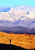
Pipeline CROSSING the Desert Park to Tom's Thumb cutoff. Looking generally EAST, toward Tom's Thumb -

Same pipeline looking NORTH toward the luxury home, former tank -

Same pipeline looking SOUTH toward the MSP, toward Horseshoe Mtn.

Sgt Lumpy - n0eq
The start of the pipeline is indeed at "Mountain Spring" on Tom's Thumb trail at trail marker TT13. It's interrupted (opened) at the oasis where the running water crosses the trail, as johnlp points out. It picks up again across the trail, on the north side of the oasis then flows down eventually to near that big house at 33.670994N 111.838012W. There used to be a tank where one of those homes is now. And just up the hill from those homes, there was a prospect. The tank was a watering hole used when driving cattle south from Brown's ranch toward the railyards in Phoenix. Up until just about 15 yrs ago, that area was still widely used by ranchers to free range their cattle. There is still a rancher just north of the new Tom's Thumb trailhead who allows his cattle and horses to free range through the preserve and through McDowell Mtn Park to the east.
But back to the pipeline...
Some info I found on the interwebs:
"The spring used to supply water to Brown's Ranch. A concrete water trough, with what looks like "EO Brown, 7-14-1923" carved into it, can still be seen near the spring. On the way up, you'll see the rusted remains of the metal pipes that brought water down from the mountain to thirsty cattle and people. You'll also see newer, plastic pipes that carry the water down now. I'm not sure where that water is going, or who is using it- the golf course, perhaps? There is even a spigot where you can turn the water on and off- just watch out for the bees that are attracted to the water that drips into a puddle under the spigot."
and
"On the way up, you'll pass the remains of some kind of rock shelter. It will be on the right side of the trail. Take a breather and look at the names and dates carved into the rocks there."
and
"The petroglyphs can be found alongside the trail, below the spring. I actually walked right past them on the way up. There are small, orange flags marking the petroglyphs all over the rock outcropping. Be careful not to step on them, or touch them, or disturb them in any way.
Across the gully, high on a steep hillside, are what I consider to be the best petroglyphs I've seen in the area. There are a number of representations of what appear to be antelopes, or ibexes, or some similar mammal. You'll have to climb and scramble up the steep hillside to see these petroglyphs, so be careful and use some common sense."
I have never seen the concrete trough, plastic pipes, remains of a stone shelter, orange flags or petroglyphs. But you can bet the next time I go up there, I will certainly look more intently for those remnants of man made-ness. Not sure how I feel about orange flags. I think if those are present, they're asking for trouble.
There is still a seperate pipe that I can't account for at 33.670116N 111.835287W. That pipe runs from somewhere south of the houses, downhill, northward toward the houses (the former tank). There's a bit of a game trail leading both directions parallel to that pipe. But I don't like to go off trail and tramp around in the more undisturbed areas (and it's illegal). So I won't be able to investigate that one much further.
Pipeline CROSSING the Desert Park to Tom's Thumb cutoff. Looking generally EAST, toward Tom's Thumb -
Same pipeline looking NORTH toward the luxury home, former tank -
Same pipeline looking SOUTH toward the MSP, toward Horseshoe Mtn.
Sgt Lumpy - n0eq
contribute to this member driven resource
ie: RS > Save/Share after hikes
-
 tibberGuides: 21 | Official Routes: 51Triplogs Last: 16 d | RS: 547Water Reports 1Y: 0 | Last: 1,015 d
 - Joined: Feb 26 2004 1:27 pm
- City, State: Phoenix, AZ
Re: Pipeline in McDowell Sonoran Preserve?
Thank you for the extensive write up. For those of us who frequent the area, I think this is very interesting.
For me, sometimes it's just as much about the journey as the destination.
Oh, and once in awhile, don't forget to look back at the trail you've traveled.
Oh, and once in awhile, don't forget to look back at the trail you've traveled.
contribute to this member driven resource
ie: RS > Save/Share after hikes
-
 paulshikleejrGuides: 20 | Official Routes: 41Triplogs Last: 1,055 d | RS: 4Water Reports 1Y: 0 | Last: 3,951 d
 - Joined: Feb 02 2010 4:37 pm
- City, State: Scottsdale, AZ
- Contact:
Re: Pipeline in McDowell Sonoran Preserve?
Thanks, SgtLumpy!
I'd seen that a few times on the various trails, but was too burnt at those times to think much about it.
Very informative!
I'd seen that a few times on the various trails, but was too burnt at those times to think much about it.
Very informative!
Decisionmaking and action should only be informed by, not subject to, healthy, reasonable concern.
That being said, anything worth doing is worth doing to excess.
That being said, anything worth doing is worth doing to excess.
contribute to this member driven resource
ie: RS > Save/Share after hikes
-
 mazatzalGuides: 0 | Official Routes: 6Triplogs Last: 18 d | RS: 1Water Reports 1Y: 0 | Last: 853 d
 - Joined: Jul 28 2004 2:18 pm
- City, State: Scottsdale, AZ
Re: Pipeline in McDowell Sonoran Preserve?
I think Kemper Marley was also grazing sheep on there in the 90's to avoid higher property taxes. I remember the fence being put up, the sheep and security guards before they started building the houses.SgtLumpy wrote:Up until just about 15 yrs ago, that area was still widely used by ranchers to free range their cattle.
contribute to this member driven resource
ie: RS > Save/Share after hikes
-
 Alston_NealGuides: 1 | Official Routes: 0Triplogs Last: 164 d | RS: 0Water Reports 1Y: 0 | Last: never
 - Joined: Apr 19 2008 5:53 pm
- City, State: Phoenix, AZ
Re: Pipeline in McDowell Sonoran Preserve?
Ah yes the tax cows. Funny my wife and I were talking about that yesterday.
Thanks for the great info Lumpy.
Thanks for the great info Lumpy.
contribute to this member driven resource
ie: RS > Save/Share after hikes