 Route Editor

I was wondering if there is any interest in forming a group to hike Picacho Peak.
I would imagine any saturday would be fine. We can all meet somewhere on the south side and carpool anyone who wants a ride.
Anyone interested?
Picacho Peak Anyone?
Moderators: HAZ Group Coordinators, HAZ - Moderators
Linked Guides none
-
 CakewalkGuides: 1 | Official Routes: 0Triplogs Last: 8,577 d | RS: 0Water Reports 1Y: 0 | Last: never
 - Joined: Feb 03 2002 11:26 pm
- City, State: Glendale, AZ
Picacho Peak Anyone?
< Insert Witty Remark here >
contribute to this member driven resource
ie: RS > Save/Share after hikes 

-
 joebartelsGuides: 264 | Official Routes: 224Triplogs Last: 3 d | RS: 2065Water Reports 1Y: 28 | Last: 15 d
 - Joined: Nov 20 1996 12:00 pm
I'm not exactly sure on the origin or precise scientific name of the seeds but I hear they're might fertile!
As mentioned in HAZ Development everybody is welcome to a special title. Just send me a pm.
Now back to the topic at hand...
Here's a juicy little treat for broadband users from the HAZ Vault
(beware it's over a half MB)
360 Pan photo courtesy of Gary Oglesby
As mentioned in HAZ Development everybody is welcome to a special title. Just send me a pm.
Now back to the topic at hand...
Here's a juicy little treat for broadband users from the HAZ Vault
(beware it's over a half MB)
360 Pan photo courtesy of Gary Oglesby
- joe
contribute to this member driven resource
ie: RS > Save/Share after hikes
-
CakewalkGuides: 1 | Official Routes: 0Triplogs Last: 8,577 d | RS: 0Water Reports 1Y: 0 | Last: never
- Joined: Feb 03 2002 11:26 pm
- City, State: Glendale, AZ
contribute to this member driven resource
ie: RS > Save/Share after hikes
-
 MikeGuides: 5 | Official Routes: 0Triplogs Last: 8,713 d | RS: 0Water Reports 1Y: 0 | Last: never
 - Joined: Feb 03 2002 11:45 am
- City, State: Scottsdale, AZ
contribute to this member driven resource
ie: RS > Save/Share after hikes
-
CakewalkGuides: 1 | Official Routes: 0Triplogs Last: 8,577 d | RS: 0Water Reports 1Y: 0 | Last: never
- Joined: Feb 03 2002 11:26 pm
- City, State: Glendale, AZ
Well Kids....
Being the good group host that I am, I tried to get a map of the park and the trails, but for SOME reason, that website is down this morning....
Well I do have this to offer, If you dont have gloves, Wal-mart has some gardening gloves for a few bucks. I wouldnt spent alot for something Im not likley to use again, being an apartment dweller and all.
If anyone still needs a ride from the north/west side, send me a PM.
See y'all on Saturday morning....
< Insert Witty Remark here >
contribute to this member driven resource
ie: RS > Save/Share after hikes
-
 snow22_5150Guides: 0 | Official Routes: 0Triplogs Last: 7,848 d | RS: 0Water Reports 1Y: 0 | Last: never
 - Joined: Apr 22 2002 2:13 pm
- City, State: Mesa, AZ
Quick question...would anyone suggest wearing shorts or long pants? I haven't done Picacho Peak before or if I have I was too young to remember.  Anyhow, I am excited about this, just have to get the final word on a sitter for my kids, hubby can't get in this weekend. I will let you all know tonight so you aren't waiting on me tomorrow.
Kristyn
"The best education is to be perpetually thrilled by life."
"The best education is to be perpetually thrilled by life."
contribute to this member driven resource
ie: RS > Save/Share after hikes
-
 PaintninazGuides: 1 | Official Routes: 0Triplogs Last: 59 d | RS: 19Water Reports 1Y: 0 | Last: 3,254 d
 - Joined: Feb 04 2002 9:20 am
- City, State: Phoenix, AZ
contribute to this member driven resource
ie: RS > Save/Share after hikes
-
 MtnGeekGuides: 9 | Official Routes: 0Triplogs Last: 2,128 d | RS: 0Water Reports 1Y: 0 | Last: never
 - Joined: May 01 2002 11:09 am
- City, State: Denver, CO
Picacho Peak?
What is Picacho Peak? Where is Picacho Peak? how high is Picacho Peak and where is Frys, your meeting place? I might be interested in going. I just moved to Phoenix and dont know the area yet. I live near Dear Valley and I-17. Should I take loop 101 or I-17? I need instructions. How long will it take me to get to Fry's? This looks like a cool opertunity for me to get to know some AZ hikers.
contribute to this member driven resource
ie: RS > Save/Share after hikes
-
MikeGuides: 5 | Official Routes: 0Triplogs Last: 8,713 d | RS: 0Water Reports 1Y: 0 | Last: never
- Joined: Feb 03 2002 11:45 am
- City, State: Scottsdale, AZ
Unvamp,
Picacho Peak is about midway between Casa Grande and Tucson, right next to I-10. You can read more about it in the trail dex at http://www.hikearizona.com/decoder.php? ... er%20Trail. It's a very cool and fun hike, with a little bit of climbing involved, but not very technical stuff.
To get to Fry's Electronics, take I-I7 south to I-10, go east on I-10. You'll exit I-10 at Baseline Road, turn right, and Fry's Electronics will be just past the freeway on the right. You can't miss it, it's huge.
Have a good time, I wish I could make this one!!
contribute to this member driven resource
ie: RS > Save/Share after hikes
-
 GTG_AZHGuides: 1 | Official Routes: 0Triplogs Last: 8,478 d | RS: 0Water Reports 1Y: 0 | Last: never
 - Joined: Feb 03 2002 11:45 am
- City, State: Peoria, AZ - Originally from Rocket City USA
Attendance
I don't think Linda and I will make this one. Sudden change in weekend plans has wrecked my Saturday hiking time. Enjoy the hike, maybe we'll catch up next time.
GTG
GTG
'Alright now look over here and smile! and pretend like you're having a good time!'
contribute to this member driven resource
ie: RS > Save/Share after hikes
-
 desert dwellerGuides: 0 | Official Routes: 0Triplogs Last: none | RS: 0Water Reports 1Y: 0 | Last: never
 - Joined: Mar 23 2002 12:19 pm
- City, State: Tucson, AZ
How Many?
So Cakewalk, how many are now confirmed for the hike?
The flat area on top of the peak isn't that big, ya know.
The flat area on top of the peak isn't that big, ya know.
contribute to this member driven resource
ie: RS > Save/Share after hikes
-
CakewalkGuides: 1 | Official Routes: 0Triplogs Last: 8,577 d | RS: 0Water Reports 1Y: 0 | Last: never
- Joined: Feb 03 2002 11:26 pm
- City, State: Glendale, AZ
Snow22_5150: Im sure shorts are fine, It looks like there is a clear trail to the summit.
Unvamp: Please feel free to join us.
Im not sure how many we still have going, but I will be at fry's parking lot untill 7 am. ( small silver car at a far end of the lot. )
Hope to see someone ( anyone ) there.
Unvamp: Please feel free to join us.
Im not sure how many we still have going, but I will be at fry's parking lot untill 7 am. ( small silver car at a far end of the lot. )
Hope to see someone ( anyone ) there.
< Insert Witty Remark here >
contribute to this member driven resource
ie: RS > Save/Share after hikes
-
MtnGeekGuides: 9 | Official Routes: 0Triplogs Last: 2,128 d | RS: 0Water Reports 1Y: 0 | Last: never
- Joined: May 01 2002 11:09 am
- City, State: Denver, CO
contribute to this member driven resource
ie: RS > Save/Share after hikes
-
snow22_5150Guides: 0 | Official Routes: 0Triplogs Last: 7,848 d | RS: 0Water Reports 1Y: 0 | Last: never
- Joined: Apr 22 2002 2:13 pm
- City, State: Mesa, AZ
contribute to this member driven resource
ie: RS > Save/Share after hikes
-
CakewalkGuides: 1 | Official Routes: 0Triplogs Last: 8,577 d | RS: 0Water Reports 1Y: 0 | Last: never
- Joined: Feb 03 2002 11:26 pm
- City, State: Glendale, AZ
contribute to this member driven resource
ie: RS > Save/Share after hikes
-
MtnGeekGuides: 9 | Official Routes: 0Triplogs Last: 2,128 d | RS: 0Water Reports 1Y: 0 | Last: never
- Joined: May 01 2002 11:09 am
- City, State: Denver, CO
I'll be there!
If you see a charcoal coulered nissan with a bounch of stickeers on the back looking lost, its me. FLAG ME DOWN!!!! I dont want to get up at 5:00 and miss you when you when your there.
contribute to this member driven resource
ie: RS > Save/Share after hikes
-
CakewalkGuides: 1 | Official Routes: 0Triplogs Last: 8,577 d | RS: 0Water Reports 1Y: 0 | Last: never
- Joined: Feb 03 2002 11:26 pm
- City, State: Glendale, AZ
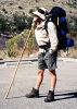
The Picacho peak group hike was a great success..
In all 5 people participated. We all summited in about an hour and a half.
The trail was more difficult than I expected, but thats one more on my list of conquered peaks.
Thanks to everyone to participated, hope to see you on the trails!
In all 5 people participated. We all summited in about an hour and a half.
The trail was more difficult than I expected, but thats one more on my list of conquered peaks.
Thanks to everyone to participated, hope to see you on the trails!
< Insert Witty Remark here >
contribute to this member driven resource
ie: RS > Save/Share after hikes
-
 ck_1Guides: 9 | Official Routes: 0Triplogs Last: 8,546 d | RS: 0Water Reports 1Y: 0 | Last: never
 - Joined: Feb 04 2002 9:30 am
- City, State: Mesa, AZ
It's a cool hike isn't it! I'm glad everyone enjoyed it...ya gotta love the fact that after you bust your but to get to the saddle, you then descend almost as much as you ascended to then turn around and head back up again...that is if you took the shorter trail from the eastern side, if not, than you certainly missed some fun!
'The Journey is the Destination!'
contribute to this member driven resource
ie: RS > Save/Share after hikes
-
CakewalkGuides: 1 | Official Routes: 0Triplogs Last: 8,577 d | RS: 0Water Reports 1Y: 0 | Last: never
- Joined: Feb 03 2002 11:26 pm
- City, State: Glendale, AZ
Yeah.. we took the hunter...
I was horrified to see all that altitude lost, and so quickly. As I descended that part, I was thinking ' what goes down, must turn around and go back up...'
It was a great time!
I was horrified to see all that altitude lost, and so quickly. As I descended that part, I was thinking ' what goes down, must turn around and go back up...'
It was a great time!
Last edited by Cakewalk on May 10 2002 4:19 am, edited 1 time in total.
< Insert Witty Remark here >
contribute to this member driven resource
ie: RS > Save/Share after hikes
-
joebartelsGuides: 264 | Official Routes: 224Triplogs Last: 3 d | RS: 2065Water Reports 1Y: 28 | Last: 15 d
- Joined: Nov 20 1996 12:00 pm
contribute to this member driven resource
ie: RS > Save/Share after hikes
-
 olesmaGuides: 0 | Official Routes: 0Triplogs Last: 8,689 d | RS: 0Water Reports 1Y: 0 | Last: never
 - Joined: Feb 09 2002 1:02 pm
- City, State: Mesa, AZ
Huffin and puffin
Definitely a good hike - it was good to meet some of the members of the group. I was a little bummed out that there were only 5 of us - but a smaller group was able to travel a little faster I think.
I have to say that I showed either my age or my lack of fitness (whichever excuse you prefer) - got my butt kicked both up and down. I'm more accustomed to being the one in front pulling or in the back pushing everyone else along. Instead I got my butt dragged up and then hauled down.
But still...I had forgotten how fun that hike really was. I hadn't done it in probably 5 years or so. Good times.
That's just about it for the desert hikes for this summer though - I think it's time to move on to the mountain hikes. Getting a little hot.....
'Weird is a relative, not an absolute.' - A. Einstein
contribute to this member driven resource
ie: RS > Save/Share after hikes