 Route Editor

I am changing my plans from the Superstitions Backpack to the Mazatzals. I intend to hike in rd 25A and make base camp at (near?) Thicket Spring. I would appreciate anyone providing information about campsites in the area and the quality of the spring.
I have not decided yet if I will head out there Thursday or Friday. I plan on hiking out Sunday afternoon unless we find him before then.
Anyone is welcome to join me, or simply drop by for part of a day to help.
Apologies to Joe B for setting up a competing trip.
Mazatzal Backpack Thanksgiving Break
Moderators: HAZ Group Coordinators, HAZ - Moderators
-
 nonotGuides: 107 | Official Routes: 108Triplogs Last: 109 d | RS: 0Water Reports 1Y: 9 | Last: 109 d
 - Joined: Nov 18 2005 11:52 pm
- City, State: Phoenix, AZ
Mazatzal Backpack Thanksgiving Break
http://hikearizona.com/garmin_maps.php
Hike Arizona it is full of sharp, pointy, ankle-twisting, HAZmaster crushing ROCKS!!
Hike Arizona it is full of sharp, pointy, shin-stabbing, skin-shredding plants!
Hike Arizona it is full of striking, biting, stabbing, venomous wildlife!
Hike Arizona it is full of sharp, pointy, ankle-twisting, HAZmaster crushing ROCKS!!
Hike Arizona it is full of sharp, pointy, shin-stabbing, skin-shredding plants!
Hike Arizona it is full of striking, biting, stabbing, venomous wildlife!
contribute to this member driven resource
ie: RS > Save/Share after hikes 

-
 VapormanGuides: 3 | Official Routes: 0Triplogs Last: 4,966 d | RS: 0Water Reports 1Y: 0 | Last: never
 - Joined: Mar 28 2005 4:10 pm
- City, State: Gilbert, AZ
Re: Mazatzal Backpack Thanksgiving Break
@Tough_Boots
Yea, you said you're starting from the Peely TH around 7am; that should be early enough to meet us at the springs before we head out & channel 14.0 works for me.
@nonot
LoL, to be honest I don't know this area very well having never hiked it and I'm just going off the beta on HAZ & my maps. When I said trail along the west fork, upon further research I meant to say that Cornucooia trail #86. Sounds like there's enough people driving up Friday morning that we could just hitch a ride with Kenny or Suzaz. Though there's light chance of rain forecasted for Sunday so we could avoid the roads by hiking out that #86 trail and FR25A. What areas did you plan on searching?
Yea, canyoneering is an extreme sport... EXTREMELY dramatic!!! =p
contribute to this member driven resource
ie: RS > Save/Share after hikes
-
 GrasshopperGuides: 48 | Official Routes: 143Triplogs Last: 315 d | RS: 0Water Reports 1Y: 0 | Last: 1,040 d
 - Joined: Dec 28 2006 5:06 pm
- City, State: Scottsdale, AZ
Re: Mazatzal Backpack Thanksgiving Break
@nonot
You guys and gals don't forget to check the Peeley TH Weather FCST (from the HAZ Home Page link) a few times to confirm any changes appropriate packing.. It's going to be pumpkin cold up there at night and early mornings. Good luck to you and all others planning and doing behind the scenes searches.. :thanx:
Also, our new members and personal friends of GPSjoe's son (the Jensen's) are taking an early morning drive from PHX to the PEELEY TH and back to confirm for ALL heading out there any present driving restrictions on FR201 like snow, mud, ice, and etc.. so check in here late morning 11:ish tomorrow, Turkey Day-2010.
(Outside.. "there is No Place Like It!!")
contribute to this member driven resource
ie: RS > Save/Share after hikes
-
GrasshopperGuides: 48 | Official Routes: 143Triplogs Last: 315 d | RS: 0Water Reports 1Y: 0 | Last: 1,040 d
- Joined: Dec 28 2006 5:06 pm
- City, State: Scottsdale, AZ
Re: Mazatzal Backpack Thanksgiving Break
Nonot and ALL- see my just posted forum thread on the main GPSjoe forum topic and reply back on that forum thread... ie, arizonaheat went out to Peeley TH today and gave a brief update on FR201.. I need to know ASAP if you still want the Jenson's to go out there again and report back on Turkey Day AM...thxGrasshopper wrote:Also, our new members and personal friends of GPSjoe's son (the Jensen's) are taking an early morning drive from PHX to the PEELEY TH and back to confirm for ALL heading out there any present driving restrictions on FR201 like snow, mud, ice, and etc.. so check in here late morning 11:ish tomorrow, Turkey Day-2010.
(Outside.. "there is No Place Like It!!")
contribute to this member driven resource
ie: RS > Save/Share after hikes
-
 suzazGuides: 1 | Official Routes: 0Triplogs Last: 3,252 d | RS: 0Water Reports 1Y: 0 | Last: never
 - Joined: Nov 23 2003 1:19 pm
- City, State: Gold Canyon, AZ
Re: Mazatzal Backpack Thanksgiving Break
I have rearranged plans for the weekend as I know many others have, too. I will be there on Friday at the Mt Peeley TH around 7:30am and will have one or two other "technically" experienced friends with me. (Thx in advance for all the words of caution) We will be prepared for the terrain and weather. My first plan is to get a feel for that turn around spot that Joe has used. I need to see the area, walk around, look, maybe even sit for a bit. I'd like to focus on a particular ravine from the top down. (still debating which one that will be) Curious if you all have a particular one you will work from the bottom on Friday??
PS---I'll be packing extra pumpkin bread
PS---I'll be packing extra pumpkin bread
contribute to this member driven resource
ie: RS > Save/Share after hikes
-
 cdominGuides: 0 | Official Routes: 0Triplogs Last: none | RS: 0Water Reports 1Y: 0 | Last: never
 - Joined: Nov 23 2010 3:41 pm
- City, State: Chicago, IL
Re: Mazatzal Backpack Thanksgiving Break
I cannot thank you all enough. What you are doing means so much to Joe's family and friends. Your efforts are absolutely amazing. I will have much more to say to you all once I have my thoughts better collected. Knowing he is in good hands is so important to us right now and that is what is getting us through this difficult time. I just wanted to let you all know how much we appreciate your actions and thoughts ahead of this weekend's search.
Christian Domin (GPSJoe's son)
Christian Domin (GPSJoe's son)
contribute to this member driven resource
ie: RS > Save/Share after hikes
-
 te_waGuides: 3 | Official Routes: 0Triplogs Last: 1,894 d | RS: 2Water Reports 1Y: 0 | Last: 2,094 d
 - Joined: Aug 22 2003 9:16 pm
- City, State: Mesa
Re: Mazatzal Backpack Thanksgiving Break
either im confused or heading in from 25a all the way to that camp Sirena posted is out of the way. are you going to go that far west just to camp??
there is a camp spot that is well used at the intersection of Thicket and Saddle Mtn.
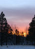
this photo was taken when water was plentiful, my bet is the creek is perennial.
http://www.hikearizona.com/t2010/05/10/ ... 5.jpg?FCR=
there is a camp spot that is well used at the intersection of Thicket and Saddle Mtn.
this photo was taken when water was plentiful, my bet is the creek is perennial.
http://www.hikearizona.com/t2010/05/10/ ... 5.jpg?FCR=
squirrel!
contribute to this member driven resource
ie: RS > Save/Share after hikes
-
 tkkncGuides: 0 | Official Routes: 1Triplogs Last: 1,650 d | RS: 0Water Reports 1Y: 0 | Last: 1,648 d
 - Joined: Jun 02 2003 5:36 pm
- City, State: Phoenix, AZ
Re: Mazatzal Backpack Thanksgiving Break
I plan to camp at
the coords of the camp site is
GPS Data Format Deg NAD83 ElevFeet
Cts Camp,33.99239,-111.48377,5332
http://hikearizona.com/photoset.php?ID=13312
On the map the planned camped is Cts Camp
From the pictures you can tell the campsite is narrow and rocky, but it was the flattest widest area we found that was not choked with brush (besides the trail). It is not as nice as the campsite you have pictured, but is at the bottom of the proposed bailout routs.
contribute to this member driven resource
ie: RS > Save/Share after hikes
-
VapormanGuides: 3 | Official Routes: 0Triplogs Last: 4,966 d | RS: 0Water Reports 1Y: 0 | Last: never
- Joined: Mar 28 2005 4:10 pm
- City, State: Gilbert, AZ
Re: Mazatzal Backpack Thanksgiving Break
@te-wa & nonot
Again, I don't know the area very well or 100% certain of all these locations being mentioned... Would someone mind throwing up a GPS point to were we're setting up base camp so that I don't have to guess were to meet you guys. I' assuming you're talking about 33.990714 -111.484656 but correct me if I'm wrong. ;)
I
Yea, canyoneering is an extreme sport... EXTREMELY dramatic!!! =p
contribute to this member driven resource
ie: RS > Save/Share after hikes
-
te_waGuides: 3 | Official Routes: 0Triplogs Last: 1,894 d | RS: 2Water Reports 1Y: 0 | Last: 2,094 d
- Joined: Aug 22 2003 9:16 pm
- City, State: Mesa
Re: Mazatzal Backpack Thanksgiving Break
you dont need to guess, just look at the map. the intersection of the Thicket Spring tr. and the Saddle Mountain trail. a nicer campsite. Ken's location is nice, but rocky, on a slope, and small.
the pic i showed will hold several tents and hammocks.
it can easily be reached via a 3 mile hike from Mormon Grove.
it wouldnt make much sense to camp at either Ken or my location if you are going in to search from the top. might as well stay at the Peeley trailhead camp, just a 100' walk Northwest from the parking lot.
if you are going in from Mormon Grove however, the camp in my pic is at:
33.969119 -111.507016
(in my photo you can actually see the trail signs. water is in mcfarland just in the background. if i can get out there saturday i'll do the dayhike portion from either end to help with clues. my gut feeling {not that it really means anything.. lol} is that he lost battery power and GPS failure resulted in confusion.)
squirrel!
contribute to this member driven resource
ie: RS > Save/Share after hikes
-
VapormanGuides: 3 | Official Routes: 0Triplogs Last: 4,966 d | RS: 0Water Reports 1Y: 0 | Last: never
- Joined: Mar 28 2005 4:10 pm
- City, State: Gilbert, AZ
Re: Mazatzal Backpack Thanksgiving Break
@te-wa
LoL, this NF map isn't that great and I couldn't find it beause your spot is way too far away from the search area to be useful. ;) I'm thinking we need to camp at the junction of 86 & 95 just down from thicket springs so that we're just below the drainages that we want to search. The plan is to hike up them from the bottom & return back down to camp. We're not camping at Peely TH since most of our rides can't get there and we need a reliable water source and camping in the backcountry is prob safer for our gear than just leaving them at a TH.
LoL, this NF map isn't that great and I couldn't find it beause your spot is way too far away from the search area to be useful. ;) I'm thinking we need to camp at the junction of 86 & 95 just down from thicket springs so that we're just below the drainages that we want to search. The plan is to hike up them from the bottom & return back down to camp. We're not camping at Peely TH since most of our rides can't get there and we need a reliable water source and camping in the backcountry is prob safer for our gear than just leaving them at a TH.
Yea, canyoneering is an extreme sport... EXTREMELY dramatic!!! =p
contribute to this member driven resource
ie: RS > Save/Share after hikes
-
te_waGuides: 3 | Official Routes: 0Triplogs Last: 1,894 d | RS: 2Water Reports 1Y: 0 | Last: 2,094 d
- Joined: Aug 22 2003 9:16 pm
- City, State: Mesa
Re: Mazatzal Backpack Thanksgiving Break
ppl have reported the road is in good condition. camping at Peeley is the best bet. your water source is the 5 gallons you drove in 
agreed tho, no reason to camp near mcfarland / thicket spring. it seems silly to go uphill when you can start at the top, go down your desired drainage, then take Thicket uphill back to camp.
agreed tho, no reason to camp near mcfarland / thicket spring. it seems silly to go uphill when you can start at the top, go down your desired drainage, then take Thicket uphill back to camp.
squirrel!
contribute to this member driven resource
ie: RS > Save/Share after hikes
-
VapormanGuides: 3 | Official Routes: 0Triplogs Last: 4,966 d | RS: 0Water Reports 1Y: 0 | Last: never
- Joined: Mar 28 2005 4:10 pm
- City, State: Gilbert, AZ
Re: Mazatzal Backpack Thanksgiving Break
Well starting from the bottom and returning back down gives us two passes instead of just one... Any I don't think my car could make it to Peely TH. ;)
Yea, canyoneering is an extreme sport... EXTREMELY dramatic!!! =p
contribute to this member driven resource
ie: RS > Save/Share after hikes
-
 imikeGuides: 253 | Official Routes: 0Triplogs Last: 3,056 d | RS: 0Water Reports 1Y: 0 | Last: 4,728 d
 - Joined: Nov 05 2008 10:05 pm
- City, State: Cloudcroft, NM
Re: Mazatzal Backpack Thanksgiving Break
you'll see more searching from bottom up, too.
Ageless Mind... Timeless Body... No Way! Use It and Lose It. Just the way it is...
contribute to this member driven resource
ie: RS > Save/Share after hikes
-
 Tough_BootsGuides: 0 | Official Routes: 6Triplogs Last: 2,685 d | RS: 20Water Reports 1Y: 0 | Last: 2,825 d
 - Joined: Mar 28 2008 7:08 pm
- City, State: Phoenix, AZ
Re: Mazatzal Backpack Thanksgiving Break
Alright, I wasn't able to be online yesterday. Is the consensus that nonot and Vaporman are camping tonight near Thicket Springs? We gotta find them Saturday morning.
contribute to this member driven resource
ie: RS > Save/Share after hikes
-
 juliachaosGuides: 0 | Official Routes: 8Triplogs Last: 3,280 d | RS: 0Water Reports 1Y: 0 | Last: never
 - Joined: Mar 01 2010 11:36 am
- City, State: Phoenix, AZ
- Contact:
Re: Mazatzal Backpack Thanksgiving Break
Is anyone going just on Sunday and would want to carpool?
contribute to this member driven resource
ie: RS > Save/Share after hikes
-
te_waGuides: 3 | Official Routes: 0Triplogs Last: 1,894 d | RS: 2Water Reports 1Y: 0 | Last: 2,094 d
- Joined: Aug 22 2003 9:16 pm
- City, State: Mesa
Re: Mazatzal Backpack Thanksgiving Break
possibly. if i can make it, just point me in the right direction and say "march"juliachaos wrote:Is anyone going just on Sunday and would want to carpool?
I'll let u know before saturday night. that is the best, as of now, that i can forecast. i hope it works out, as i have a good clearance 4x4 suv and i can offer you a ride from ftn hills.
mike
squirrel!
contribute to this member driven resource
ie: RS > Save/Share after hikes
-
suzazGuides: 1 | Official Routes: 0Triplogs Last: 3,252 d | RS: 0Water Reports 1Y: 0 | Last: never
- Joined: Nov 23 2003 1:19 pm
- City, State: Gold Canyon, AZ
Re: Mazatzal Backpack Thanksgiving Break
yes they are camped at Thicket Spring ---I believe at the base of ravine of 7
contribute to this member driven resource
ie: RS > Save/Share after hikes
-
Tough_BootsGuides: 0 | Official Routes: 6Triplogs Last: 2,685 d | RS: 20Water Reports 1Y: 0 | Last: 2,825 d
- Joined: Mar 28 2008 7:08 pm
- City, State: Phoenix, AZ
Re: Mazatzal Backpack Thanksgiving Break
suzaz wrote:yes they are camped at Thicket Spring ---I believe at the base of ravine of 7
contribute to this member driven resource
ie: RS > Save/Share after hikes
-
 JoelHazeltonGuides: 16 | Official Routes: 1Triplogs Last: 144 d | RS: 1Water Reports 1Y: 2 | Last: 304 d
 - Joined: Mar 22 2006 7:45 am
- City, State: Phoenix, AZ
- Contact:
Re: Mazatzal Backpack Thanksgiving Break
They are literally camping ON the Cornucopia trail, just shy of the junction with Thicket Springs (coming from the Peeley trailhead). You'll see their campsite from above and will hike right into it. It will be less than 1.5 mi from the Peeley Trailhead.
I have a report of some of the areas that were covered today, but I've first got to reiterate what everyone has heard a hundred times. It is brutal terrain out there. The south slopes of Sheep Mountain are covered with manzanita, and the drainages are choked with vegetation. I thought traversing the ravines below the peak 3-2 saddle on Four Peaks was the worst bushwhack of my life... These drainages have changed that. Jon and I would go from cussing up a storm, to laughing at the ridiculousness of the bushwhack, back to cussing up a storm, back to laughing, and eventually to frustrated silence as we thrashed, climbed and crawled our way through the manzanita. Your visibility is limited to what's directly in front of your face at many spots, and much of the time that will be a branch (or several) scraping across your face. This also makes the search for Joe extremely difficult, as he could have been 10 feet away from us at any point and we never would have known.
With that said... It sounds like much of the southern slopes of Sheep Mountain have been covered as of today. Jon and I were out there and talked to Steve (Nonot), Kenny, Letty (RedRoxx) and Brian (Vaporman).
Based on the drainages map of the south slopes of Sheep Mountain:
Jon and I hiked up drainage #6 and it's immediate surrounding ridges. We then climbed the rocky slopes at the head of this drainage and up to the steep ridge that leads up to peak 6910. At this point, frequent flagging on agave stalks from here on up to peak 6910 indicated that the particular ridge had been covered. At this point Jon and I returned down the northeastern ridge of ravine #6, which seemed like a sensible bailout route. Once the manzanita got too thick for travel we dropped into a ravine between 6 and 7 and returned to the Thicket Springs trail via that, which was brutal.
I believe many hikers today explored ravine 7 and the ridges west of it. At the trailhead, there was a note that Susan and 3 others were searching ravine 7, and when Jon and I talked to Brian and Steve at their campsite they said they had also explored ravine 7. Brian said he also covered the ridge immediately west of ravine 5.
"Arizona is the land of contrast... You can go from Minnesota to California in a matter of minutes, then have Mexican food that night." -Jack Dykinga
http://www.joelhazelton.com
http://www.joelhazelton.com
contribute to this member driven resource
ie: RS > Save/Share after hikes
-
GrasshopperGuides: 48 | Official Routes: 143Triplogs Last: 315 d | RS: 0Water Reports 1Y: 0 | Last: 1,040 d
- Joined: Dec 28 2006 5:06 pm
- City, State: Scottsdale, AZ
Re: Mazatzal Backpack Thanksgiving Break
@azpride
Joel, well done and understood.. thanks to you all. Would you mind just copying and paste this summary write up on our main forum thread as well. Many who are monitoring and making search plans are not also monitoring this particular thread...T-hank-S
Joel, well done and understood.. thanks to you all. Would you mind just copying and paste this summary write up on our main forum thread as well. Many who are monitoring and making search plans are not also monitoring this particular thread...T-hank-S
(Outside.. "there is No Place Like It!!")
contribute to this member driven resource
ie: RS > Save/Share after hikes