 Route Editor

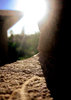
I was recently up at Willow Springs Lake for a fishing trip, and decided to do a little exploring on the other side of the dam. I scrambled down the spillway and found what seemed to be an old service road/trail leading away from the dam.
I was thinking about a short backpacking trip to find out where and how far it went, but I'm not sure where it leads or anything like that.
Anyone know what this road is, where it goes, and if its even worth the trip?
Thanks for the help!
Jay
Willow springs Lake Dam Trail?
Moderator: HAZ - Moderators
Linked Guides none
Linked Area, etc none
-
 jaysmithGuides: 0 | Official Routes: 0Triplogs Last: 4,757 d | RS: 0Water Reports 1Y: 0 | Last: never
 - Joined: Mar 11 2009 2:59 pm
- City, State: Phoenix
contribute to this member driven resource
ie: RS > Save/Share after hikes 

-
 chumleyGuides: 94 | Official Routes: 239Triplogs Last: 11 d | RS: 73Water Reports 1Y: 92 | Last: 10 d
 - Joined: Sep 18 2002 8:59 am
- City, State: Tempe, AZ
Re: Willow springs Lake Dam Trail?
The TrailDex Topo map shows an old road (9505 I think) which leads away from the dam in an easterly direction. If that's what you saw, then you can see on the map that it leads past "hidden lake" to its terminus at FR236.
http://hikearizona.com/location_g.php?L ... =15&M=6&G=
Did you also see an old road that leads downstream in the canyon? Looking at the map, that's where the real interest lies! If you head downstream, it leads deeper and deeper into the canyon. At 3.5-4 miles you intersect with Woods Canyon. You could head back up Woods Canyon to the dam of that lake (about 7 miles) for a nice canyon loop. But if you continue on downstream in what is now Chevelon Canyon, you get into a very tight and deep canyon, with no crossings that I am aware of until the Telephone Ridge Trail (about 14 miles from Willow Springs Dam), and eventually Chevelon Canyon Lake (3 miles from Telephone Ridge Trail)
The A-S NF lists a trail on their website as the "Woods Canyon Lake to Chevelon Lake Trail" and states that its a "most difficult" "3-5 day backpacking trip" -- most of which has no developed trail. This hike has not yet been featured on HAZ, but sounds like it would be quite fun for anybody interested in that length of backpack.
Anybody ever done this stretch of canyon?
I'm not sure what my spirit animal is, but I'm confident it has rabies.
contribute to this member driven resource
ie: RS > Save/Share after hikes
-
 azbackpackrGuides: 34 | Official Routes: 30Triplogs Last: 42 d | RS: 0Water Reports 1Y: 8 | Last: 52 d
 - Joined: Jan 21 2006 6:46 am
- City, State: Eagar AZ
Re: Willow springs Lake Dam Trail?
I have only looked at it longingly on the map. I have hiked Chevelon Crossing upstream toward the dam.
I found a write-up of this hike in Streamside Trails, Dayhiking Central Arizona's Lakes, Rivers and Creeks, by Steve Krause, Published by Pinyon Publishing Co. 1994, '96, '99.
Incidentally this book also talks about East Chevelon Creek Trail, which someone was looking for recently on another thread. It is the section closest to Woods Canyon Lake. I think I will go find that other thread and post it.
There is a point of no return unremarked at the time in most lives. Graham Greene The Comedians
A clean house is a sign of a misspent life.
A clean house is a sign of a misspent life.
contribute to this member driven resource
ie: RS > Save/Share after hikes
-
jaysmithGuides: 0 | Official Routes: 0Triplogs Last: 4,757 d | RS: 0Water Reports 1Y: 0 | Last: never
- Joined: Mar 11 2009 2:59 pm
- City, State: Phoenix
Re: Willow springs Lake Dam Trail?
Did you also see an old road that leads downstream in the canyon? Looking at the map, that's where the real interest lies! If you head downstream, it leads deeper and deeper into the canyon. At 3.5-4 miles you intersect with Woods Canyon. You could head back up Woods Canyon to the dam of that lake (about 7 miles) for a nice canyon loop. But if you continue on downstream in what is now Chevelon Canyon, you get into a very tight and deep canyon, with no crossings that I am aware of until the Telephone Ridge Trail (about 14 miles from Willow Springs Dam), and eventually Chevelon Canyon Lake (3 miles from Telephone Ridge Trail)
The A-S NF lists a trail on their website as the "Woods Canyon Lake to Chevelon Lake Trail" and states that its a "most difficult" "3-5 day backpacking trip" -- most of which has no developed trail. This hike has not yet been featured on HAZ, but sounds like it would be quite fun for anybody interested in that length of backpack.
Anybody ever done this stretch of canyon?[/quote]
Yeah, That was the one. The road followed the stream (well, runoff from the lake, anyway) further into the canyon. I did walk about a mile back until I had to head back to the lake, but I am definitely intrigued. I wonder how far the road goes until it ends. Sounds like Chevlon Canyon is pretty rough, but perhaps still worth a look. I was thinking it would be a good trip from Willow Springs dam to Chevlon Canyon Lake Campground, but not sure if thats biting off more than I can chew at first. I would definitely be interested in doing this trip if its not too hairy.
I would love to hear if anyone has done this canyon as well!
contribute to this member driven resource
ie: RS > Save/Share after hikes
-
 curtwGuides: 0 | Official Routes: 0Triplogs Last: none | RS: 0Water Reports 1Y: 0 | Last: never
 - Joined: Jun 06 2009 9:14 pm
- City, State: Scottsdale, AZ
Re: Willow springs Lake Dam Trail?
Hello all -
I just registered here to find out what it looks like several of you are trying to find out. What is the hike from Woods Canyon Lake to Chevelon Canyon Lake like? So far I've only found two things of value. The first is an ecological study of that stretch of stream from around that's posted on the web. Sorry I don't have the link. There wasn't much in the way of describing a hike, but gives you a sense of the flora and fauna. The other thing I got was from the FS office in Heber. The receptionist there called that part of Chevelon Canyon the "Bermuda Triangle" of the forest. She mailed me a 2-page letter with some topo maps that a couple hikers sent her around 2004. That description makes it sound like a great hike. Worth calling there if you're interested.
Or, you can wait until the end of July. I am planning on hiking the canyon mid-July. If I can actually make it, and make it out of the canyon alive, I will post a thorough description of it. Then again, maybe it'll be so fantastic I won't want to let anyone know about it.
contribute to this member driven resource
ie: RS > Save/Share after hikes
-
curtwGuides: 0 | Official Routes: 0Triplogs Last: none | RS: 0Water Reports 1Y: 0 | Last: never
- Joined: Jun 06 2009 9:14 pm
- City, State: Scottsdale, AZ
Re: Willow springs Lake Dam Trail?
I just hiked the first 3 or 4 miles of Woods Canyon to see what it looks like. It's really beautiful. I reread the 2-page letter I got from the USFS and it makes more sense now. The first thing I realized is that the person who wrote the letter was hiking it with a boy scout troop. It took them 4 days and 5 nights. The letter said the first 6 miles were the toughest due to boulders and deadfall. If miles 3-6 are as easy as miles 0-3, even if they're twice as hard, the hike has to be a piece of cake.
I did encounter some boulder hopping on my hike Saturday. No big deal it was in very short stretches. I might be a little more difficult with a heavier pack but nothing earthshaking. There was deadfall, too but no big deal. Just a few fallen trees. The trail was distinct at the beginning as you might imagine but faded the farther in. Even where the trail seemed to disappear, it was easy going. Lot's of stream crossings to stay in the flats around meanders but there are plenty of rocks to cross the stream on.
There was water the entire stretch I hiked. It was muddy and stagant looking at the start but started clearing up the farther into the canyon we got. The letter states that the water dries up about a mile from the confluence of Willow Springs Creek and Chevelon Creek which is about mile 5. It doesn't reappear again until about a mile or so downstream from the confluence so I estimate you have to go maybe 8 miles until you hit water again. I didn't get far enough to see the water dry up but it shouldn't be an issue to carry enough water to make it the eight miles until you hit the water. The letter goes on to say that water is plentiful the remainder of the way to Chevelon Lake. I've got to think this 22 mile hike is fairly easy all the way.
We saw evidence of humans the entire hike on Saturday - a couple fire rings and a few pieces of random trash. That ticked me off but I'm going to bet the trash washed downstream from Woods Canyon Lake at some point. There's plenty of garbage there to wash downstream. We also saw evidence of what was probably a mountain lion - a big spine from some animal gnawed clean and some scat nearby. Looked pretty recent. Saw an elk, too.
Anyway, full report to come late July.
contribute to this member driven resource
ie: RS > Save/Share after hikes
-
azbackpackrGuides: 34 | Official Routes: 30Triplogs Last: 42 d | RS: 0Water Reports 1Y: 8 | Last: 52 d
- Joined: Jan 21 2006 6:46 am
- City, State: Eagar AZ
Re: Willow springs Lake Dam Trail?
Awesome, thanks for checking it out for us!
There is a point of no return unremarked at the time in most lives. Graham Greene The Comedians
A clean house is a sign of a misspent life.
A clean house is a sign of a misspent life.
contribute to this member driven resource
ie: RS > Save/Share after hikes
-
curtwGuides: 0 | Official Routes: 0Triplogs Last: none | RS: 0Water Reports 1Y: 0 | Last: never
- Joined: Jun 06 2009 9:14 pm
- City, State: Scottsdale, AZ
Re: Willow springs Lake Dam Trail?
I just got back from hiking from Woods Canyon Lake to Chevelon Lake. It was awesome. Exhausting, but awesome. I mentioned in an earlier post that the first several miles were beautiful and easy. They were this time too, not to mention we saw at least 30 elk crossing the creek. Well let me tell you, that's about it for easy. The rest can get pretty gnarly. After the first several miles the water dries up, the canyon narrows, and stream turns into nothing but boulders. Washing machine sized boulders. We had to hike 8 hours to get about 8 miles to where we saw water again. It was around 2 miles past the confluence of Willow Springs Creek and Chevelon Creek. There's a beautiful spring with excellent water. The stream had water in it the rest of the way.
The balance of the hike consisted of boulder/rock hopping, stream crossings, game trails if existing, and bushwhacking. We made 7 miles in 7 hours the following day and about 4 miles in 4 hours the third day. The USFS site says 3-5 day backpacking trip for the adventurous hiker. We did it in 2.5 days but we were really hoofing it. Minimal breaks, forced march kind of hiking. We wanted to get far enough to make sure we got it done in the time we had. You do need to be adventurous and experienced. The middle of the hike is very remote. Lots of bear and bobcat sign.
As soon as I figure out how to post a real trip report at this site, I will do so, complete with pictures. This is a hike definitely worth doing.
contribute to this member driven resource
ie: RS > Save/Share after hikes
-
crewlleGuides: 0 | Official Routes: 0Triplogs Last: none | RS: 0Water Reports 1Y: 0 | Last: never
- Joined: Apr 11 2011 4:30 am
- City, State: santa fe spring
Re: Willow springs Lake Dam Trail?
t's worth the hike any time of year. Beautiful place, and less crowded once it gets cold. 
contribute to this member driven resource
ie: RS > Save/Share after hikes
-
azbackpackrGuides: 34 | Official Routes: 30Triplogs Last: 42 d | RS: 0Water Reports 1Y: 8 | Last: 52 d
- Joined: Jan 21 2006 6:46 am
- City, State: Eagar AZ
Re: Willow springs Lake Dam Trail?
It's probably never crowded, as described by CurtW. (The lake itself does get crowded, but that is just the trailhead.) I have hiked a section of it from Chevelon Crossing to Chevelon lake. Again, similar to the upper section, there is no trail, and you will likely see no people.crewlle wrote:t's worth the hike any time of year. Beautiful place, and less crowded once it gets cold.
There is a point of no return unremarked at the time in most lives. Graham Greene The Comedians
A clean house is a sign of a misspent life.
A clean house is a sign of a misspent life.
contribute to this member driven resource
ie: RS > Save/Share after hikes