 Route Editor

Kane Gulch Ranger Station
Moderator: HAZ - Moderators
Linked Guides none
Linked Area, etc none
-
 rdavisiiiGuides: 0 | Official Routes: 0Triplogs Last: 5,227 d | RS: 0Water Reports 1Y: 0 | Last: never
 - Joined: Jul 25 2006 8:03 am
- City, State: Fryeburg, Me
- Contact:
Kane Gulch Ranger Station
I have read that the drive up to Cedar Mesa has a dirt portion. How is that road on passenger cars?
Lower aircraft have the right of way!
contribute to this member driven resource
ie: RS > Save/Share after hikes 

-
 azbackpackrGuides: 34 | Official Routes: 30Triplogs Last: 36 d | RS: 0Water Reports 1Y: 8 | Last: 46 d
 - Joined: Jan 21 2006 6:46 am
- City, State: Eagar AZ
Re: Kane Gulch Ranger Station
Took my 1989 Dodge Caravan minivand with bad rings up the Mokee Dugway about 3 years ago. It was fun! If you go in the other way, off 95, not very far at all on the dirt, but you'd miss all the fun. I went to Mexican Hat to look at the river, then up toward the Dugway, saw the Goosenecks, then up the Dugway to Cedar Mesa. Had time to kill before meeting friends, so went to Natural Bridges NM for a hike. All in one day, having left Springerville early in the morning. We camped in the parking lot of the ranger station since they got there at night.
I saw nice new cars on the Dugway, and even motorhomes, which I guess aren't really recommended.
I saw nice new cars on the Dugway, and even motorhomes, which I guess aren't really recommended.
There is a point of no return unremarked at the time in most lives. Graham Greene The Comedians
A clean house is a sign of a misspent life.
A clean house is a sign of a misspent life.
contribute to this member driven resource
ie: RS > Save/Share after hikes
-
 RedRoxx44Guides: 5 | Official Routes: 0Triplogs Last: 5 d | RS: 0Water Reports 1Y: 0 | Last: 6,521 d
 - Joined: Feb 15 2003 8:07 am
- City, State: outside, anywhere
Re: Kane Gulch Ranger Station
I remember when the Kane Gulch Ranger Station was a small trailer and you sat outside and talked to the ranger. I remember when that dugway was narrower in sections too. ---SIGH-----
I remember signing yourself in at TH's, no advance permits, and walking in for a same day no problem. Oh well---
I remember signing yourself in at TH's, no advance permits, and walking in for a same day no problem. Oh well---
contribute to this member driven resource
ie: RS > Save/Share after hikes
-
 PaleoRobGuides: 171 | Official Routes: 78Triplogs Last: 672 d | RS: 24Water Reports 1Y: 0 | Last: 1,060 d
 - Joined: Apr 03 2006 12:21 pm
- City, State: Pocatello, ID
- Contact:
Re: Kane Gulch Ranger Station
Dirt section up the Moki Dugway is decent for cars. Went up it in a Mustang GT and Jetta station wagon (in a blizzard no less) so even if you are driving a lowered Metro it is passable.
contribute to this member driven resource
ie: RS > Save/Share after hikes
-
 big_loadGuides: 0 | Official Routes: 1Triplogs Last: 509 d | RS: 3Water Reports 1Y: 0 | Last: 2,712 d
 - Joined: Oct 28 2003 11:20 am
- City, State: Andover, NJ
Re: Kane Gulch Ranger Station
I suppose they didn't have such a great selection of books back then, either. I'm still kicking myself for not stocking up.RedRoxx44 wrote:I remember when the Kane Gulch Ranger Station was a small trailer and you sat outside and talked to the ranger.
contribute to this member driven resource
ie: RS > Save/Share after hikes
-
 hippiepunkpirateGuides: 25 | Official Routes: 23Triplogs Last: 501 d | RS: 0Water Reports 1Y: 0 | Last: 3,874 d
 - Joined: May 30 2008 7:43 am
- City, State: Peoria, AZ
- Contact:
Re: Kane Gulch Ranger Station
I have the same sentiments.big_load wrote:I suppose they didn't have such a great selection of books back then, either. I'm still kicking myself for not stocking up.
contribute to this member driven resource
ie: RS > Save/Share after hikes
-
 writelotsGuides: 19 | Official Routes: 3Triplogs Last: 1,390 d | RS: 3Water Reports 1Y: 0 | Last: 1,390 d
 - Joined: Nov 22 2005 2:20 pm
- City, State: Tucson, AZ
- Contact:
Re: Kane Gulch Ranger Station
It's not so much how it is on cars, but how it is on riders.rdavisiii wrote:I have read that the drive up to Cedar Mesa has a dirt portion. How is that road on passenger cars?
-----------------------------------
Change will not come if we wait for some other person or some other time. We are the ones we've been waiting for. We are the change that we seek.- Barack Obama
Change will not come if we wait for some other person or some other time. We are the ones we've been waiting for. We are the change that we seek.- Barack Obama
contribute to this member driven resource
ie: RS > Save/Share after hikes
-
 hikeazGuides: 6 | Official Routes: 0Triplogs Last: 1,239 d | RS: 0Water Reports 1Y: 0 | Last: 1,239 d
 - Joined: May 13 2002 10:07 am
- City, State: Tempe, AZ
- Contact:
Re: Kane Gulch Ranger Station
Just came back from Cedar Mesa down the dugway (went up the dugway as well). The road is in fine shape - suitable for any type of vehicle. I even saw 2 harleys on their way up.
If you for some reason need to avoid dirt driving altogether, merely take the route in from Monticello. Remember, though, that most all the trailheads on CM will have varying degrees of dirt access, some can be rough, although hitchhiking up on CM goes very well).
If you for some reason need to avoid dirt driving altogether, merely take the route in from Monticello. Remember, though, that most all the trailheads on CM will have varying degrees of dirt access, some can be rough, although hitchhiking up on CM goes very well).
"The censorship method ... is that of handing the job over to some frail and erring mortal man, and making him omnipotent on the assumption that his official status will make him infallible and omniscient."
George Bernard Shaw
George Bernard Shaw
contribute to this member driven resource
ie: RS > Save/Share after hikes
-
azbackpackrGuides: 34 | Official Routes: 30Triplogs Last: 36 d | RS: 0Water Reports 1Y: 8 | Last: 46 d
- Joined: Jan 21 2006 6:46 am
- City, State: Eagar AZ
Re: Kane Gulch Ranger Station
Yeah, the road into the Government trail gets ugly pretty quickly in a passenger car. I got my minivan pretty far in there, though! Poor old minivan. Wish the rings hadn't worn out...loved that thing...
There is a point of no return unremarked at the time in most lives. Graham Greene The Comedians
A clean house is a sign of a misspent life.
A clean house is a sign of a misspent life.
contribute to this member driven resource
ie: RS > Save/Share after hikes
-
rdavisiiiGuides: 0 | Official Routes: 0Triplogs Last: 5,227 d | RS: 0Water Reports 1Y: 0 | Last: never
- Joined: Jul 25 2006 8:03 am
- City, State: Fryeburg, Me
- Contact:
Re: Kane Gulch Ranger Station
Thanks for the info. Ended up in the jeep and saw first hand I could have taken a lowered pinto if I wanted. What a place! I cannot wait to go back there again. The roads down to Collins and Bullet where tame, I think a normal car could make both with little issue. Next time I think I will hike down stream instead of up stream.
Lower aircraft have the right of way!
contribute to this member driven resource
ie: RS > Save/Share after hikes
-
azbackpackrGuides: 34 | Official Routes: 30Triplogs Last: 36 d | RS: 0Water Reports 1Y: 8 | Last: 46 d
- Joined: Jan 21 2006 6:46 am
- City, State: Eagar AZ
Re: Kane Gulch Ranger Station
We walked down Bullet but not far enough to see all the kivas.
There is a point of no return unremarked at the time in most lives. Graham Greene The Comedians
A clean house is a sign of a misspent life.
A clean house is a sign of a misspent life.
contribute to this member driven resource
ie: RS > Save/Share after hikes
-
big_loadGuides: 0 | Official Routes: 1Triplogs Last: 509 d | RS: 3Water Reports 1Y: 0 | Last: 2,712 d
- Joined: Oct 28 2003 11:20 am
- City, State: Andover, NJ
Re: Kane Gulch Ranger Station
This is just so tantalizing! "All the kivas" and rljamy's triplog comment on the multiplicity of ruins. I may have to try again this fall instead of next spring.azbackpackr wrote:all the kivas
contribute to this member driven resource
ie: RS > Save/Share after hikes
-
 MoovyoazGuides: 5 | Official Routes: 6Triplogs Last: 823 d | RS: 4Water Reports 1Y: 0 | Last: 1,141 d
 - Joined: Dec 06 2002 11:13 pm
- City, State: Phoenix, AZ
- Contact:
Re: Kane Gulch Ranger Station
How about a trip report on Owl Creek?hikeaz wrote:Just came back from Cedar Mesa down the dugway (went up the dugway as well). The road is in fine shape - suitable for any type of vehicle. I even saw 2 harleys on their way up.
If you for some reason need to avoid dirt driving altogether, merely take the route in from Monticello. Remember, though, that most all the trailheads on CM will have varying degrees of dirt access, some can be rough, although hitchhiking up on CM goes very well).
A drunkard's dream if I ever did see one
contribute to this member driven resource
ie: RS > Save/Share after hikes
-
RedRoxx44Guides: 5 | Official Routes: 0Triplogs Last: 5 d | RS: 0Water Reports 1Y: 0 | Last: 6,521 d
- Joined: Feb 15 2003 8:07 am
- City, State: outside, anywhere
Re: Kane Gulch Ranger Station
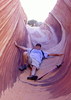
Owl Creek/Fish loop is very nice and beautiful canyons but most of the ruins are up high, a neat little ruin a little down owl's slickrock steps.
Many special places on the Cedar Mesa.
Many special places on the Cedar Mesa.
contribute to this member driven resource
ie: RS > Save/Share after hikes