 Route Editor

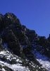
Another high flow "experiment" is scheduled to start on the 11th of November. I am hoping to have time to at least go to Pierce Ferry to see it. Pierce Ferry Rapid might be fun to watch. I have seen photos of the last one, and it came up and covered most of the ramp there. Here is the official information from the Bureau of Reclamation:
High Flow Experiment to begin November 11
October 30, 2013
The Department of Interior Glen Canyon Leadership Team has directed the
Bureau of Reclamation to carry out a High Flow Experiment from Glen Canyon
Dam November 11-16, 2013. This notification describes the operations of Glen
Canyon Dam in November for the days prior to, during, and after the High
Flow Experiment.
Beginning on November 1, 2013, and through November 10, 2013, the releases
from Glen Canyon Dam will total approximately 14,008 acre-feet per day.
Hourly and daily average releases from Glen Canyon Dam for November 1-10
will be scheduled through Western Area Power Administration to be consistent
with the Glen Canyon Dam Operating Criteria (Federal Register, Volume 62,
No. 41, March 3, 1997) and to also achieve, as nearly as is practicable,
this daily release volume. Releases are anticipated to fluctuate between
approximately 8,000 cubic feet per second (cfs) during the daytime hours and
5,000 cfs during the nighttime hours of midnight to 7:00 a.m.
During November 11-16, releases from Glen Canyon Dam will be made according
to the hourly schedule described at
http://www.usbr.gov/uc/water/crsp/cs/im ... ograph.JPG.
The above link shows the scheduled hourly releases from Glen Canyon Dam
during the High Flow Experiment. Note that the schedule shows power plant
capacity releases of approximately 22,200 cfs with full bypass increasing
the total release up to approximately 37,000 cfs. The 37,200 cfs will be
maintained till Friday November 15. It is understood that the actual plant
capacity with seven units running and 40 megawatts (MW) of system regulation
may be slightly more or less than this estimate.
During all days of November, including during the High Flow Experiment, 40
MW of system regulation will be maintained at Glen Canyon Dam. During the
High Flow Experiment, 41 MW of system reserves will be moved off of Glen
Canyon Dam. During the days prior to and after the HFE, the usual 41 MW of
system reserves will be maintained at Glen Canyon Dam.
After the High Flow Experiment, releases will return to a daily total of
approximately 14,008 acre-feet per day. Beginning November 16, 2013 at 1500
hours, hourly and daily average releases from Glen Canyon Dam will resume
being scheduled through Western Area Power Administration to be consistent
with the Glen Canyon Dam Operating Criteria (Federal Register, Volume 62,
No. 41, March 3, 1997) and to also achieve, as nearly as is practicable,
this daily release volume. Releases are anticipated to fluctuate between
approximately 8,000 cfs during the daytime hours and 5,000 cfs during the
nighttime hours of midnight to 7:00 a.m. The scheduled release volume for
November 2013 including the High Flow Experiment is approximately 700,000
acre-feet.
The release volume for December is expected to be 600,000 acre-feet, with
fluctuations between approximately 6,000 cfs and 12,000 cfs. The release
volume for January is expected to be 800,000 acre-feet. Releases for
December and January will be confirmed with a subsequent notification toward
the end of November.
This notification supersedes all previously issued notifications and is
current until a new notification is issued. All times identified in this
notification and attached schedule are local time (MST).
This update courtesy of Katrina Grantz, Bureau of Reclamation
Another high flow "experiment" in Grand Canyon
Moderator: HAZ - Moderators
Linked Guides none
Linked Area, etc none
-
 azbackpackrGuides: 34 | Official Routes: 30Triplogs Last: 41 d | RS: 0Water Reports 1Y: 8 | Last: 51 d
 - Joined: Jan 21 2006 6:46 am
- City, State: Eagar AZ
Another high flow "experiment" in Grand Canyon
There is a point of no return unremarked at the time in most lives. Graham Greene The Comedians
A clean house is a sign of a misspent life.
A clean house is a sign of a misspent life.
contribute to this member driven resource
ie: RS > Save/Share after hikes 

-
 KwaiChangGuides: 0 | Official Routes: 0Triplogs Last: 3,870 d | RS: 0Water Reports 1Y: 0 | Last: never
 - Joined: Jun 13 2010 6:47 pm
- City, State: Bradenton, FL
Re: Another high flow "experiment" in Grand Canyon
Someone smarter than me and in the know will be able to answer my stooopid question - WHY do they do this??? 
Out of all the things I've lost I miss my mind the most.....
contribute to this member driven resource
ie: RS > Save/Share after hikes
-
azbackpackrGuides: 34 | Official Routes: 30Triplogs Last: 41 d | RS: 0Water Reports 1Y: 8 | Last: 51 d
- Joined: Jan 21 2006 6:46 am
- City, State: Eagar AZ
Re: Another high flow "experiment" in Grand Canyon
Due to the Glen Canyon Dam, silt from upriver no long comes down the Canyon, which affects the beaches. However, an ever bigger effect on the beaches is the constant daily fluctuation of the river level due to the dam's hydroelectric production schedule. Therefore, the beaches get washed away over time. A big flood such as this one stirs things up, I guess, I am not sure how it works but it is supposed to help preserve and build beaches.Kwai Chang wrote:Someone smarter than me and in the know will be able to answer my stooopid question - WHY do they do this???
Beaches are important, not only for the health of the riparian area, trees, plants, animals, etc., but also because they are the only places to camp if you are on a river trip.
To see how the river fluctuates on a daily basis, see this page: http://waterdata.usgs.gov/az/nwis/uv/?s ... 0065,00060
To watch fluctuations on waterways throughout the state, click on links on the main page: http://waterdata.usgs.gov/az/nwis/current/?type=flow
There is a point of no return unremarked at the time in most lives. Graham Greene The Comedians
A clean house is a sign of a misspent life.
A clean house is a sign of a misspent life.
contribute to this member driven resource
ie: RS > Save/Share after hikes
-
 chumleyGuides: 94 | Official Routes: 239Triplogs Last: 10 d | RS: 73Water Reports 1Y: 92 | Last: 9 d
 - Joined: Sep 18 2002 8:59 am
- City, State: Tempe, AZ
Re: Another high flow "experiment" in Grand Canyon
In theory, it is intended to mimic how the river would flow naturally through the canyon if there were no dams upstream to regulate the flow.
In reality, it doesn't.
In reality, it doesn't.
I'm not sure what my spirit animal is, but I'm confident it has rabies.
contribute to this member driven resource
ie: RS > Save/Share after hikes
-
 JimGuides: 76 | Official Routes: 39Triplogs Last: 4 d | RS: 94Water Reports 1Y: 7 | Last: 4 d
 - Joined: Sep 08 2006 8:14 pm
Re: Another high flow "experiment" in Grand Canyon
What you mean there wasn't a large run off of snow pack in early November? Seriously, I can see this in April, but November makes no sense from an ecologic point of view. Seems political, and in part to satisfy something like mandated releases from one basin to another, or to increase storage in lower reservoirs during the time of year with lower evaporation.chumley wrote:
In reality, it doesn't.
contribute to this member driven resource
ie: RS > Save/Share after hikes
-
 CannondaleKidGuides: 44 | Official Routes: 48Triplogs Last: 67 d | RS: 0Water Reports 1Y: 1 | Last: 293 d
 - Joined: May 04 2004 8:39 pm
- City, State: Mesa, AZ
- Contact:
Re: Another high flow "experiment" in Grand Canyon
This part alone provides the evidence that in no way shape or form does this equate to the natural flows, no matter what the season.azbackpackr wrote:the constant daily fluctuation of the river level due to the dam's hydroelectric production schedule.
:SB:
CannondaleKid
contribute to this member driven resource
ie: RS > Save/Share after hikes
-
azbackpackrGuides: 34 | Official Routes: 30Triplogs Last: 41 d | RS: 0Water Reports 1Y: 8 | Last: 51 d
- Joined: Jan 21 2006 6:46 am
- City, State: Eagar AZ
Re: Another high flow "experiment" in Grand Canyon
Well whatever. I just want to go see it. It's a good excuse to get out of the house and go hang out by the river with friends.
There is a point of no return unremarked at the time in most lives. Graham Greene The Comedians
A clean house is a sign of a misspent life.
A clean house is a sign of a misspent life.
contribute to this member driven resource
ie: RS > Save/Share after hikes
-
KwaiChangGuides: 0 | Official Routes: 0Triplogs Last: 3,870 d | RS: 0Water Reports 1Y: 0 | Last: never
- Joined: Jun 13 2010 6:47 pm
- City, State: Bradenton, FL
Re: Another high flow "experiment" in Grand Canyon
Thanks for the info Liz....interesting reading tho I have to agree - nothing "natural" about it at all.....
Out of all the things I've lost I miss my mind the most.....
contribute to this member driven resource
ie: RS > Save/Share after hikes
-
 EspiGuides: 0 | Official Routes: 0Triplogs Last: 3,535 d | RS: 0Water Reports 1Y: 0 | Last: 4,906 d
 - Joined: Nov 15 2011 9:06 pm
- City, State: Tempe, AZ
Re: Another high flow "experiment" in Grand Canyon
I meant to post the same thing here and got distracted by work. I found out about it while planning a few days at the ferry for some fishing. Ill be up there on the 16th and am curious... I am guessing it will be alot of fishing and not much catching.
contribute to this member driven resource
ie: RS > Save/Share after hikes
-
azbackpackrGuides: 34 | Official Routes: 30Triplogs Last: 41 d | RS: 0Water Reports 1Y: 8 | Last: 51 d
- Joined: Jan 21 2006 6:46 am
- City, State: Eagar AZ
Re: Another high flow "experiment" in Grand Canyon
Yeah, and if you were going to motor upstream, I'd think the current would be awfully strong. I sure wouldn't want to try to paddle a kayak up!Espi wrote:I meant to post the same thing here and got distracted by work. I found out about it while planning a few days at the ferry for some fishing. Ill be up there on the 16th and am curious... I am guessing it will be alot of fishing and not much catching.
There is a point of no return unremarked at the time in most lives. Graham Greene The Comedians
A clean house is a sign of a misspent life.
A clean house is a sign of a misspent life.
contribute to this member driven resource
ie: RS > Save/Share after hikes
-
azbackpackrGuides: 34 | Official Routes: 30Triplogs Last: 41 d | RS: 0Water Reports 1Y: 8 | Last: 51 d
- Joined: Jan 21 2006 6:46 am
- City, State: Eagar AZ
Re: Another high flow "experiment" in Grand Canyon
I'm in Kingman, and will be at Pearce Ferry later on today. I will look for you, Espi. Maybe I will wear my bright green HAZ shirt. I ought to be there by lunchtime.Espi wrote:I meant to post the same thing here and got distracted by work. I found out about it while planning a few days at the ferry for some fishing. Ill be up there on the 16th and am curious... I am guessing it will be alot of fishing and not much catching.
There is a point of no return unremarked at the time in most lives. Graham Greene The Comedians
A clean house is a sign of a misspent life.
A clean house is a sign of a misspent life.
contribute to this member driven resource
ie: RS > Save/Share after hikes
-
azbackpackrGuides: 34 | Official Routes: 30Triplogs Last: 41 d | RS: 0Water Reports 1Y: 8 | Last: 51 d
- Joined: Jan 21 2006 6:46 am
- City, State: Eagar AZ
Re: Another high flow "experiment" in Grand Canyon
Went down yesterday to the ramp, which is mostly underwater, and also hiked to Pearce Ferry Rapid. Will post triplog and photos later. Today I will do a repeat as the water is ramping down. Yesterday I saw the rapid at peak flow of about 38K. It is definitely not runnable. Due to the fact that Lake Mead is lower than last year, the rapid has a bigger drop, and with that volume of water going around that corner it is truly scary and amazing. Maybe I will get around to posting my video onto Youtube so that I can link here.
There is a point of no return unremarked at the time in most lives. Graham Greene The Comedians
A clean house is a sign of a misspent life.
A clean house is a sign of a misspent life.
contribute to this member driven resource
ie: RS > Save/Share after hikes
-
JimGuides: 76 | Official Routes: 39Triplogs Last: 4 d | RS: 94Water Reports 1Y: 7 | Last: 4 d
- Joined: Sep 08 2006 8:14 pm
Re: Another high flow "experiment" in Grand Canyon
http://www.nytimes.com/2014/01/06/us/co ... .html?_r=0
That article from a few days ago lends some credibility to my guess that the release had far more to do with Lake Mead's dropping levels than a desire to improve the river. Especially given the fall release.
Interesting to note, the article states Las Vegas returns most of it's used water to the lake. Most treatment systems do not remove drugs, medications, or prescribed chemicals from sewage. That water must be pretty polluted, relatively speaking. People using it down stream probably don't need to worry when they shower, but I would filter anything I drink. I'm thinking not just of the various party enhancing substances people use in Vegas, but of medications people take all the time.
contribute to this member driven resource
ie: RS > Save/Share after hikes
-
chumleyGuides: 94 | Official Routes: 239Triplogs Last: 10 d | RS: 73Water Reports 1Y: 92 | Last: 9 d
- Joined: Sep 18 2002 8:59 am
- City, State: Tempe, AZ
Re: Another high flow "experiment" in Grand Canyon
Was an unimpeded Colorado River ever blue?The once broad and blue river...
I always thought murky and muddy, to possibly brownish-green was its healthy, natural color.
I'm not sure what my spirit animal is, but I'm confident it has rabies.
contribute to this member driven resource
ie: RS > Save/Share after hikes
-
 big_loadGuides: 0 | Official Routes: 1Triplogs Last: 514 d | RS: 3Water Reports 1Y: 0 | Last: 2,717 d
 - Joined: Oct 28 2003 11:20 am
- City, State: Andover, NJ
Re: Another high flow "experiment" in Grand Canyon
It wouldn't have been called "Colorado" if it were blue. I think somebody let their imagination run wild.chumley wrote:Was an unimpeded Colorado River ever blue?The once broad and blue river...
I always thought murky and muddy, to possibly brownish-green was its healthy, natural color.
contribute to this member driven resource
ie: RS > Save/Share after hikes
-
JimGuides: 76 | Official Routes: 39Triplogs Last: 4 d | RS: 94Water Reports 1Y: 7 | Last: 4 d
- Joined: Sep 08 2006 8:14 pm
Re: Another high flow "experiment" in Grand Canyon
Semantics!
But that wasn't why I posted it. I posted because I thought dropping water levels were why they released water from Powell, late last year.
And, yes, it seems unlikely the river was ever anything resembling blue until the dams. Eastern ignorance. Then again, we still have tons of water as long as we don't grow totally out of place crops that can easily be grown in wetter areas. Cotton, alfalfa, corn, and so on. I've seen all of that using lower river basin water, and upper basin water, too.
Dates, winter vegetables, things we can only grow using the water when other places can't produce, that makes sense.
You guys should see the Rio Grande over here. Dry in most places south of Albuquerque. Low reservoir levels. Yet somehow, huge plantations of water demanding pecan orchards are all over the place in the Mesilla Valley, New Mexico's equivalent of the lower Colorado farm region. I can understand some local chile production, and summer vegetables (too cold in winter over here for most things), but pecan trees make no sense.
contribute to this member driven resource
ie: RS > Save/Share after hikes
-
big_loadGuides: 0 | Official Routes: 1Triplogs Last: 514 d | RS: 3Water Reports 1Y: 0 | Last: 2,717 d
- Joined: Oct 28 2003 11:20 am
- City, State: Andover, NJ
Re: Another high flow "experiment" in Grand Canyon
@Jim_H
I wonder how long they've been growing pecans in Mesilla. Those trees look pretty old.
I wonder how long they've been growing pecans in Mesilla. Those trees look pretty old.
contribute to this member driven resource
ie: RS > Save/Share after hikes
-
JimGuides: 76 | Official Routes: 39Triplogs Last: 4 d | RS: 94Water Reports 1Y: 7 | Last: 4 d
- Joined: Sep 08 2006 8:14 pm
Re: Another high flow "experiment" in Grand Canyon
Maybe since the original dams were built 100 years ago, or before using wells. They do well, with water. They just require a lot, and can be grown in wetter areas like the Mississippi river valley. I heard and article about local Messilla Valley growers shipping a lot of their crop to China, so domestically they are not important. I suspect the relatively dry climate produces a better nut than the stuff in the humid south.
contribute to this member driven resource
ie: RS > Save/Share after hikes
-
 cactuscatGuides: 0 | Official Routes: 3Triplogs Last: 163 d | RS: 26Water Reports 1Y: 2 | Last: 335 d
 - Joined: Oct 15 2002 12:08 pm
- City, State: Rimrock, Arizona
Re: Another high flow "experiment" in Grand Canyon
We sell a wine called "Canyon Cutter" in my store and the label says "as pure as the Colorado River water" ... always cracks me up! 
contribute to this member driven resource
ie: RS > Save/Share after hikes