Hell's Gate #37

Day Hiking & general trail related

Moderator: HAZ - Moderators

 Linked Area, etc none
Post Reply
User avatar
chumley
Guides: 94 | Official Routes: 242
Triplogs Last: 11 d | RS: 66
Water Reports 1Y: 78 | Last: 12 d
Joined: Sep 18 2002 8:59 am
City, State: Tempe, AZ

Hell's Gate #37

Post by chumley »

Has anybody hiked this entire trail? Seems like all HAZ trips encompass only the north half of the trail, turning around at Hell's Gate (Tonto Creek jct).

Hikebot posted a route, but won't reply to my PMs. ](*,)

The south half of the trail has a TH at FR133. Looking at satellite photos, I seriously question the condition that road is in.

Has anybody even driven FR133 to anywhere near the southern TH?
I'm not sure what my spirit animal is, but I'm confident it has rabies.
contribute to this member driven resource
ie: RS > Save/Share after hikes Route Scout GPS Topo Mapper on the App Store Route Scout GPS Topo Mapper on Google Play
User avatar
big_load
Guides: 0 | Official Routes: 1
Triplogs Last: 600 d | RS: 3
Water Reports 1Y: 0 | Last: 2,488 d
Joined: Oct 28 2003 11:20 am
City, State: Andover, NJ

Re: Hell's Gate #37

Post by big_load »

chumley wrote: Seems like all HAZ trips encompass only the north half of the trail, turning around at Hell's Gate
I'd rather turn around than go through. I'm not ready to abandon all hope (yet).
contribute to this member driven resource
ie: RS > Save/Share after hikes Route Scout GPS Topo Mapper on the App Store Route Scout GPS Topo Mapper on Google Play
User avatar
mazatzal
Guides: 0 | Official Routes: 6
Triplogs Last: 50 d | RS: 1
Water Reports 1Y: 0 | Last: 623 d
Joined: Jul 28 2004 2:18 pm
City, State: Scottsdale, AZ

Re: Hell's Gate #37

Post by mazatzal »

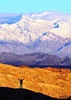
Drove to Smoky Hollow many years ago and hiked down to Hell's Gate and turned around! Shortest way there but long drive.
The road was rough - the descent down rocky scree to Winter Cabin was the worst part. I heard the other road northeast is even rougher.
contribute to this member driven resource
ie: RS > Save/Share after hikes Route Scout GPS Topo Mapper on the App Store Route Scout GPS Topo Mapper on Google Play
User avatar
chumley
Guides: 94 | Official Routes: 242
Triplogs Last: 11 d | RS: 66
Water Reports 1Y: 78 | Last: 12 d
Joined: Sep 18 2002 8:59 am
City, State: Tempe, AZ

Re: Hell's Gate #37

Post by chumley »

mazatzal wrote:I heard the other road northeast is even rougher
FR1673? Haha, yeah. I'd say so. I had a tough time even seeing it on satellite view.

Thanks for the info though!
I'm not sure what my spirit animal is, but I'm confident it has rabies.
contribute to this member driven resource
ie: RS > Save/Share after hikes Route Scout GPS Topo Mapper on the App Store Route Scout GPS Topo Mapper on Google Play
User avatar
ASUAviator
Guides: 1 | Official Routes: 2
Triplogs Last: 3,042 d | RS: 0
Water Reports 1Y: 0 | Last: 3,104 d
Joined: Nov 06 2010 12:12 pm
City, State: Phoenix, AZ

Re: Hell's Gate #37

Post by ASUAviator »

Sounds like a quad trip
contribute to this member driven resource
ie: RS > Save/Share after hikes Route Scout GPS Topo Mapper on the App Store Route Scout GPS Topo Mapper on Google Play
User avatar
nonot
Guides: 107 | Official Routes: 108
Triplogs Last: 23 d | RS: 0
Water Reports 1Y: 7 | Last: 22 d
Joined: Nov 18 2005 11:52 pm
City, State: Phoenix, AZ

Re: Hell's Gate #37

Post by nonot »

Just since he started the subject... has anyone checked out Spring Canyon nearby either?
http://hikearizona.com/garmin_maps.php

Hike Arizona it is full of sharp, pointy, ankle-twisting, HAZmaster crushing ROCKS!!
Hike Arizona it is full of sharp, pointy, shin-stabbing, skin-shredding plants!
Hike Arizona it is full of striking, biting, stabbing, venomous wildlife!
contribute to this member driven resource
ie: RS > Save/Share after hikes Route Scout GPS Topo Mapper on the App Store Route Scout GPS Topo Mapper on Google Play
User avatar
chumley
Guides: 94 | Official Routes: 242
Triplogs Last: 11 d | RS: 66
Water Reports 1Y: 78 | Last: 12 d
Joined: Sep 18 2002 8:59 am
City, State: Tempe, AZ

Re: Hell's Gate #37

Post by chumley »

@nonot was one of the places I was looking at the other day... Any responses would be appreciated.

I expect few have ventured down from the top and those heading down Tonto probably don't take much time out of their trip to explore up Spring. :-k
I'm not sure what my spirit animal is, but I'm confident it has rabies.
contribute to this member driven resource
ie: RS > Save/Share after hikes Route Scout GPS Topo Mapper on the App Store Route Scout GPS Topo Mapper on Google Play
User avatar
mazatzal
Guides: 0 | Official Routes: 6
Triplogs Last: 50 d | RS: 1
Water Reports 1Y: 0 | Last: 623 d
Joined: Jul 28 2004 2:18 pm
City, State: Scottsdale, AZ

Re: Hell's Gate #37

Post by mazatzal »

I think only OUTLANDER went there. I've looked at that area and the mail trail from Gisela to Young is still on the list - anyone interested?
Last edited by mazatzal on Apr 15 2015 10:25 pm, edited 1 time in total.
contribute to this member driven resource
ie: RS > Save/Share after hikes Route Scout GPS Topo Mapper on the App Store Route Scout GPS Topo Mapper on Google Play
User avatar
chumley
Guides: 94 | Official Routes: 242
Triplogs Last: 11 d | RS: 66
Water Reports 1Y: 78 | Last: 12 d
Joined: Sep 18 2002 8:59 am
City, State: Tempe, AZ

Re: Hell's Gate #37

Post by chumley »

@mazatzal
Interesting. I was looking at it thinking it would be a great place for a grow site. Except I think the access issue would make it impractical! :M2C:

Then again. What do I know? :whistle:
I'm not sure what my spirit animal is, but I'm confident it has rabies.
contribute to this member driven resource
ie: RS > Save/Share after hikes Route Scout GPS Topo Mapper on the App Store Route Scout GPS Topo Mapper on Google Play
User avatar
mazatzal
Guides: 0 | Official Routes: 6
Triplogs Last: 50 d | RS: 1
Water Reports 1Y: 0 | Last: 623 d
Joined: Jul 28 2004 2:18 pm
City, State: Scottsdale, AZ

Re: Hell's Gate #37

Post by mazatzal »

Setting up a mail trail shuttle is a nightmare :lol: but I'd love to hike from Gisela to Young so much history...
contribute to this member driven resource
ie: RS > Save/Share after hikes Route Scout GPS Topo Mapper on the App Store Route Scout GPS Topo Mapper on Google Play
User avatar
hikeaz
Guides: 6 | Official Routes: 0
Triplogs Last: 1,016 d | RS: 0
Water Reports 1Y: 0 | Last: 1,015 d
Joined: May 13 2002 10:07 am
City, State: Tempe, AZ
Contact:

Re: Hell's Gate #37

Post by hikeaz »

I has been 20 (+/-) years since I hiked into H.G. from FR 133. The road, as you get nearer the starting point (no T/H as such) gets rougher and is (was) not signed well if at all. I drove in a stock (big) Bronco & did not need 4WD. The hiking trail, at the time was not well-used but there were many cattle trails that continually bisected it, often being the better route to take as the 'trail' was full of 'rollers'. The route down is pretty short; certainly shorter than from the north side.

Re. the Mail Trail - it seems (unfortunately) that this trail has become a dirt bike trail - but maybe the silver lining is that you could have someone drop off a dirt bike for the ride back.
"The censorship method ... is that of handing the job over to some frail and erring mortal man, and making him omnipotent on the assumption that his official status will make him infallible and omniscient."
George Bernard Shaw
contribute to this member driven resource
ie: RS > Save/Share after hikes Route Scout GPS Topo Mapper on the App Store Route Scout GPS Topo Mapper on Google Play
User avatar
toddak
Guides: 13 | Official Routes: 6
Triplogs Last: 21 d | RS: 0
Water Reports 1Y: 0 | Last: 1,496 d
Joined: Nov 15 2005 8:46 pm
City, State: Jackson, CA

Re: Hell's Gate #37

Post by toddak »

contribute to this member driven resource
ie: RS > Save/Share after hikes Route Scout GPS Topo Mapper on the App Store Route Scout GPS Topo Mapper on Google Play
Post Reply

Return to “Trail Chat”