| Humphreys Peak |
| Humphreys Peak, Arizona - Coconino County | Summit |
|
|||||||||||||||||||||||||||||
Highest point in the state of Arizona, as well as Coconino County. The USGS TOPO lists its elevation at 12,633 feet above sea level, however, some sources list it at 12,637'. |
|||||||||||||||||||||||||||||
| .: r2korova :. | |
 |
|
Humphreys Summit Trail #151 | |
| .: Oregon_Hiker :. | |
 |
|
Lockett Meadow Meander | |
| .: John10s :. | |
 |
|
Schultz - Doyle Loop | |
| .: John10s :. | |
 |
|
Rees - Abineau - Inner Basin Loop | |
| .: azflyguy :. | |
 |
|
Humphreys Summit Trail #151 | |
| .: chumley :. | |
 |
|
Agassiz - Humphreys | |
| .: chumley :. | |
 |
|
Agassiz - Humphreys | |
| .: diablo :. | |
 |
|
Birthday Black Canyon Success | |
| .: DixieFlyer :. | |
 |
|
Juniper Ridge - Castle Creek Wilderness HP | |
| .: DixieFlyer :. | |
 |
|
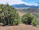
Hobble Mountains Hi Pt 7454 | |
| .: DixieFlyer :. | |
 |
|
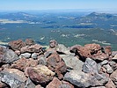
Humphreys Summit Trail #151 | |
| .: DixieFlyer :. | |
 |
|
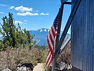
Kendrick Peak Trail #22 | |
| .: DixieFlyer :. | |
 |
|
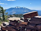
Kendrick Peak Trail #22 | |
| .: John10s :. | |
 |
|
Mazatzal 7500 Peak Trifecta | |
| .: FLYING_FLIVER :. | |
 |
|
Hackberry Mountain | |
| .: FLYING_FLIVER :. | |
 |
|
Hackberry Mountain | |
| .: FLYING_FLIVER :. | |
 |
|
Hackberry Mountain | |
| .: DixieFlyer :. | |
 |
|
Hackberry Mountain - CNF | |
| page 1, 2, 3, 4, 5 ... 11 |
|
|
|
|

| Information on this page has been gathered from member submissions. Effort has been made to avoid any infringement of copyright. Additionally, any use is anticipated to be within the "fair use" doctrine. If any copyright has been infringed, please notify the webmaster. The disputed information will be removed and your issue will be resolved. If you are a submitting member, please inform and discuss with HAZ if you think you are submitting any copyright issue. Please help us stay with the law. |