| Mount Ord |
| Mount Ord, Arizona - Gila County | Summit |
|
|||||||||||||||||||||||||||||
|
|||||||||||||||||||||||||||||
| .: DesertNymph :. | |
 |
|
Sunflower Trail #344 | |
| .: DesertNymph :. | |
 |
|
Sunflower Trail #344 | |
| .: DesertNymph :. | |
 |
|
Pine Mountain - AZT #21 | |
| .: DixieFlyer :. | |
 |
|
Mount Ord from 626 TH | |
| .: DixieFlyer :. | |
 |
|
Mount Ord from 626 TH | |
| .: pseudalpine :. | |
 |
|
Ballantine Trail #283 | |
| .: DesertNymph :. | |
 |
|
Mazatzal Divide: Peeley to Y-Bar | |
| .: John10s :. | |
 |
|
Boulder Mountain | |
| .: DixieFlyer :. | |
 |
|
Mount Ord from 626 TH | |
| .: DixieFlyer :. | |
 |
|
Thunderbird Peak - Glendale HP | |
| .: DixieFlyer :. | |
 |
|
Usery Mountain South Summit | |
| .: chumley :. | |
 |
|
Rimtop Snowshoe | |
| .: chumley :. | |
 |
|
Rimtop Snowshoe | |
| .: DixieFlyer :. | |
 |
|
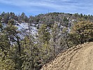
Mount Ord from Slate Creek TH | |
| .: DixieFlyer :. | |
 |
|
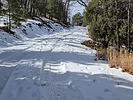
Mount Ord from Slate Creek TH | |
| .: DixieFlyer :. | |
 |
|
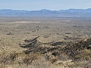
McDowell Reds | |
| .: DixieFlyer :. | |
 |
|
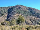
An ExtraORDinary Hike | |
| .: pseudalpine :. | |
 |
|
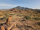
Bear Spring Loop via Bushnell Tanks | |
| page 1, 2, 3, 4, 5 ... 8 |
|
|
|
|

| Information on this page has been gathered from member submissions. Effort has been made to avoid any infringement of copyright. Additionally, any use is anticipated to be within the "fair use" doctrine. If any copyright has been infringed, please notify the webmaster. The disputed information will be removed and your issue will be resolved. If you are a submitting member, please inform and discuss with HAZ if you think you are submitting any copyright issue. Please help us stay with the law. |